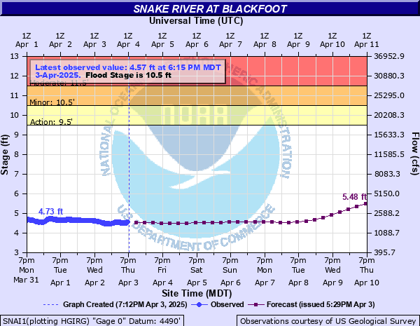
Snake River at Blackfoot
Critical Stages
9.5' - Action
10.5' - Flood
11.5' - Moderate
13' - Major
Latest Observation
Updated: 1:15 PM MST 12/15/25
Status: No Flooding
Stage: 5.21 ft
Flow: 3.1 kcfs
Forecast
| Time | Stage (ft) | Flow (kcfs) |
|---|---|---|
| 5 PM 12/15 | 5.18 | 3.03 |
| 11 PM 12/15 | 5.17 | 3.01 |
| 5 AM 12/16 | 5.16 | 2.98 |
| 11 AM 12/16 | 5.16 | 2.98 |
| 5 PM 12/16 | 5.16 | 2.98 |
| 11 PM 12/16 | 5.15 | 2.96 |
| 5 AM 12/17 | 5.14 | 2.94 |
| 11 AM 12/17 | 5.13 | 2.92 |
| 5 PM 12/17 | 5.12 | 2.89 |
| 11 PM 12/17 | 5.11 | 2.87 |
| 5 AM 12/18 | 5.1 | 2.85 |
| 11 AM 12/18 | 5.09 | 2.83 |
| 5 PM 12/18 | 5.08 | 2.8 |
| 11 PM 12/18 | 5.08 | 2.8 |
| 5 AM 12/19 | 5.09 | 2.83 |
| 11 AM 12/19 | 5.1 | 2.85 |
| 5 PM 12/19 | 5.11 | 2.87 |
| 11 PM 12/19 | 5.13 | 2.92 |
| 5 AM 12/20 | 5.14 | 2.94 |
| 11 AM 12/20 | 5.16 | 2.98 |
| 5 PM 12/20 | 5.17 | 3.01 |
| 11 PM 12/20 | 5.18 | 3.03 |
| 5 AM 12/21 | 5.19 | 3.05 |
| 11 AM 12/21 | 5.19 | 3.05 |
| 5 PM 12/21 | 5.2 | 3.08 |
| 11 PM 12/21 | 5.2 | 3.08 |
| 5 AM 12/22 | 5.21 | 3.1 |
| 11 AM 12/22 | 5.22 | 3.12 |
| 5 PM 12/22 | 5.23 | 3.14 |
| 11 PM 12/22 | 5.24 | 3.17 |
| 5 AM 12/23 | 5.25 | 3.19 |
| 11 AM 12/23 | 5.25 | 3.19 |
| 5 PM 12/23 | 5.26 | 3.22 |
| 11 PM 12/23 | 5.26 | 3.22 |
| 5 AM 12/24 | 5.26 | 3.22 |
| 11 AM 12/24 | 5.26 | 3.22 |
| 5 PM 12/24 | 5.26 | 3.22 |
| 11 PM 12/24 | 5.28 | 3.26 |
| 5 AM 12/25 | 5.32 | 3.36 |
| Time | Stage (ft) | Flow (kcfs) |
|---|---|---|
| 1:15 PM 12/15 | 5.21 | 3.1 |
| 1:00 PM 12/15 | 5.24 | 3.17 |
| 12:45 PM 12/15 | 5.23 | 3.14 |
| 12:30 PM 12/15 | 5.22 | 3.12 |
| 12:15 PM 12/15 | 5.19 | 3.05 |
| 12:00 PM 12/15 | 5.21 | 3.1 |
| 11:45 AM 12/15 | 5.19 | 3.05 |
| 11:30 AM 12/15 | 5.19 | 3.05 |
| 11:15 AM 12/15 | 5.22 | 3.12 |
| 11:00 AM 12/15 | 5.2 | 3.08 |
| 10:45 AM 12/15 | 5.21 | 3.1 |
| 10:30 AM 12/15 | 5.19 | 3.05 |
| 10:15 AM 12/15 | 5.19 | 3.05 |
| 10:00 AM 12/15 | 5.17 | 3.01 |
| 9:45 AM 12/15 | 5.18 | 3.03 |
| 9:30 AM 12/15 | 5.21 | 3.1 |
| 9:15 AM 12/15 | 5.2 | 3.08 |
| 9:00 AM 12/15 | 5.21 | 3.1 |
| 8:45 AM 12/15 | 5.17 | 3.01 |
| 8:30 AM 12/15 | 5.21 | 3.1 |
| 8:15 AM 12/15 | 5.19 | 3.05 |
| 8:00 AM 12/15 | 5.21 | 3.1 |
| 7:45 AM 12/15 | 5.21 | 3.1 |
| 7:30 AM 12/15 | 5.2 | 3.08 |
| 7:15 AM 12/15 | 5.18 | 3.03 |
| 7:00 AM 12/15 | 5.2 | 3.08 |
| 6:45 AM 12/15 | 5.2 | 3.08 |
| 6:30 AM 12/15 | 5.17 | 3.01 |
| 6:15 AM 12/15 | 5.2 | 3.08 |
| 6:00 AM 12/15 | 5.19 | 3.05 |
13.5' -
Inundation of roads and parking lots will occur in the commercial area near the intersection of U.S. Route 26 and Interstate 15. Water is at least 1 foot above the loading docks at the Ridleys Plaza. Significant flooding of farmland and roads near the river is likely. Major flooding could occur in the Jensen's Grove area that could impact Walmart.
13' -
Major flooding will occur throughout Bingham County. Major damage will occur on farm ground and water could top over the top of the Highway 26 bridge at Interstate 15.
12.6' -
Major flooding will occur in the Rose area at the Rose Ponds along Interstate 15, and in the Riverton and Schrader Island area. At 12.0 feet, the water will come over the top of the levee at Rose Ponds.
11.5' -
Lowland flooding will occur. Flooding is possible along US Highway 26 beneath the Interstate 15 underpass.
11' -
Minor flooding will occur in the Riverton area and in the Watson slough area.
10.5' -
Minor lowland flooding will occur along sections of the river from Rose to Blackfoot and downstream from Blackfoot. Water may seep into Jensens Grove.
9.5' -
Minor flooding will occur near Rose. Minor lowland flooding is possible along the river downstream from Blackfoot.
| Date | Stage (ft) |
|---|---|
| Jun 17, 1997 | 13.55 |
| May 28, 2011 | 12.04 |
| Jun 16, 2017 | 11.26 |
| Jun 4, 2018 | 10.8 |
| Jun 6, 1999 | 10.74 |
| Jun 25, 2009 | 10.44 |
| Jun 14, 2010 | 10.35 |
| May 18, 1984 | 10.18 |
| May 3, 2006 | 10.1 |
| Apr 28, 2019 | 9.9 |
| May 8, 1986 | 9.66 |
| Jun 14, 1983 | 9.4 |
| Jun 2, 2008 | 9.1 |
| Jun 12, 1981 | 9 |
| Jul 1, 2020 | 8.78 |
| May 18, 2015 | 8.51 |
| May 21, 2013 | 8.3 |
| Apr 14, 2012 | 8.07 |
| May 25, 2004 | 7.93 |
| Jun 9, 2014 | 7.69 |
Data provided by the National Weather Service.