« Back to Apple Mountain Lake Rivers
North Fork Shenandoah River near Strasburg
Critical Stages
10' - Action
17' - Flood
20' - Moderate
25' - Major
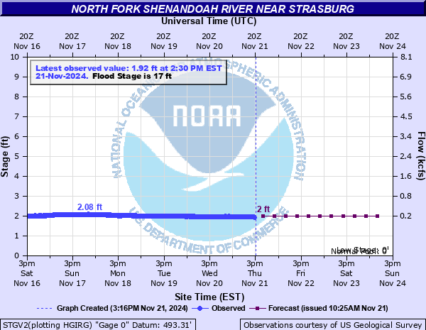
Latest Observation
Updated: 9:30 AM EST 12/14/25
Status: No Flooding
Stage: 1.83 ft
Flow: 0.112 kcfs
Forecast
| Time | Stage (ft) | Flow (kcfs) |
|---|---|---|
| 1 PM 12/14 | 1.8 | 0.104 |
| 7 PM 12/14 | 1.8 | 0.104 |
| 1 AM 12/15 | 1.8 | 0.104 |
| 7 AM 12/15 | 1.8 | 0.104 |
| 1 PM 12/15 | 1.8 | 0.104 |
| 7 PM 12/15 | 1.8 | 0.104 |
| 1 AM 12/16 | 1.8 | 0.104 |
| 7 AM 12/16 | 1.8 | 0.104 |
| 1 PM 12/16 | 1.8 | 0.104 |
| 7 PM 12/16 | 1.8 | 0.104 |
| 1 AM 12/17 | 1.8 | 0.104 |
| 7 AM 12/17 | 1.8 | 0.104 |
| Time | Stage (ft) | Flow (kcfs) |
|---|---|---|
| 9:30 AM 12/14 | 1.83 | 0.112 |
| 9:15 AM 12/14 | 1.83 | 0.112 |
| 9:00 AM 12/14 | 1.84 | 0.115 |
| 8:45 AM 12/14 | 1.84 | 0.115 |
| 8:30 AM 12/14 | 1.85 | 0.118 |
| 8:15 AM 12/14 | 1.84 | 0.115 |
| 8:00 AM 12/14 | 1.84 | 0.115 |
| 7:45 AM 12/14 | 1.85 | 0.118 |
| 7:30 AM 12/14 | 1.85 | 0.118 |
| 7:15 AM 12/14 | 1.85 | 0.118 |
| 7:00 AM 12/14 | 1.86 | 0.121 |
| 6:45 AM 12/14 | 1.83 | 0.112 |
| 6:30 AM 12/14 | 1.84 | 0.115 |
| 6:15 AM 12/14 | 1.85 | 0.118 |
| 6:00 AM 12/14 | 1.84 | 0.115 |
| 5:45 AM 12/14 | 1.85 | 0.118 |
| 5:30 AM 12/14 | 1.84 | 0.115 |
| 5:15 AM 12/14 | 1.85 | 0.118 |
| 5:00 AM 12/14 | 1.84 | 0.115 |
| 4:45 AM 12/14 | 1.84 | 0.115 |
| 4:30 AM 12/14 | 1.85 | 0.118 |
| 4:15 AM 12/14 | 1.85 | 0.118 |
| 4:00 AM 12/14 | 1.85 | 0.118 |
| 3:45 AM 12/14 | 1.85 | 0.118 |
| 3:30 AM 12/14 | 1.85 | 0.118 |
| 3:15 AM 12/14 | 1.85 | 0.118 |
| 3:00 AM 12/14 | 1.85 | 0.118 |
| 2:45 AM 12/14 | 1.84 | 0.115 |
| 2:30 AM 12/14 | 1.85 | 0.118 |
| 2:15 AM 12/14 | 1.85 | 0.118 |
25' -
Floodwaters reach the track and tennis courts at Strasburg High School.
20' -
Several roads are flooded near the river, especially south of Strasburg. Downstream, water begins to inundate the North Fork Campground. Campers and trailers will need to seek higher ground.
17' -
Significant flooding of fields is occurring. The Strasburg River Walk is flooded.
13' -
Agricultural flooding occurs near the river. Several low spots of Deer Rapids Road are flooded.
10' -
Livestock fields east of Strasburg begin to flood. The livestock should be moved to higher ground. Water approaches Deer Rapids Road south of Strasburg.
7' -
Several low water bridges over the North Fork of the Shenandoah River are covered by water. This will cut off access to homes and businesses. Residents should never attempt to drive across water-covered low water bridges!
| Date | Stage (ft) |
|---|---|
| Sep 7, 1996 | 32.27 |
| Oct 16, 1942 | 31.2 |
| Mar 18, 1936 | 30.21 |
| Jan 20, 1996 | 27.96 |
| Nov 5, 1985 | 27.37 |
| Aug 18, 1955 | 23.55 |
| Oct 6, 1972 | 23.48 |
| Mar 20, 1975 | 21.22 |
| Apr 26, 1937 | 20.93 |
| Jun 22, 1972 | 20.88 |
| Sep 19, 1945 | 20.4 |
| Oct 10, 1976 | 19.33 |
| May 23, 1942 | 19.28 |
| Sep 20, 2003 | 19.27 |
| May 18, 2011 | 19.07 |
| Mar 5, 1993 | 19.06 |
| Dec 2, 1934 | 18.99 |
| Apr 17, 2011 | 18.33 |
| Apr 17, 1987 | 18.27 |
| Oct 16, 1954 | 18.25 |
Data provided by the National Weather Service.