Little River near Eatonton
Critical Stages
14' - Action
20' - Flood
24' - Moderate
30' - Major
Latest Observation
Updated: 5:30 AM EST 12/8/25
Status: No Flooding
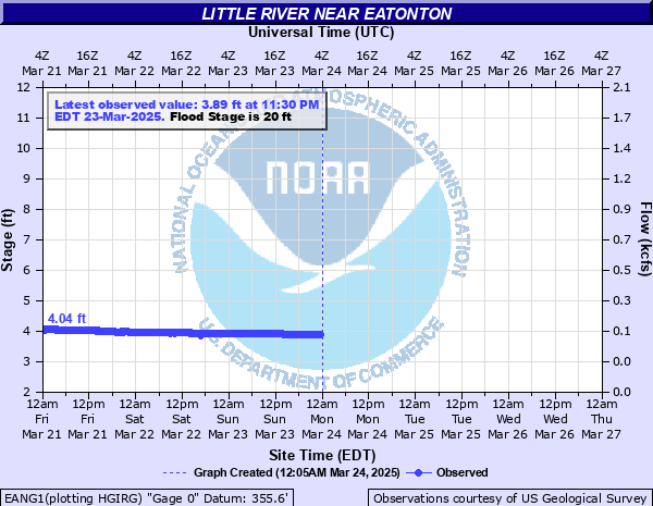
Stage: 3.94 ft
Flow: 0.111 kcfs
Forecast
Forecast not available for this location.
| Time | Stage (ft) | Flow (kcfs) |
|---|---|---|
| 5:30 AM 12/8 | 3.94 | 0.111 |
| 5:15 AM 12/8 | 3.94 | 0.111 |
| 5:00 AM 12/8 | 3.94 | 0.111 |
| 4:45 AM 12/8 | 3.95 | 0.112 |
| 4:30 AM 12/8 | 3.95 | 0.112 |
| 4:15 AM 12/8 | 3.95 | 0.112 |
| 4:00 AM 12/8 | 3.95 | 0.112 |
| 3:45 AM 12/8 | 3.95 | 0.112 |
| 3:30 AM 12/8 | 3.95 | 0.112 |
| 3:15 AM 12/8 | 3.95 | 0.112 |
| 3:00 AM 12/8 | 3.95 | 0.112 |
| 2:45 AM 12/8 | 3.95 | 0.112 |
| 2:30 AM 12/8 | 3.95 | 0.112 |
| 2:15 AM 12/8 | 3.95 | 0.112 |
| 2:00 AM 12/8 | 3.95 | 0.112 |
| 1:45 AM 12/8 | 3.95 | 0.112 |
| 1:30 AM 12/8 | 3.95 | 0.112 |
| 1:15 AM 12/8 | 3.95 | 0.112 |
| 1:00 AM 12/8 | 3.95 | 0.112 |
| 12:45 AM 12/8 | 3.95 | 0.112 |
| 12:30 AM 12/8 | 3.95 | 0.112 |
| 12:15 AM 12/8 | 3.96 | 0.114 |
| 12:00 AM 12/8 | 3.95 | 0.112 |
| 11:45 PM 12/7 | 3.96 | 0.114 |
| 11:30 PM 12/7 | 3.96 | 0.114 |
| 11:15 PM 12/7 | 3.96 | 0.114 |
| 11:00 PM 12/7 | 3.96 | 0.114 |
| 10:45 PM 12/7 | 3.96 | 0.114 |
| 10:30 PM 12/7 | 3.96 | 0.114 |
| 10:15 PM 12/7 | 3.97 | 0.115 |
30' -
Major flooding begins. Widespread inundation flooding occurs in the woodlands and fields along the river of the Oconee National Forest upstream and downstream from the gage on Georgia Highway 16 or Monticello Road. Portions of Martin Mill Road...Church Street and Horton Drive near the river will be under 6 feet of water. This will be the worse flooding since February 1948.
28' -
Significant flooding continues in the woodlands and fields along the river of the Oconee National Forest upstream and downstream from the gage on Georgia Highway 16 or Monticello Road. Portions of Martin Mill Road...Church Street and Horton Drive near the river will be under 4 feet of water.
26' -
Significant flooding continues in the woodlands and fields along the river of the Oconee National Forest upstream and downstream from the gage on Georgia Highway 16 or Monticello Road. Portions of Martin Mill Road...Church Street and Horton Drive near the river will be under two feet of water.
24' -
Moderate flooding begins. Significant flooding occurs in the woodlands and fields along the river of the Oconee National Forest upstream and downstream from the gage on Georgia Highway 16 or Monticello Road. Portions of Martin Mill Road...Church Street and Horton Drive near the river will begin to flood.
22' -
Minor flooding continues to expand into the woodlands and fields along the river of the Oconee National Forest upstream and downstream from the gage on Georgia Highway 16 or Monticello Road.
20' -
Flood stage is reached. Minor flooding begins in the woodlands and fields along the river of the Oconee National Forest upstream and downstream from the gage on Georgia Highway 16 or Monticello Road.
17' -
Bankfull conditions continue to expand along the river upstream and downstream from the gage on Georgia Highway 16 or Monticello Road.
14' -
Bankfull conditions occur along the river upstream and downstream from the gage on Georgia Highway 16 or Monticello Road.
| Date | Stage (ft) |
|---|---|
| Feb 9, 1948 | 30.8 |
| Mar 18, 1990 | 28.78 |
| Mar 9, 1998 | 26.31 |
| Feb 24, 1979 | 25.71 |
| Feb 12, 1995 | 24.98 |
| Sep 22, 2009 | 24.7 |
| Jan 1, 2016 | 23.73 |
| Mar 27, 2023 | 22.86 |
| Feb 7, 2020 | 22.79 |
| Nov 11, 2009 | 22.59 |
| Sep 18, 2009 | 22.4 |
| Dec 22, 2015 | 20.75 |
| Feb 7, 2020 | 20.51 |
| Oct 6, 2021 | 20.29 |
| Apr 7, 2022 | 20.13 |
| Dec 24, 2015 | 20.09 |
Data provided by the National Weather Service.