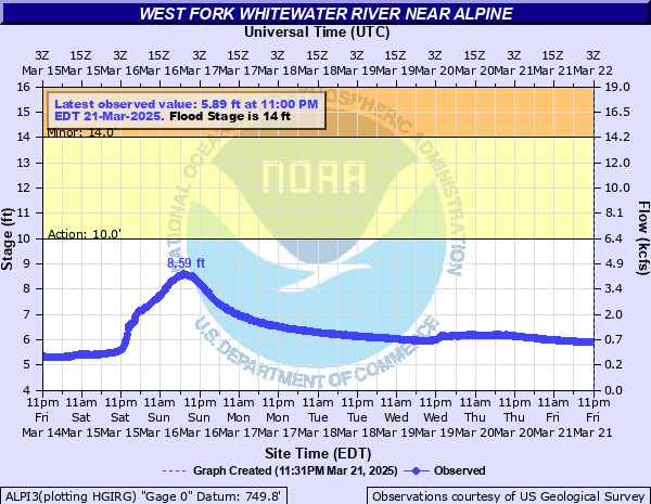
West Fork Whitewater River near Alpine
Critical Stages
10' - Action
14' - Flood
17' - Moderate
19' - Major
Latest Observation
Updated: 3:00 AM EST 12/10/25
Status: No Flooding
Stage: 4.36 ft
Flow: 0.108 kcfs
Forecast
Forecast not available for this location.
| Time | Stage (ft) | Flow (kcfs) |
|---|---|---|
| 3:00 AM 12/10 | 4.36 | 0.108 |
| 2:45 AM 12/10 | 4.36 | 0.108 |
| 2:30 AM 12/10 | 4.39 | 0.115 |
| 2:15 AM 12/10 | 4.37 | 0.11 |
| 2:00 AM 12/10 | 4.37 | 0.11 |
| 1:45 AM 12/10 | 4.38 | 0.112 |
| 1:30 AM 12/10 | 4.38 | 0.112 |
| 1:15 AM 12/10 | 4.37 | 0.11 |
| 1:00 AM 12/10 | 4.37 | 0.11 |
| 12:45 AM 12/10 | 4.4 | 0.117 |
| 12:30 AM 12/10 | 4.37 | 0.11 |
| 12:15 AM 12/10 | 4.41 | 0.119 |
| 12:00 AM 12/10 | 4.41 | 0.119 |
| 11:45 PM 12/9 | 4.41 | 0.119 |
| 11:30 PM 12/9 | 4.37 | 0.11 |
| 11:15 PM 12/9 | 4.36 | 0.108 |
| 11:00 PM 12/9 | 4.37 | 0.11 |
| 10:45 PM 12/9 | 4.4 | 0.117 |
| 10:30 PM 12/9 | 4.38 | 0.112 |
| 10:15 PM 12/9 | 4.37 | 0.11 |
| 10:00 PM 12/9 | 4.38 | 0.112 |
| 9:45 PM 12/9 | 4.39 | 0.115 |
| 9:30 PM 12/9 | 4.4 | 0.117 |
| 9:15 PM 12/9 | 4.4 | 0.117 |
| 9:00 PM 12/9 | 4.41 | 0.119 |
| 8:45 PM 12/9 | 4.41 | 0.119 |
| 8:30 PM 12/9 | 4.41 | 0.119 |
| 8:15 PM 12/9 | 4.41 | 0.119 |
| 8:00 PM 12/9 | 4.41 | 0.119 |
| 7:45 PM 12/9 | 4.41 | 0.119 |
19' -
This is similar to the FEMA 1 percent flood. Flooding occurs along the West Fork of the Whitewater in southern Fayette and northern Franklin Counties, including in Alpine, Nulltown and Laurel. In Connersville, homes between Dora Avenue and the river on the east side of Connersville incur flooding, as well as along Grand Avenue in the south side of Connersville. Structures impacted in Laurel are mainly along and west of West South Street.
18' -
Flooding impacts structures in especially the south side of Connersville, as well as Laurel in Franklin county. Flooding becomes widespread through other low areas, including near Alpine and Nulltown. In Connersville, properties between Dora Avenue and the river on the east side of Connersville incur flooding, as well as along Grand Avenue in the south side of Connersville. Properties impacted in Laurel are mainly along and west of West South Street.
17' -
Water extends well outside of the river banks with water on county roads from Alpine to Nulltown.
15.5' -
Flood water encroaches toward county roads, and flooding of low-lying agricultural land continues in Fayette and northern Franklin Counties.
14' -
Flooding of low-lying agricultural land can be expected in southern Fayette County, with water over some county roads close to the river.
| Date | Stage (ft) |
|---|---|
| Jan 6, 2005 | 20.94 |
| Jun 5, 2008 | 19.71 |
| Dec 31, 1990 | 19.7 |
| Dec 23, 2013 | 19.26 |
| May 26, 1989 | 19.01 |
| Mar 6, 2011 | 18.74 |
| May 14, 2002 | 18.7 |
| Sep 3, 2003 | 18.68 |
| Jan 5, 2004 | 18.64 |
| Feb 7, 2008 | 18.15 |
| Jan 10, 2008 | 18.02 |
| Mar 2, 2007 | 17.89 |
| Jul 18, 2001 | 17.8 |
| Apr 4, 2018 | 17.72 |
| Feb 8, 2019 | 17.55 |
| Jan 13, 2005 | 17.54 |
| Mar 16, 2007 | 17.53 |
| Oct 5, 1986 | 17.5 |
| Dec 18, 2001 | 17.5 |
| May 17, 1990 | 17.46 |
Data provided by the National Weather Service.