« Back to Baileys Harbor Rivers
Menominee River near Pembine
Critical Stages
14' - Action
16' - Flood
17' - Moderate
18.5' - Major
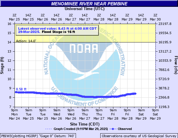
Latest Observation
Updated: 4:00 AM CST 12/16/25
Status: No Flooding
Stage: 10.52 ft
Flow: 6.81 kcfs
Forecast
Forecast not available for this location.
| Time | Stage (ft) | Flow (kcfs) |
|---|---|---|
| 4:00 AM 12/16 | 10.52 | 6.81 |
| 3:45 AM 12/16 | 10.52 | 6.81 |
| 3:30 AM 12/16 | 10.52 | 6.81 |
| 3:15 AM 12/16 | 10.53 | 6.83 |
| 3:00 AM 12/16 | 10.53 | 6.83 |
| 2:45 AM 12/16 | 10.53 | 6.83 |
| 2:30 AM 12/16 | 10.54 | 6.85 |
| 2:15 AM 12/16 | 10.55 | 6.87 |
| 2:00 AM 12/16 | 10.56 | 6.89 |
| 1:45 AM 12/16 | 10.56 | 6.89 |
| 1:30 AM 12/16 | 10.56 | 6.89 |
| 1:15 AM 12/16 | 10.58 | 6.94 |
| 1:00 AM 12/16 | 10.58 | 6.94 |
| 12:45 AM 12/16 | 10.59 | 6.96 |
| 12:30 AM 12/16 | 10.59 | 6.96 |
| 12:15 AM 12/16 | 10.6 | 6.98 |
| 12:00 AM 12/16 | 10.61 | 7 |
| 11:45 PM 12/15 | 10.62 | 7.02 |
| 11:30 PM 12/15 | 10.63 | 7.05 |
| 11:15 PM 12/15 | 10.63 | 7.05 |
| 11:00 PM 12/15 | 10.64 | 7.07 |
| 10:45 PM 12/15 | 10.65 | 7.09 |
| 10:30 PM 12/15 | 10.66 | 7.11 |
| 10:15 PM 12/15 | 10.66 | 7.11 |
| 10:00 PM 12/15 | 10.68 | 7.16 |
| 9:45 PM 12/15 | 10.67 | 7.13 |
| 9:30 PM 12/15 | 10.68 | 7.16 |
| 9:15 PM 12/15 | 10.68 | 7.16 |
| 9:00 PM 12/15 | 10.68 | 7.16 |
| 8:45 PM 12/15 | 10.69 | 7.18 |
18' -
This stage compares to a record flow rate of 25800 cubic feet per second at Chalk Hill Dam set in 1960 and White Rapids Dam also set in 1960.
16.8' -
Floodwaters may be affecting homes in the Miscauno Island area. Water is covering Pike River Road, Beach Road and the River Road boat landing east of Wausaukee. This stage compares to a flow rate of around 24000 cubic feet per second at both Chalk Hill Dam and White Rapids Dam.
16' -
Flooding affects mainly lowland and forested land adjacent to the river.
15' -
Floodwaters are mainly confined to lowland. Water approaches a few homes along River Road near Miscauno Island. There may be an ice jam during the winter months downstream of the Pemene Falls.
13.5' -
Minor flooding is occuring in wooded lowland.
12' -
There is minor flooding of wooded lowland.
| Date | Stage (ft) |
|---|---|
| Dec 17, 1985 | 18.94 |
| Jan 6, 2018 | 16.95 |
| Jan 30, 1993 | 16.21 |
| Dec 13, 2017 | 16.19 |
| Apr 19, 2002 | 15.81 |
| Apr 17, 2023 | 15.74 |
| Feb 1, 2016 | 15 |
| Jan 16, 2022 | 14.81 |
| Apr 24, 2019 | 14.69 |
| Mar 15, 1990 | 14.67 |
| Feb 6, 2003 | 14.16 |
| May 4, 2013 | 13.62 |
| Apr 7, 1997 | 13.32 |
| Jun 1, 1991 | 13.02 |
| May 20, 2017 | 12.99 |
| Apr 2, 1998 | 12.95 |
| Apr 6, 2020 | 12.85 |
| Apr 22, 1992 | 12.64 |
| Jun 19, 2018 | 11.69 |
| Mar 18, 2016 | 11.36 |
Data provided by the National Weather Service.