Palo Duro Creek at Spearman
Critical Stages
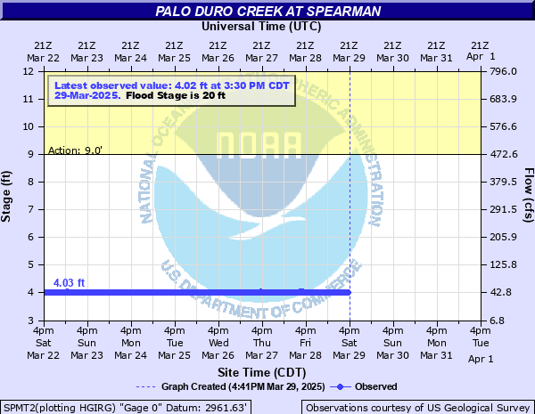
9' - Action
20' - Flood
21' - Moderate
22' - Major
Latest Observation
Updated: 6:30 AM CST 12/16/25
Status: No Flooding
Stage: 4 ft
Flow: 0 kcfs
Forecast
Forecast not available for this location.
| Time | Stage (ft) | Flow (kcfs) |
|---|---|---|
| 6:30 AM 12/16 | 4 | 0 |
| 6:15 AM 12/16 | 4 | 0 |
| 6:00 AM 12/16 | 4 | 0 |
| 5:45 AM 12/16 | 4 | 0 |
| 5:30 AM 12/16 | 4 | 0 |
| 5:15 AM 12/16 | 4 | 0 |
| 5:00 AM 12/16 | 4 | 0 |
| 4:45 AM 12/16 | 4 | 0 |
| 4:30 AM 12/16 | 4 | 0 |
| 4:15 AM 12/16 | 4 | 0 |
| 4:00 AM 12/16 | 4 | 0 |
| 3:45 AM 12/16 | 4 | 0 |
| 3:30 AM 12/16 | 4 | 0 |
| 3:15 AM 12/16 | 4 | 0 |
| 3:00 AM 12/16 | 4 | 0 |
| 2:45 AM 12/16 | 4 | 0 |
| 2:30 AM 12/16 | 4 | 0 |
| 2:15 AM 12/16 | 4 | 0 |
| 2:00 AM 12/16 | 4 | 0 |
| 1:45 AM 12/16 | 4 | 0 |
| 1:30 AM 12/16 | 4 | 0 |
| 1:15 AM 12/16 | 4 | 0 |
| 1:00 AM 12/16 | 4 | 0 |
| 12:45 AM 12/16 | 4 | 0 |
| 12:30 AM 12/16 | 4 | 0 |
| 12:15 AM 12/16 | 4 | 0 |
| 12:00 AM 12/16 | 4.01 | 0 |
| 11:45 PM 12/15 | 4 | 0 |
| 11:30 PM 12/15 | 4.01 | 0 |
| 11:15 PM 12/15 | 4 | 0 |
23' -
Bridge rails are flooded. The road surface on the bridge is under 3 feet of water. 2 to 3 homes downstream of the gage site are flooded. Ranch land is flooded on both sides of the creek and cattle are threatened.
20' -
Road surface on bridge floods. 2 to 3 homes downstream of the gage site are flooded. Ranch land is flooded on both sides of the creek and cattle are threatened.
19' -
Houses downstream of gage site flood.
12' -
Moderate overbank flooding occurs. Cattle are threatened and damage to fences is possible
9' -
The creek is at bankfull stage. Some minor overbank flooding occurs and cattle in the floodplain may be threatened.
| Date | Stage (ft) |
|---|---|
| Jun 4, 1936 | 23.68 |
| Oct 7, 1946 | 22.55 |
| Jun 13, 2010 | 22.48 |
| Jun 4, 1936 | 21 |
| Jun 19, 2004 | 20.1 |
| May 20, 2023 | 16.37 |
| May 20, 2010 | 15.94 |
| Jun 9, 2002 | 14.31 |
| Oct 2, 1998 | 14 |
| Jun 26, 2000 | 10.12 |
| Jun 28, 2000 | 8.92 |
| Jun 28, 2000 | 8.39 |
Data provided by the National Weather Service.