« Back to Barnard Township Rivers
Penobscot River above Grindstone
Critical Stages
11.5' - Action
14' - Flood
16' - Moderate
17' - Major
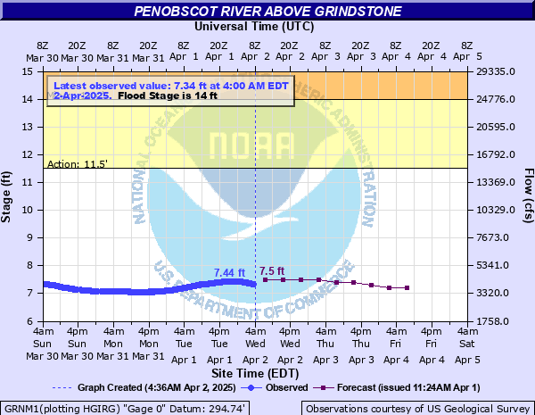
Latest Observation
Updated: 10:00 PM EST 12/14/25
Status: No Flooding
Stage: 5.09 ft
Flow: 0.787 kcfs
Forecast
| Time | Stage (ft) | Flow (kcfs) |
|---|---|---|
| 1 AM 12/15 | 5 | 0.714 |
| 7 AM 12/15 | 5 | 0.714 |
| 1 PM 12/15 | 5 | 0.714 |
| 7 PM 12/15 | 5 | 0.714 |
| 1 AM 12/16 | 5 | 0.714 |
| 7 AM 12/16 | 5 | 0.714 |
| 1 PM 12/16 | 5 | 0.714 |
| 7 PM 12/16 | 5 | 0.714 |
| 1 AM 12/17 | 5 | 0.714 |
| 7 AM 12/17 | 5 | 0.714 |
| Time | Stage (ft) | Flow (kcfs) |
|---|---|---|
| 10:00 PM 12/14 | 5.09 | 0.787 |
| 9:45 PM 12/14 | 5.09 | 0.787 |
| 9:30 PM 12/14 | 5.09 | 0.787 |
| 9:15 PM 12/14 | 5.09 | 0.787 |
| 9:00 PM 12/14 | 5.09 | 0.787 |
| 8:45 PM 12/14 | 5.09 | 0.787 |
| 8:30 PM 12/14 | 5.09 | 0.787 |
| 8:15 PM 12/14 | 5.09 | 0.787 |
| 8:00 PM 12/14 | 5.09 | 0.787 |
| 7:45 PM 12/14 | 5.09 | 0.787 |
| 7:30 PM 12/14 | 5.09 | 0.787 |
| 7:15 PM 12/14 | 5.09 | 0.787 |
| 7:00 PM 12/14 | 5.09 | 0.787 |
| 6:45 PM 12/14 | 5.09 | 0.787 |
| 6:30 PM 12/14 | 5.09 | 0.787 |
| 6:15 PM 12/14 | 5.09 | 0.787 |
| 6:00 PM 12/14 | 5.09 | 0.787 |
| 5:45 PM 12/14 | 5.09 | 0.787 |
| 5:30 PM 12/14 | 5.09 | 0.787 |
| 5:15 PM 12/14 | 5.09 | 0.787 |
| 5:00 PM 12/14 | 5.1 | 0.795 |
| 4:45 PM 12/14 | 5.1 | 0.795 |
| 4:30 PM 12/14 | 5.1 | 0.795 |
| 4:15 PM 12/14 | 5.1 | 0.795 |
| 4:00 PM 12/14 | 5.1 | 0.795 |
| 3:45 PM 12/14 | 5.1 | 0.795 |
| 3:30 PM 12/14 | 5.1 | 0.795 |
| 3:15 PM 12/14 | 5.1 | 0.795 |
| 3:00 PM 12/14 | 5.1 | 0.795 |
| 2:45 PM 12/14 | 5.1 | 0.795 |
17' -
Widespread flooding of State Route 11 from Hay Brook to Grindstone to Medway. Numerous homes, camps and campgrounds inundated. Flooding similar to April 1923. Penobscot River Trails inaccessible. Widespread flooding upstream to the Swift Brook Road in T3 R7 Wels.
16' -
State Route 11 significantly flooded and impassable to all travel in several areas between Medway and the Penobscot River Trails in Grindstone. Homes and camps inundated. Logging roads west and near the river will be flooded. Hathaway Road flooded near the river.
14.5' -
State Route 11 becomes impassable between the Penobscot River Trails road and Hay Brook with significant backwater flooding. Additional flooding of State Route 11 near Frazier Road to the Grindstone Falls Rest Area. 1-2 feet of inundation of State Route 11 near the USGS gage at the railroad trestle. Low lying structures are threatened downstream to Medway.
14' -
State Route 11 flooded in places but remains passable. Homes and camps begin to get threatened. Significant flooding of Penobscot River Trails and unaccessable. Moderate backwater flooding of Mud & Hay Brooks.
13' -
Minor flooding of the flood plain through Penobscot River Trails cutting some trails off from access.
12' -
River rising nearing bankfull with minor floodplain flooding along the Penobscot River Trails.
| Date | Stage (ft) |
|---|---|
| Apr 30, 1923 | 16.9 |
| Apr 30, 2008 | 15.02 |
| Apr 29, 1973 | 14.71 |
| Dec 19, 2023 | 14.67 |
| Sep 29, 1909 | 14.3 |
| Mar 20, 1936 | 14 |
| Apr 28, 2019 | 12.5 |
| Dec 14, 2010 | 12.49 |
| Apr 27, 2018 | 12.22 |
| Apr 16, 2014 | 11.87 |
| Oct 19, 2022 | 11.22 |
| Apr 14, 2020 | 10.7 |
| Nov 17, 2007 | 10.41 |
Data provided by the National Weather Service.