« Back to Bedford County Rivers
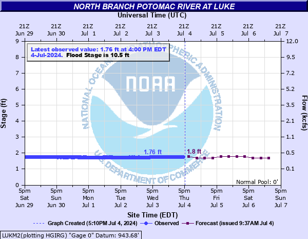
North Branch Potomac River at Luke
Critical Stages
9' - Action
10.5' - Flood
12.5' - Moderate
15' - Major
Latest Observation
Updated: 2:00 AM EST 12/15/25
Status: No Flooding
Stage: 1.37 ft
Flow: 0.199 kcfs
Forecast
| Time | Stage (ft) | Flow (kcfs) |
|---|---|---|
| 7 AM 12/15 | 1.4 | 0.208 |
| 1 PM 12/15 | 1.4 | 0.208 |
| 7 PM 12/15 | 1.4 | 0.208 |
| 1 AM 12/16 | 1.4 | 0.208 |
| 7 AM 12/16 | 1.4 | 0.208 |
| 1 PM 12/16 | 1.4 | 0.208 |
| 7 PM 12/16 | 1.4 | 0.208 |
| 1 AM 12/17 | 1.4 | 0.208 |
| 7 AM 12/17 | 1.4 | 0.208 |
| Time | Stage (ft) | Flow (kcfs) |
|---|---|---|
| 2:00 AM 12/15 | 1.37 | 0.199 |
| 1:45 AM 12/15 | 1.37 | 0.199 |
| 1:30 AM 12/15 | 1.37 | 0.199 |
| 1:15 AM 12/15 | 1.37 | 0.199 |
| 1:00 AM 12/15 | 1.37 | 0.199 |
| 12:45 AM 12/15 | 1.37 | 0.199 |
| 12:30 AM 12/15 | 1.37 | 0.199 |
| 12:15 AM 12/15 | 1.37 | 0.199 |
| 12:00 AM 12/15 | 1.38 | 0.202 |
| 11:45 PM 12/14 | 1.38 | 0.202 |
| 11:30 PM 12/14 | 1.37 | 0.199 |
| 11:15 PM 12/14 | 1.37 | 0.199 |
| 11:00 PM 12/14 | 1.38 | 0.202 |
| 10:45 PM 12/14 | 1.37 | 0.199 |
| 10:30 PM 12/14 | 1.37 | 0.199 |
| 10:15 PM 12/14 | 1.38 | 0.202 |
| 10:00 PM 12/14 | 1.38 | 0.202 |
| 9:45 PM 12/14 | 1.37 | 0.199 |
| 9:30 PM 12/14 | 1.38 | 0.202 |
| 9:15 PM 12/14 | 1.37 | 0.199 |
| 9:00 PM 12/14 | 1.37 | 0.199 |
| 8:45 PM 12/14 | 1.37 | 0.199 |
| 8:30 PM 12/14 | 1.37 | 0.199 |
| 8:15 PM 12/14 | 1.38 | 0.202 |
| 8:00 PM 12/14 | 1.38 | 0.202 |
| 7:45 PM 12/14 | 1.37 | 0.199 |
| 7:30 PM 12/14 | 1.37 | 0.199 |
| 7:15 PM 12/14 | 1.38 | 0.202 |
| 7:00 PM 12/14 | 1.38 | 0.202 |
| 6:45 PM 12/14 | 1.37 | 0.199 |
20' -
Water overtops the railroad bridges at the old paper mill.
17' -
Levees protect the old paper mill at Luke up to approximately this level. If water reaches the top of the levee, water may affect structures.
16' -
Water reaches the railroad tracks in the town of Westernport.
15' -
Significant flooding is occurring in Westernport and Piedmont, with buildings and roads flooded.
13.5' -
Maryland Route 135 begins to flood west of the town of Luke. Water also reaches the underside of railroad bridges near the old paper mill.
12.5' -
Backwater from the Potomac begins to flood the town of Westernport. Portions of Maryland Route 135 east of downtown may be affected, and water will approach Westernport Elementary School. This flooding will be more severe if Georges Creek is also in flood.
12' -
Floodwaters begin to affect portions of Piedmont, West Virginia.
10.5' -
If water levels are elevated on Georges Creek, a combination of the creek and backwater from the Potomac will begin to flood the town of Westernport. Portions of Maryland Route 135 may be affected, and water will approach Westernport Elementary School.
7' -
Water begins to flow over the dam near the old paper mill in Luke. No flooding is occurring.
| Date | Stage (ft) |
|---|---|
| Oct 15, 1954 | 17.15 |
| Mar 25, 1924 | 17 |
| Mar 17, 1936 | 16.76 |
| Aug 17, 1955 | 15.53 |
| Jul 3, 1978 | 14.87 |
| Feb 18, 1961 | 14.21 |
| Mar 5, 1963 | 11.83 |
| Aug 6, 1956 | 11.48 |
| Mar 7, 1967 | 11.13 |
| May 24, 1968 | 10.84 |
| Feb 10, 1957 | 10.58 |
| Dec 8, 1972 | 10.47 |
| Mar 30, 1960 | 10.33 |
| Sep 7, 1996 | 10.26 |
| Mar 5, 1964 | 10 |
| Apr 1, 1993 | 9.83 |
| Apr 7, 1958 | 9.82 |
| May 6, 1988 | 9.76 |
| Apr 5, 1984 | 9.72 |
| Feb 19, 1961 | 9.64 |
Data provided by the National Weather Service.