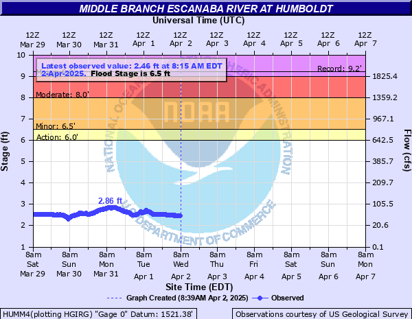
Middle Branch Escanaba River at Humboldt
Critical Stages
6' - Action
6.5' - Flood
8' - Moderate
9' - Major
Latest Observation
Updated: 7:15 PM EST 12/8/25
Status: No Flooding
Stage: 2.36 ft
Flow: 0.0462 kcfs
Forecast
Forecast not available for this location.
| Time | Stage (ft) | Flow (kcfs) |
|---|---|---|
| 7:15 PM 12/8 | 2.36 | 0.0462 |
| 7:00 PM 12/8 | 2.36 | 0.0462 |
| 6:45 PM 12/8 | 2.36 | 0.0462 |
| 6:30 PM 12/8 | 2.36 | 0.0462 |
| 6:15 PM 12/8 | 2.36 | 0.0462 |
| 6:00 PM 12/8 | 2.36 | 0.0462 |
| 5:45 PM 12/8 | 2.36 | 0.0462 |
| 5:30 PM 12/8 | 2.36 | 0.0462 |
| 5:15 PM 12/8 | 2.37 | 0.0472 |
| 5:00 PM 12/8 | 2.36 | 0.0462 |
| 4:45 PM 12/8 | 2.37 | 0.0472 |
| 4:30 PM 12/8 | 2.37 | 0.0472 |
| 4:15 PM 12/8 | 2.36 | 0.0462 |
| 4:00 PM 12/8 | 2.37 | 0.0472 |
| 3:45 PM 12/8 | 2.36 | 0.0462 |
| 3:30 PM 12/8 | 2.36 | 0.0462 |
| 3:15 PM 12/8 | 2.36 | 0.0462 |
| 3:00 PM 12/8 | 2.36 | 0.0462 |
| 2:45 PM 12/8 | 2.36 | 0.0462 |
| 2:30 PM 12/8 | 2.36 | 0.0462 |
| 2:15 PM 12/8 | 2.35 | 0.0453 |
| 2:00 PM 12/8 | 2.35 | 0.0453 |
| 1:45 PM 12/8 | 2.35 | 0.0453 |
| 1:30 PM 12/8 | 2.35 | 0.0453 |
| 1:15 PM 12/8 | 2.35 | 0.0453 |
| 1:00 PM 12/8 | 2.34 | 0.0444 |
| 12:45 PM 12/8 | 2.35 | 0.0453 |
| 12:30 PM 12/8 | 2.35 | 0.0453 |
| 12:15 PM 12/8 | 2.36 | 0.0462 |
| 12:00 PM 12/8 | 2.36 | 0.0462 |
10' -
The residence located at 1360 County Road FX begins to flood
8.3' -
The residence located at 1068 County Road FX begins to flood
8' -
Water reaches the bottom of the County Road FX bridge
7' -
Water reaches the bottom of the County Road FX bridge
6.5' -
County Road FX begins to flood
| Date | Stage (ft) |
|---|---|
| Apr 20, 1985 | 9.21 |
| Apr 17, 2002 | 8.47 |
| Apr 24, 1960 | 8.3 |
| May 1, 2013 | 7.93 |
| Oct 6, 1986 | 7.88 |
| Sep 12, 1978 | 7.73 |
| May 20, 1996 | 7.58 |
| Apr 26, 1979 | 7.36 |
| Apr 15, 2023 | 7.26 |
| Apr 19, 2004 | 7.16 |
| Apr 25, 2022 | 6.86 |
| Apr 22, 1992 | 6.79 |
| May 30, 1983 | 6.7 |
| Apr 23, 2019 | 6.56 |
| Apr 26, 1982 | 6.54 |
| May 4, 1972 | 6.43 |
| Apr 17, 1976 | 6.43 |
| Apr 22, 2008 | 6.39 |
| Apr 18, 1967 | 6.38 |
| Apr 17, 1969 | 6.32 |
Data provided by the National Weather Service.