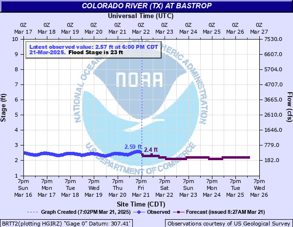
Colorado River (TX) at Bastrop
Critical Stages
14' - Action
23' - Flood
25' - Moderate
28' - Major
Latest Observation
Updated: 7:45 AM CST 12/6/25
Status: No Flooding
Stage: 2.49 ft
Flow: 0.354 kcfs
Forecast
| Time | Stage (ft) | Flow (kcfs) |
|---|---|---|
| 9 AM 12/6 | 2.5 | 0.359 |
| 10 AM 12/6 | 2.5 | 0.359 |
| 11 AM 12/6 | 2.5 | 0.359 |
| 12 PM 12/6 | 2.5 | 0.359 |
| 1 PM 12/6 | 2.5 | 0.359 |
| 2 PM 12/6 | 2.4 | 0.308 |
| 3 PM 12/6 | 2.4 | 0.308 |
| 4 PM 12/6 | 2.4 | 0.308 |
| 5 PM 12/6 | 2.4 | 0.308 |
| 6 PM 12/6 | 2.4 | 0.308 |
| 7 PM 12/6 | 2.4 | 0.308 |
| 8 PM 12/6 | 2.4 | 0.308 |
| 9 PM 12/6 | 2.4 | 0.308 |
| 10 PM 12/6 | 2.4 | 0.308 |
| 11 PM 12/6 | 2.4 | 0.308 |
| 12 AM 12/7 | 2.4 | 0.308 |
| 1 AM 12/7 | 2.4 | 0.308 |
| 2 AM 12/7 | 2.4 | 0.308 |
| 3 AM 12/7 | 2.4 | 0.308 |
| 4 AM 12/7 | 2.4 | 0.308 |
| 5 AM 12/7 | 2.4 | 0.308 |
| 6 AM 12/7 | 2.4 | 0.308 |
| 7 AM 12/7 | 2.4 | 0.308 |
| 8 AM 12/7 | 2.4 | 0.308 |
| 9 AM 12/7 | 2.4 | 0.308 |
| 10 AM 12/7 | 2.4 | 0.308 |
| 11 AM 12/7 | 2.4 | 0.308 |
| 12 PM 12/7 | 2.4 | 0.308 |
| 1 PM 12/7 | 2.4 | 0.308 |
| 2 PM 12/7 | 2.4 | 0.308 |
| 3 PM 12/7 | 2.4 | 0.308 |
| 4 PM 12/7 | 2.4 | 0.308 |
| 5 PM 12/7 | 2.4 | 0.308 |
| 6 PM 12/7 | 2.4 | 0.308 |
| 7 PM 12/7 | 2.4 | 0.308 |
| 8 PM 12/7 | 2.4 | 0.308 |
| 9 PM 12/7 | 2.4 | 0.308 |
| 10 PM 12/7 | 2.4 | 0.308 |
| 11 PM 12/7 | 2.4 | 0.308 |
| 12 AM 12/8 | 2.4 | 0.308 |
| 1 AM 12/8 | 2.4 | 0.308 |
| 2 AM 12/8 | 2.4 | 0.308 |
| 3 AM 12/8 | 2.4 | 0.308 |
| 4 AM 12/8 | 2.4 | 0.308 |
| 5 AM 12/8 | 2.4 | 0.308 |
| 6 AM 12/8 | 2.4 | 0.308 |
| 7 AM 12/8 | 2.4 | 0.308 |
| 8 AM 12/8 | 2.4 | 0.308 |
| 9 AM 12/8 | 2.4 | 0.308 |
| 10 AM 12/8 | 2.4 | 0.308 |
| 11 AM 12/8 | 2.4 | 0.308 |
| 12 PM 12/8 | 2.4 | 0.308 |
| 1 PM 12/8 | 2.4 | 0.308 |
| 2 PM 12/8 | 2.4 | 0.308 |
| 3 PM 12/8 | 2.4 | 0.308 |
| 4 PM 12/8 | 2.4 | 0.308 |
| 5 PM 12/8 | 2.4 | 0.308 |
| 6 PM 12/8 | 2.4 | 0.308 |
| 7 PM 12/8 | 2.4 | 0.308 |
| 8 PM 12/8 | 2.4 | 0.308 |
| 9 PM 12/8 | 2.4 | 0.308 |
| 10 PM 12/8 | 2.4 | 0.308 |
| 11 PM 12/8 | 2.4 | 0.308 |
| 12 AM 12/9 | 2.4 | 0.308 |
| 1 AM 12/9 | 2.4 | 0.308 |
| 2 AM 12/9 | 2.4 | 0.308 |
| 3 AM 12/9 | 2.4 | 0.308 |
| 4 AM 12/9 | 2.4 | 0.308 |
| 5 AM 12/9 | 2.4 | 0.308 |
| 6 AM 12/9 | 2.4 | 0.308 |
| 7 AM 12/9 | 2.4 | 0.308 |
| 8 AM 12/9 | 2.4 | 0.308 |
| 9 AM 12/9 | 2.4 | 0.308 |
| 10 AM 12/9 | 2.4 | 0.308 |
| 11 AM 12/9 | 2.4 | 0.308 |
| 12 PM 12/9 | 2.4 | 0.308 |
| 1 PM 12/9 | 2.4 | 0.308 |
| 2 PM 12/9 | 2.4 | 0.308 |
| 3 PM 12/9 | 2.4 | 0.308 |
| 4 PM 12/9 | 2.4 | 0.308 |
| 5 PM 12/9 | 2.4 | 0.308 |
| 6 PM 12/9 | 2.4 | 0.308 |
| 7 PM 12/9 | 2.4 | 0.308 |
| 8 PM 12/9 | 2.4 | 0.308 |
| 9 PM 12/9 | 2.4 | 0.308 |
| 10 PM 12/9 | 2.4 | 0.308 |
| 11 PM 12/9 | 2.3 | 0.258 |
| 12 AM 12/10 | 2.3 | 0.258 |
| 1 AM 12/10 | 2.3 | 0.258 |
| 2 AM 12/10 | 2.3 | 0.258 |
| 3 AM 12/10 | 2.3 | 0.258 |
| 4 AM 12/10 | 2.3 | 0.258 |
| 5 AM 12/10 | 2.3 | 0.258 |
| 6 AM 12/10 | 2.3 | 0.258 |
| 7 AM 12/10 | 2.3 | 0.258 |
| 8 AM 12/10 | 2.3 | 0.258 |
| Time | Stage (ft) | Flow (kcfs) |
|---|---|---|
| 7:45 AM 12/6 | 2.49 | 0.354 |
| 7:40 AM 12/6 | 2.49 | 0.354 |
| 7:35 AM 12/6 | 2.5 | 0.359 |
| 7:30 AM 12/6 | 2.5 | 0.359 |
| 7:25 AM 12/6 | 2.5 | 0.359 |
| 7:20 AM 12/6 | 2.5 | 0.359 |
| 7:15 AM 12/6 | 2.49 | 0.354 |
| 7:10 AM 12/6 | 2.5 | 0.359 |
| 7:05 AM 12/6 | 2.5 | 0.359 |
| 7:00 AM 12/6 | 2.5 | 0.359 |
| 6:55 AM 12/6 | 2.49 | 0.354 |
| 6:50 AM 12/6 | 2.5 | 0.359 |
| 6:45 AM 12/6 | 2.5 | 0.359 |
| 6:40 AM 12/6 | 2.49 | 0.354 |
| 6:35 AM 12/6 | 2.5 | 0.359 |
| 6:30 AM 12/6 | 2.5 | 0.359 |
| 6:25 AM 12/6 | 2.5 | 0.359 |
| 6:20 AM 12/6 | 2.51 | 0.363 |
| 6:15 AM 12/6 | 2.51 | 0.363 |
| 6:10 AM 12/6 | 2.51 | 0.363 |
| 6:05 AM 12/6 | 2.51 | 0.363 |
| 6:00 AM 12/6 | 2.51 | 0.363 |
| 5:55 AM 12/6 | 2.5 | 0.359 |
| 5:50 AM 12/6 | 2.51 | 0.363 |
| 5:45 AM 12/6 | 2.5 | 0.359 |
| 5:40 AM 12/6 | 2.51 | 0.363 |
| 5:35 AM 12/6 | 2.5 | 0.359 |
| 5:30 AM 12/6 | 2.52 | 0.367 |
| 5:25 AM 12/6 | 2.51 | 0.363 |
| 5:20 AM 12/6 | 2.51 | 0.363 |
37' -
Widespread disastrous flooding is to the roofs of the lowest homes in the Doty River, Hidden Valley, and Pecan Shores subdivisions above Smithville. Flow approaches the lowest homes and the golf course near Bastrop
35' -
Disastrous flooding severely floods homes between Bastrop and Smithville in the Doty River, Hidden Valley, and Pecan Shores subdivisions. Livestock are extremely vulnerable in the flood plain. Roads and bridges flood severely and are very dangerous. Flow threatens lowest homes near bastrop and facilities and lowest areas of the golf course near Bastrop
33' -
Disastrous flooding severely damages the Doty River, Hidden Valley, and Pecan Shores subdivisions above Smithville. Roads and bridges near the river are very dangerous
31' -
Disastrous flooding reaches many homes between Bastrop and Smithville in the Doty River, Hidden Valley and Pecan Shores subdivisions. Roads and bridges in the flood plain are very dangerous. Livestock should be moved from the flood plain
29' -
Lowest homes in the Doty River, Hidden Valley and Pecan Shores subdivisions above Smithville flood. Many primary and secondary roads and bridges flood and are very dangerous to motorists. Livestock and equipment should be moved from the flood plain
28' -
Major flooding reaches lowest homes downstream above Smithville in the Doty River, Pecan Shores, and Hidden Valley Estate subdivisions. Low roads and bridges near the river flood and are very dangerous to motorists
27' -
Moderate lowland flooding below Austin to below Smithville threatens homes above Smithville in the Doty River, Hidden Valley, and Pecan Shores Estates subdivisions. Livestock should be moved from vulnerable areas of the flood plain. Low roads and bridges in the flood plain are flooded and dangerous to motorists
25' -
Moderate lowland flooding reaches bottomlands above Bastrop near the Colorado River and Piney and Wilbarger Creek confluences. Water begins to enter the city park and officials will close the park
23' -
Minor lowland flooding reaches lowest areas of the flood plain. Secondary roads and low bridges are flooded
20' -
Flow exceeds bankfull into lowest areas of the flood plain. Jogging trail at Fisherman's Park is flooded.
18' -
Flow exceeds bankfull into lowest areas of the flood plain
16' -
Flow exceeds bankfull into lowest areas of the flood plain
14' -
Flow exceeds low sections of the banks
| Date | Stage (ft) |
|---|---|
| Jul 7, 1869 | 60.3 |
| Jun 16, 1935 | 57 |
| Dec 4, 1913 | 53.3 |
| Dec 22, 1991 | 37.48 |
| Oct 31, 2015 | 36.17 |
| Oct 29, 1960 | 34.45 |
| Oct 19, 1998 | 32.3 |
| Nov 22, 2004 | 31.65 |
| May 26, 2015 | 31.07 |
| Nov 17, 2001 | 30.96 |
| Jun 14, 1981 | 30.7 |
| Jun 14, 1987 | 29.45 |
| May 28, 2016 | 26.59 |
| Aug 28, 2017 | 26.31 |
Data provided by the National Weather Service.