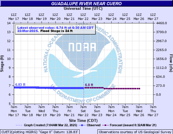
Guadalupe River near Cuero
Critical Stages
19' - Action
24' - Flood
33' - Moderate
37' - Major
Latest Observation
Updated: 7:30 AM CST 12/6/25
Status: No Flooding
Stage: 6.86 ft
Flow: 0.242 kcfs
Forecast
| Time | Stage (ft) | Flow (kcfs) |
|---|---|---|
| 9 AM 12/6 | 6.9 | 0.254 |
| 12 PM 12/6 | 6.9 | 0.254 |
| 3 PM 12/6 | 6.9 | 0.254 |
| 6 PM 12/6 | 6.9 | 0.254 |
| 9 PM 12/6 | 6.9 | 0.254 |
| 12 AM 12/7 | 6.8 | 0.224 |
| 3 AM 12/7 | 6.8 | 0.224 |
| 6 AM 12/7 | 6.8 | 0.224 |
| 9 AM 12/7 | 6.8 | 0.224 |
| 12 PM 12/7 | 6.8 | 0.224 |
| 3 PM 12/7 | 6.8 | 0.224 |
| 6 PM 12/7 | 6.8 | 0.224 |
| 9 PM 12/7 | 6.8 | 0.224 |
| 12 AM 12/8 | 6.8 | 0.224 |
| 3 AM 12/8 | 6.8 | 0.224 |
| 6 AM 12/8 | 6.8 | 0.224 |
| 9 AM 12/8 | 6.8 | 0.224 |
| 12 PM 12/8 | 6.8 | 0.224 |
| 3 PM 12/8 | 6.8 | 0.224 |
| 6 PM 12/8 | 6.8 | 0.224 |
| 9 PM 12/8 | 6.8 | 0.224 |
| 12 AM 12/9 | 6.8 | 0.224 |
| 3 AM 12/9 | 6.8 | 0.224 |
| 6 AM 12/9 | 6.7 | 0.196 |
| 9 AM 12/9 | 6.7 | 0.196 |
| 12 PM 12/9 | 6.7 | 0.196 |
| 3 PM 12/9 | 6.7 | 0.196 |
| 6 PM 12/9 | 6.7 | 0.196 |
| 9 PM 12/9 | 6.7 | 0.196 |
| 12 AM 12/10 | 6.7 | 0.196 |
| 3 AM 12/10 | 6.7 | 0.196 |
| 6 AM 12/10 | 6.7 | 0.196 |
| Time | Stage (ft) | Flow (kcfs) |
|---|---|---|
| 7:30 AM 12/6 | 6.86 | 0.242 |
| 7:15 AM 12/6 | 6.86 | 0.242 |
| 7:00 AM 12/6 | 6.86 | 0.242 |
| 6:45 AM 12/6 | 6.86 | 0.242 |
| 6:30 AM 12/6 | 6.86 | 0.242 |
| 6:15 AM 12/6 | 6.86 | 0.242 |
| 6:00 AM 12/6 | 6.86 | 0.242 |
| 5:45 AM 12/6 | 6.86 | 0.242 |
| 5:30 AM 12/6 | 6.86 | 0.242 |
| 5:15 AM 12/6 | 6.86 | 0.242 |
| 5:00 AM 12/6 | 6.86 | 0.242 |
| 4:45 AM 12/6 | 6.86 | 0.242 |
| 4:30 AM 12/6 | 6.87 | 0.245 |
| 4:15 AM 12/6 | 6.87 | 0.245 |
| 4:00 AM 12/6 | 6.86 | 0.242 |
| 3:45 AM 12/6 | 6.87 | 0.245 |
| 3:30 AM 12/6 | 6.87 | 0.245 |
| 3:15 AM 12/6 | 6.87 | 0.245 |
| 3:00 AM 12/6 | 6.87 | 0.245 |
| 2:45 AM 12/6 | 6.87 | 0.245 |
| 2:30 AM 12/6 | 6.87 | 0.245 |
| 2:15 AM 12/6 | 6.87 | 0.245 |
| 2:00 AM 12/6 | 6.87 | 0.245 |
| 1:45 AM 12/6 | 6.87 | 0.245 |
| 1:30 AM 12/6 | 6.87 | 0.245 |
| 1:15 AM 12/6 | 6.87 | 0.245 |
| 1:00 AM 12/6 | 6.87 | 0.245 |
| 12:45 AM 12/6 | 6.88 | 0.248 |
| 12:30 AM 12/6 | 6.87 | 0.245 |
| 12:15 AM 12/6 | 6.88 | 0.248 |
53.4' -
Equivalent to the 50.3 feet record flood level set October 20, 1998 at the State Highway 183 bridge. Massive flooding observed across the floodplain. Catastrophic flooding within Cuero city limits. In many locations the river is two miles wide or wider. State highways closed due to flooding. Many evacuations would likely be necessary. Note: The river gauge was moved due to safety issues for USGS personnel conducting maintenance work on the State Highway 183 bridge.
50' -
Dangerous and life threatening river flooding continues to impact numerous residential areas along the Guadalupe River upstream and downstream from Cuero. Water approaches Hwy 87 north 1.2 miles northwest of the Hwy 183/87 bridge. This height is within 4 feet of the record crest set in 1998.
44.36' -
Recorded crest at the Hwy 72 bridge, August 29, 2017 from Hurricane Harvey. Dangerous flooding is taking place along the Guadalupe River channel. Streets near Drainage District ditches are flooded. South Esplanade at the intersection of West Heaton is closed with water 8 to 10 inches over the centerline.
43' -
Water entering South Esplanade between Hamilton and Heaton. Water begins to enter homes in low-lying areas in Cuero south of Newman street. Water approximately 3 feet deep over Anderson Road.
42' -
Dangerous flooding in southern sections of Cuero from Gohlke Creek backing up into drainage ditches. Tulley road threatened. Residents should consider evacuation.
40' -
Dangerous flooding impacts homes and structures along the Guadalupe River. Water crosses county roads near the Guadalupe River and in low-lying areas. Roadways closed. Residents should consider evacuation. Livestock are cut off and potentially drowned. Drainage ditches in Cuero are flooding. Residents south of Newman in Cuero should prepare to evacuate. Hwy 87 south of Cuero has limited access.
37' -
Major Flooding. Many homes and structures in the low-lying areas along the Guadalupe River floodplain are threatened. Residents living in the floodplain should be prepared to evacuate. Additional county roads coursing through the floodplain are likely closed.
34' -
Water is crossing FM 236 at Guadalupe River bridge and the road is closed. County roads in low-lying areas of the floodplain may be closed.
33' -
Moderate flooding threatens homes in south portion of River Haven Subdivision below Cuero. Residents should consider evacuation. Any livestock remaining anywhere in the floodplain should be moved to higher ground immediately.
31' -
Water crosses State Hwy 72 on west side of the Guadalupe River west of Cuero. Roadway likely closed.
29' -
FM 766 (Hell's Gate Bridge) closed due to water across roadway between Ed Blackwell Lane and Hell's Gate Bridge.
27' -
Flooding extends into floodplain above Cuero threatening livestock. US Hwy 183 North at Hochheim has water on or crossing the roadway. Highway likely closed.
24' -
Minor low lying flooding extends into the floodplain above and below Cuero. Steen Road (between FM 766 and US Hwy 183 near Hochheim) monitored for flooding.
| Date | Stage (ft) |
|---|---|
| Oct 20, 1998 | 50.35 |
| Aug 29, 2017 | 44.36 |
| Jul 2, 1936 | 44.33 |
| Mar 1, 1903 | 43 |
| Oct 4, 1913 | 42.1 |
| Sep 1, 1981 | 41.83 |
| Nov 24, 2004 | 40.74 |
| Jun 6, 1987 | 40.01 |
| May 30, 1929 | 39.7 |
| Dec 6, 1913 | 39.1 |
| Dec 24, 1991 | 37.68 |
| Jul 9, 2002 | 37.01 |
| Jun 21, 1961 | 37 |
| Nov 7, 2002 | 36.9 |
| May 14, 1972 | 36.9 |
| May 29, 2015 | 36.84 |
| Oct 20, 1919 | 36.7 |
| Sep 23, 1967 | 36.56 |
| Oct 17, 2021 | 35.28 |
| Apr 22, 1977 | 35.24 |
Data provided by the National Weather Service.