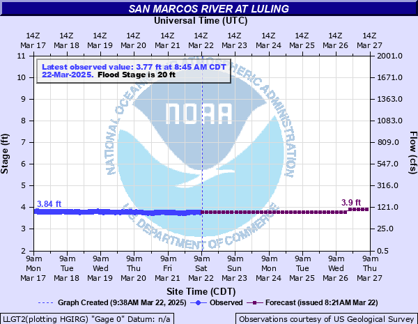
San Marcos River at Luling
Critical Stages
11' - Action
20' - Flood
24' - Moderate
30' - Major
Latest Observation
Updated: 7:45 AM CST 12/6/25
Status: No Flooding
Stage: 3.7 ft
Flow: 0.103 kcfs
Forecast
Forecast not available for this location.
| Time | Stage (ft) | Flow (kcfs) |
|---|---|---|
| 7:45 AM 12/6 | 3.7 | 0.103 |
| 7:30 AM 12/6 | 3.7 | 0.103 |
| 7:15 AM 12/6 | 3.72 | 0.106 |
| 7:00 AM 12/6 | 3.71 | 0.104 |
| 6:45 AM 12/6 | 3.71 | 0.104 |
| 6:30 AM 12/6 | 3.72 | 0.106 |
| 6:15 AM 12/6 | 3.71 | 0.104 |
| 6:00 AM 12/6 | 3.73 | 0.107 |
| 5:45 AM 12/6 | 3.73 | 0.107 |
| 5:30 AM 12/6 | 3.71 | 0.104 |
| 5:15 AM 12/6 | 3.72 | 0.106 |
| 5:00 AM 12/6 | 3.7 | 0.103 |
| 4:45 AM 12/6 | 3.71 | 0.104 |
| 4:30 AM 12/6 | 3.69 | 0.102 |
| 4:15 AM 12/6 | 3.72 | 0.106 |
| 4:00 AM 12/6 | 3.72 | 0.106 |
| 3:45 AM 12/6 | 3.72 | 0.106 |
| 3:30 AM 12/6 | 3.7 | 0.103 |
| 3:15 AM 12/6 | 3.69 | 0.102 |
| 3:00 AM 12/6 | 3.7 | 0.103 |
| 2:45 AM 12/6 | 3.7 | 0.103 |
| 2:30 AM 12/6 | 3.69 | 0.102 |
| 2:15 AM 12/6 | 3.69 | 0.102 |
| 2:00 AM 12/6 | 3.69 | 0.102 |
| 1:45 AM 12/6 | 3.68 | 0.101 |
| 1:30 AM 12/6 | 3.68 | 0.101 |
| 1:15 AM 12/6 | 3.7 | 0.103 |
| 1:00 AM 12/6 | 3.69 | 0.102 |
| 12:45 AM 12/6 | 3.68 | 0.101 |
| 12:30 AM 12/6 | 3.68 | 0.101 |
40' -
Devastating flooding reaches the lowest homes in Luling north and northeast of the golf course. All of Palmetto State Park at Ottine is under many feet of water. Water is nearly to the roof of the pavillion building. The Warm Springs rehabilitation hospital in Ottine has several feet of water in it.
36' -
Palmetto State Park is under water except for the headquarters building. The pavillion has six feet of water in it. Much of the golf course in Luling is underwater. Lowest homes northeast of the golf course are threatened. The Warm Springs rehabilitation hospital in Ottine has several feet of water in it.
32' -
Palmetto State Park is under water with water in the large pavillion building. There is extensive damage to roads, signs, camp sites and the pavillion building. Livestock are cut off and drowned in the flood plain below San Marcos to Gonzales. The lowest sections of the golf course in Luling are under water.
30' -
Major flooding reaches nearly all of Palmetto State Park with extensive damage to park facilities, signs, fences and roads. Flow is to the slab of the large pavillion building. Livestock in the flood plain below San Marcos to Gonzales are cut off. Lowest sections of the golf course in Luling flood.
28' -
Most of Palmetto State Park is flooded including Farm to Market 2091 through the park. Flow is approaching the large park pavillion building. All park visitors are evacuated. At Highway 80 in Luling flow is well into the flood plain and approaching the golf course. Livestock are cut off in the flood plain below San Marcos to Gonzales.
24' -
Moderate flooding in Palmetto State Park five miles below Luling inundates many park facilities and roads.
20' -
Minor lowland flooding reaches lowest camp sites and several sections of park roads at Palmetto State Park five miles below Luling.
16' -
Over bank flow reaches lowest areas of the flood plain with no significant damage.
| Date | Stage (ft) |
|---|---|
| Oct 18, 1998 | 41.85 |
| Jan 1, 1869 | 40.4 |
| May 29, 1929 | 37.1 |
| May 25, 2015 | 36.58 |
| Oct 31, 2015 | 36.27 |
| Sep 12, 1952 | 34.95 |
| Nov 22, 2004 | 34.91 |
| Jun 14, 1981 | 34.82 |
| Nov 16, 2001 | 34.64 |
| Jul 6, 2002 | 33.73 |
| Dec 22, 1991 | 33.65 |
| Nov 18, 2004 | 32.83 |
| Jun 23, 1997 | 32.65 |
| Mar 12, 2007 | 31.75 |
| Jun 4, 1987 | 31.4 |
| Jul 21, 2007 | 31.31 |
| Feb 5, 1992 | 30.92 |
| Oct 15, 2021 | 30.56 |
| Aug 27, 2017 | 30.09 |
| Dec 23, 1986 | 28.73 |
Data provided by the National Weather Service.