Guadalupe River above Comal River at New Braunfels
Critical Stages
6' - Action
7' - Flood
10' - Moderate
14' - Major
Latest Observation
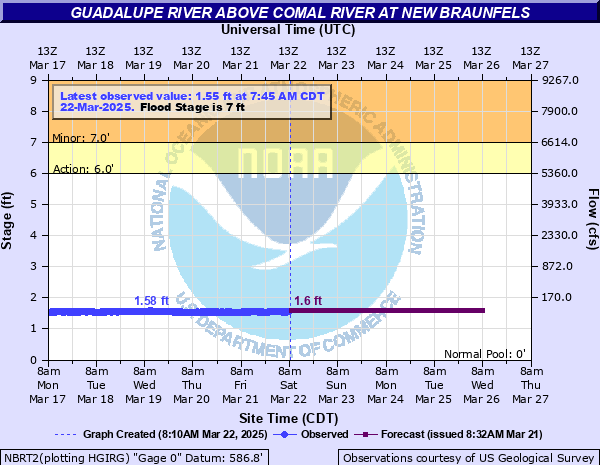
Updated: 8:00 AM CST 12/6/25
Status: No Flooding
Stage: 1.81 ft
Flow: 0.0926 kcfs
Forecast
| Time | Stage (ft) | Flow (kcfs) |
|---|---|---|
| 9 AM 12/6 | 1.8 | 0.09 |
| 10 AM 12/6 | 1.8 | 0.09 |
| 11 AM 12/6 | 1.8 | 0.09 |
| 12 PM 12/6 | 1.8 | 0.09 |
| 1 PM 12/6 | 1.8 | 0.09 |
| 2 PM 12/6 | 1.8 | 0.09 |
| 3 PM 12/6 | 1.8 | 0.09 |
| 4 PM 12/6 | 1.8 | 0.09 |
| 5 PM 12/6 | 1.8 | 0.09 |
| 6 PM 12/6 | 1.8 | 0.09 |
| 7 PM 12/6 | 1.8 | 0.09 |
| 8 PM 12/6 | 1.8 | 0.09 |
| 9 PM 12/6 | 1.8 | 0.09 |
| 10 PM 12/6 | 1.8 | 0.09 |
| 11 PM 12/6 | 1.8 | 0.09 |
| 12 AM 12/7 | 1.8 | 0.09 |
| 1 AM 12/7 | 1.8 | 0.09 |
| 2 AM 12/7 | 1.8 | 0.09 |
| 3 AM 12/7 | 1.8 | 0.09 |
| 4 AM 12/7 | 1.8 | 0.09 |
| 5 AM 12/7 | 1.8 | 0.09 |
| 6 AM 12/7 | 1.8 | 0.09 |
| 7 AM 12/7 | 1.8 | 0.09 |
| 8 AM 12/7 | 1.8 | 0.09 |
| 9 AM 12/7 | 1.8 | 0.09 |
| 10 AM 12/7 | 1.8 | 0.09 |
| 11 AM 12/7 | 1.8 | 0.09 |
| 12 PM 12/7 | 1.8 | 0.09 |
| 1 PM 12/7 | 1.8 | 0.09 |
| 2 PM 12/7 | 1.8 | 0.09 |
| 3 PM 12/7 | 1.8 | 0.09 |
| 4 PM 12/7 | 1.8 | 0.09 |
| 5 PM 12/7 | 1.8 | 0.09 |
| 6 PM 12/7 | 1.8 | 0.09 |
| 7 PM 12/7 | 1.8 | 0.09 |
| 8 PM 12/7 | 1.8 | 0.09 |
| 9 PM 12/7 | 1.8 | 0.09 |
| 10 PM 12/7 | 1.8 | 0.09 |
| 11 PM 12/7 | 1.8 | 0.09 |
| 12 AM 12/8 | 1.8 | 0.09 |
| 1 AM 12/8 | 1.8 | 0.09 |
| 2 AM 12/8 | 1.8 | 0.09 |
| 3 AM 12/8 | 1.8 | 0.09 |
| 4 AM 12/8 | 1.8 | 0.09 |
| 5 AM 12/8 | 1.8 | 0.09 |
| 6 AM 12/8 | 1.8 | 0.09 |
| 7 AM 12/8 | 1.8 | 0.09 |
| 8 AM 12/8 | 1.8 | 0.09 |
| 9 AM 12/8 | 1.8 | 0.09 |
| 10 AM 12/8 | 1.8 | 0.09 |
| 11 AM 12/8 | 1.8 | 0.09 |
| 12 PM 12/8 | 1.8 | 0.09 |
| 1 PM 12/8 | 1.8 | 0.09 |
| 2 PM 12/8 | 1.8 | 0.09 |
| 3 PM 12/8 | 1.8 | 0.09 |
| 4 PM 12/8 | 1.8 | 0.09 |
| 5 PM 12/8 | 1.8 | 0.09 |
| 6 PM 12/8 | 1.8 | 0.09 |
| 7 PM 12/8 | 1.8 | 0.09 |
| 8 PM 12/8 | 1.8 | 0.09 |
| 9 PM 12/8 | 1.8 | 0.09 |
| 10 PM 12/8 | 1.8 | 0.09 |
| 11 PM 12/8 | 1.8 | 0.09 |
| 12 AM 12/9 | 1.8 | 0.09 |
| 1 AM 12/9 | 1.8 | 0.09 |
| 2 AM 12/9 | 1.8 | 0.09 |
| 3 AM 12/9 | 1.8 | 0.09 |
| 4 AM 12/9 | 1.8 | 0.09 |
| 5 AM 12/9 | 1.8 | 0.09 |
| 6 AM 12/9 | 1.8 | 0.09 |
| 7 AM 12/9 | 1.8 | 0.09 |
| 8 AM 12/9 | 1.8 | 0.09 |
| 9 AM 12/9 | 1.8 | 0.09 |
| 10 AM 12/9 | 1.8 | 0.09 |
| 11 AM 12/9 | 1.8 | 0.09 |
| 12 PM 12/9 | 1.8 | 0.09 |
| 1 PM 12/9 | 1.8 | 0.09 |
| 2 PM 12/9 | 1.8 | 0.09 |
| 3 PM 12/9 | 1.8 | 0.09 |
| 4 PM 12/9 | 1.8 | 0.09 |
| 5 PM 12/9 | 1.8 | 0.09 |
| 6 PM 12/9 | 1.8 | 0.09 |
| 7 PM 12/9 | 1.8 | 0.09 |
| 8 PM 12/9 | 1.8 | 0.09 |
| 9 PM 12/9 | 1.8 | 0.09 |
| 10 PM 12/9 | 1.8 | 0.09 |
| 11 PM 12/9 | 1.8 | 0.09 |
| 12 AM 12/10 | 1.8 | 0.09 |
| 1 AM 12/10 | 1.8 | 0.09 |
| 2 AM 12/10 | 1.8 | 0.09 |
| 3 AM 12/10 | 1.8 | 0.09 |
| 4 AM 12/10 | 1.8 | 0.09 |
| 5 AM 12/10 | 1.8 | 0.09 |
| 6 AM 12/10 | 1.8 | 0.09 |
| 7 AM 12/10 | 1.8 | 0.09 |
| 8 AM 12/10 | 1.8 | 0.09 |
| Time | Stage (ft) | Flow (kcfs) |
|---|---|---|
| 8:00 AM 12/6 | 1.81 | 0.0926 |
| 7:45 AM 12/6 | 1.8 | 0.09 |
| 7:30 AM 12/6 | 1.8 | 0.09 |
| 7:15 AM 12/6 | 1.8 | 0.09 |
| 7:00 AM 12/6 | 1.8 | 0.09 |
| 6:45 AM 12/6 | 1.81 | 0.0926 |
| 6:30 AM 12/6 | 1.81 | 0.0926 |
| 6:15 AM 12/6 | 1.81 | 0.0926 |
| 6:00 AM 12/6 | 1.81 | 0.0926 |
| 5:45 AM 12/6 | 1.81 | 0.0926 |
| 5:30 AM 12/6 | 1.81 | 0.0926 |
| 5:15 AM 12/6 | 1.82 | 0.0953 |
| 5:00 AM 12/6 | 1.82 | 0.0953 |
| 4:45 AM 12/6 | 1.82 | 0.0953 |
| 4:30 AM 12/6 | 1.82 | 0.0953 |
| 4:15 AM 12/6 | 1.81 | 0.0926 |
| 4:00 AM 12/6 | 1.82 | 0.0953 |
| 3:45 AM 12/6 | 1.81 | 0.0926 |
| 3:30 AM 12/6 | 1.81 | 0.0926 |
| 3:15 AM 12/6 | 1.81 | 0.0926 |
| 3:00 AM 12/6 | 1.8 | 0.09 |
| 2:45 AM 12/6 | 1.81 | 0.0926 |
| 2:30 AM 12/6 | 1.8 | 0.09 |
| 2:15 AM 12/6 | 1.81 | 0.0926 |
| 2:00 AM 12/6 | 1.8 | 0.09 |
| 1:45 AM 12/6 | 1.81 | 0.0926 |
| 1:30 AM 12/6 | 1.81 | 0.0926 |
| 1:15 AM 12/6 | 1.81 | 0.0926 |
| 1:00 AM 12/6 | 1.81 | 0.0926 |
| 12:45 AM 12/6 | 1.81 | 0.0926 |
33' -
Disastrous, life threatening flooding reaches many homes in New Braunfels. All roads, streets and bridges in the flood plain below Canyon Dam to below Seguin are severely flooded and dangerous. RV and mobile home parks below New Braunfels are inundated. Camping areas along River Road below Canyon Dam will be under more than 25 feet of water.
29' -
Disastrous life threatening flooding has the potential to drown people in the flood plain below Canyon Dam to below Seguin. Recreational camps along River Road below Canyon Dam flood severely. River Road is impassable. Visitors should evacuate on foot away from the river. Hundreds of homes in New Braunfels, Treasure Island and Seguin flood severely with some homes washing downstream.
25' -
Disastrous life threatening flooding occurs below Canyon Dam to below Seguin. Roads near the river flood severely and are extremely dangerous to motorists. Campgrounds along River Road flood. Much of River Road is impassable and extremely dangerous for auto traffic. Visitors should not evacuate in cars on River Road. Evacuate on foot directly away from the river up canyon walls. Lowest homes in New Braunfels flood severely.
21' -
Major flooding puts 4 feet of water over the Common Street bridge. River Road upstream and adjoining campgrounds are severely flooded and extremely dangerous. Lowest homes in New Braunfels are threatened. The bridge at Gruene is under more than 15 feet of water.
17' -
The Common Street bridge floor over the Guadalupe River floods. Lowest homes are threatened. Much of River Road floods. Sleeping campers, autos and gear on the Guadalupe River banks can wash downstream.
14' -
Major lowland flooding threatens lowest homes. Numerous roads, streets and low bridges are flooded. River Road and camping areas upstream are severely flooded and extremely dangerous.
12.5' -
Several sections of River Road flood. Autos, gear and sleeping campers can wash downstream from low banks adjacent to the river. Flow is well into the flood plain through New Braunfels.
10' -
Moderate lowland floodng closes several sections of River Road. Campers autos and equipment along the river can be washed downstream.
7' -
Minor lowland flooding reaches the lowest sections of River Road above New Braunfels threatening sleeping campers, autos and gear on low areas near and above Gruene. The bridge on Gruene Road becomes flooded and impassable.
6' -
Minor lowland flooding reaches the lower portions of campsites along River Road. Water reaches the bridge floor at Gruene Road.
5' -
Flow exceeds lowest banks.
| Date | Stage (ft) |
|---|---|
| Aug 8, 1869 | 38 |
| Dec 13, 1913 | 38 |
| Oct 17, 1998 | 35.57 |
| Jun 15, 1935 | 32.95 |
| Jul 3, 1932 | 32.48 |
| May 12, 1972 | 31.65 |
| Sep 11, 1952 | 30.7 |
| Jul 6, 2002 | 28.95 |
| Jun 9, 2010 | 27.26 |
| Sep 28, 1936 | 24.85 |
| Oct 30, 2015 | 22.52 |
| Nov 22, 2004 | 16.57 |
| Oct 14, 2021 | 12.69 |
| May 5, 1993 | 11.82 |
| Mar 4, 1992 | 9.77 |
| Jun 25, 1987 | 7.35 |
| May 30, 1995 | 7.34 |
Data provided by the National Weather Service.