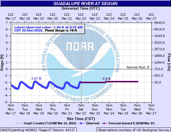
Guadalupe River at Seguin
Critical Stages
17' - Action
19' - Flood
22' - Moderate
26' - Major
Latest Observation
Updated: 7:15 AM CST 12/6/25
Status: No Flooding
Stage: -2.43 ft
Flow: -999 kcfs
Forecast
Forecast not available for this location.
| Time | Stage (ft) | Flow (kcfs) |
|---|---|---|
| 7:15 AM 12/6 | -2.43 | -999 |
| 7:00 AM 12/6 | -2.43 | -999 |
| 6:45 AM 12/6 | -2.43 | -999 |
| 6:30 AM 12/6 | -2.42 | -999 |
| 6:15 AM 12/6 | -2.42 | -999 |
| 6:00 AM 12/6 | -2.4 | -999 |
| 5:45 AM 12/6 | -2.4 | -999 |
| 5:30 AM 12/6 | -2.38 | -999 |
| 5:15 AM 12/6 | -2.37 | -999 |
| 5:00 AM 12/6 | -2.36 | -999 |
| 4:45 AM 12/6 | -2.35 | -999 |
| 4:30 AM 12/6 | -2.33 | -999 |
| 4:15 AM 12/6 | -2.32 | -999 |
| 4:00 AM 12/6 | -2.3 | -999 |
| 3:45 AM 12/6 | -2.29 | -999 |
| 3:30 AM 12/6 | -2.27 | -999 |
| 3:15 AM 12/6 | -2.26 | -999 |
| 3:00 AM 12/6 | -2.25 | -999 |
| 2:45 AM 12/6 | -2.23 | -999 |
| 2:30 AM 12/6 | -2.21 | -999 |
| 2:15 AM 12/6 | -2.2 | -999 |
| 2:00 AM 12/6 | -2.18 | -999 |
| 1:45 AM 12/6 | -2.17 | -999 |
| 1:30 AM 12/6 | -2.15 | -999 |
| 1:15 AM 12/6 | -2.14 | -999 |
| 1:00 AM 12/6 | -2.12 | -999 |
| 12:45 AM 12/6 | -2.1 | -999 |
| 12:30 AM 12/6 | -2.09 | -999 |
| 12:15 AM 12/6 | -2.07 | -999 |
| 12:00 AM 12/6 | -2.05 | -999 |
32' -
Several homes in low areas of the flood plain in Seguin are destroyed. Several structures are washed downstream. Nearly all of Treasure Island at Lake McQueeny is under water with homes severely flooded and damaged. Livestock in the flood plain above Seguin to below Cuero are cut off and potentially drowned.
29' -
Widespread disastrous flooding destroys lowest homes in the flood plain and damages many more. Numerous roads and bridges are severely flooded and dangerous.
26' -
Major flooding damages several homes in the Glen Cove Subdivision and downstream. Numerous roads, streets and bridges are extremely dangerous. Livestock should be moved from the flood plain immediately.
22' -
Moderate lowland flooding threatens homes in the Glen Cove Subdivdision in Seguin. Roads and low bridges near the river are flooded and dangerous. Runoff down Walnut Branch northwest of downtown Seguin threatens lowest homes and apartments.
19' -
Minor lowland flooding is in low areas of the flood plain approaching but not reaching lowest homes in Seguin. Runoff down Walnut Branch northwest of downtown Seguin is a threat to lowest homes and apartments. Flood waters have reached the lowest row of RV lots at the River Shade RV Park near the HWY 123 bridge.
17' -
Water starts to threaten RV lots closest to the river at the River Shafe RV Park near the HWY 123 bridge.
| Date | Stage (ft) |
|---|---|
| Oct 18, 1998 | 36.8 |
| Jun 16, 1935 | 35.5 |
| Sep 11, 1952 | 33.9 |
| Jan 1, 1935 | 33 |
| May 11, 1972 | 32.8 |
| Jan 1, 1913 | 32.5 |
| Nov 22, 2004 | 31 |
| Jul 7, 2002 | 31 |
| Sep 27, 1973 | 27 |
| Oct 14, 2021 | 19.24 |
| May 14, 2019 | 7.98 |
| Mar 28, 2018 | 7.91 |
| Mar 10, 2017 | 7.29 |
| May 12, 2020 | 4.52 |
Data provided by the National Weather Service.