Blanco River at Wimberley
Critical Stages
10' - Action
13' - Flood
17' - Moderate
26' - Major
Latest Observation
Updated: 8:00 AM CST 12/6/25
Status: No Flooding
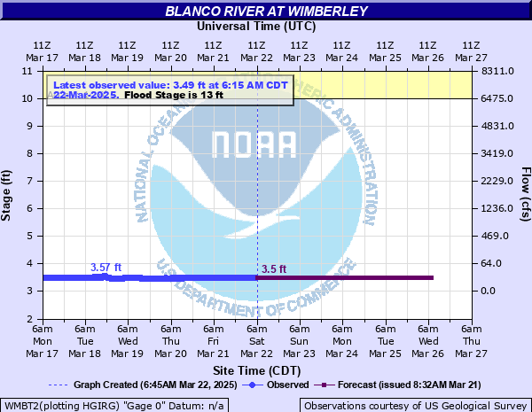
Stage: 3.51 ft
Flow: 0.0074 kcfs
Forecast
| Time | Stage (ft) | Flow (kcfs) |
|---|---|---|
| 9 AM 12/6 | 3.5 | 0.007 |
| 10 AM 12/6 | 3.5 | 0.007 |
| 11 AM 12/6 | 3.5 | 0.007 |
| 12 PM 12/6 | 3.5 | 0.007 |
| 1 PM 12/6 | 3.5 | 0.007 |
| 2 PM 12/6 | 3.5 | 0.007 |
| 3 PM 12/6 | 3.5 | 0.007 |
| 4 PM 12/6 | 3.5 | 0.007 |
| 5 PM 12/6 | 3.5 | 0.007 |
| 6 PM 12/6 | 3.5 | 0.007 |
| 7 PM 12/6 | 3.5 | 0.007 |
| 8 PM 12/6 | 3.5 | 0.007 |
| 9 PM 12/6 | 3.5 | 0.007 |
| 10 PM 12/6 | 3.4 | 0.004 |
| 11 PM 12/6 | 3.5 | 0.007 |
| 12 AM 12/7 | 3.5 | 0.007 |
| 1 AM 12/7 | 3.5 | 0.007 |
| 2 AM 12/7 | 3.4 | 0.004 |
| 3 AM 12/7 | 3.4 | 0.004 |
| 4 AM 12/7 | 3.4 | 0.004 |
| 5 AM 12/7 | 3.4 | 0.004 |
| 6 AM 12/7 | 3.4 | 0.004 |
| 7 AM 12/7 | 3.4 | 0.004 |
| 8 AM 12/7 | 3.4 | 0.004 |
| 9 AM 12/7 | 3.4 | 0.004 |
| 10 AM 12/7 | 3.4 | 0.004 |
| 11 AM 12/7 | 3.4 | 0.004 |
| 12 PM 12/7 | 3.4 | 0.004 |
| 1 PM 12/7 | 3.4 | 0.004 |
| 2 PM 12/7 | 3.4 | 0.004 |
| 3 PM 12/7 | 3.4 | 0.004 |
| 4 PM 12/7 | 3.4 | 0.004 |
| 5 PM 12/7 | 3.4 | 0.004 |
| 6 PM 12/7 | 3.4 | 0.004 |
| 7 PM 12/7 | 3.4 | 0.004 |
| 8 PM 12/7 | 3.4 | 0.004 |
| 9 PM 12/7 | 3.4 | 0.004 |
| 10 PM 12/7 | 3.4 | 0.004 |
| 11 PM 12/7 | 3.4 | 0.004 |
| 12 AM 12/8 | 3.4 | 0.004 |
| 1 AM 12/8 | 3.4 | 0.004 |
| 2 AM 12/8 | 3.4 | 0.004 |
| 3 AM 12/8 | 3.4 | 0.004 |
| 4 AM 12/8 | 3.4 | 0.004 |
| 5 AM 12/8 | 3.4 | 0.004 |
| 6 AM 12/8 | 3.4 | 0.004 |
| 7 AM 12/8 | 3.4 | 0.004 |
| 8 AM 12/8 | 3.4 | 0.004 |
| 9 AM 12/8 | 3.4 | 0.004 |
| 10 AM 12/8 | 3.4 | 0.004 |
| 11 AM 12/8 | 3.4 | 0.004 |
| 12 PM 12/8 | 3.4 | 0.004 |
| 1 PM 12/8 | 3.4 | 0.004 |
| 2 PM 12/8 | 3.4 | 0.004 |
| 3 PM 12/8 | 3.4 | 0.004 |
| 4 PM 12/8 | 3.4 | 0.004 |
| 5 PM 12/8 | 3.4 | 0.004 |
| 6 PM 12/8 | 3.4 | 0.004 |
| 7 PM 12/8 | 3.4 | 0.004 |
| 8 PM 12/8 | 3.4 | 0.004 |
| 9 PM 12/8 | 3.4 | 0.004 |
| 10 PM 12/8 | 3.4 | 0.004 |
| 11 PM 12/8 | 3.4 | 0.004 |
| 12 AM 12/9 | 3.4 | 0.004 |
| 1 AM 12/9 | 3.4 | 0.004 |
| 2 AM 12/9 | 3.4 | 0.004 |
| 3 AM 12/9 | 3.4 | 0.004 |
| 4 AM 12/9 | 3.4 | 0.004 |
| 5 AM 12/9 | 3.4 | 0.004 |
| 6 AM 12/9 | 3.4 | 0.004 |
| 7 AM 12/9 | 3.4 | 0.004 |
| 8 AM 12/9 | 3.4 | 0.004 |
| 9 AM 12/9 | 3.4 | 0.004 |
| 10 AM 12/9 | 3.4 | 0.004 |
| 11 AM 12/9 | 3.4 | 0.004 |
| 12 PM 12/9 | 3.4 | 0.004 |
| 1 PM 12/9 | 3.4 | 0.004 |
| 2 PM 12/9 | 3.4 | 0.004 |
| 3 PM 12/9 | 3.4 | 0.004 |
| 4 PM 12/9 | 3.4 | 0.004 |
| 5 PM 12/9 | 3.4 | 0.004 |
| 6 PM 12/9 | 3.4 | 0.004 |
| 7 PM 12/9 | 3.4 | 0.004 |
| 8 PM 12/9 | 3.4 | 0.004 |
| 9 PM 12/9 | 3.4 | 0.004 |
| 10 PM 12/9 | 3.4 | 0.004 |
| 11 PM 12/9 | 3.4 | 0.004 |
| 12 AM 12/10 | 3.4 | 0.004 |
| 1 AM 12/10 | 3.4 | 0.004 |
| 2 AM 12/10 | 3.4 | 0.004 |
| 3 AM 12/10 | 3.4 | 0.004 |
| 4 AM 12/10 | 3.4 | 0.004 |
| 5 AM 12/10 | 3.4 | 0.004 |
| 6 AM 12/10 | 3.4 | 0.004 |
| 7 AM 12/10 | 3.4 | 0.004 |
| 8 AM 12/10 | 3.4 | 0.004 |
| Time | Stage (ft) | Flow (kcfs) |
|---|---|---|
| 8:00 AM 12/6 | 3.51 | 0.0074 |
| 7:55 AM 12/6 | 3.51 | 0.0074 |
| 7:50 AM 12/6 | 3.51 | 0.0074 |
| 7:45 AM 12/6 | 3.51 | 0.0074 |
| 7:40 AM 12/6 | 3.51 | 0.0074 |
| 7:35 AM 12/6 | 3.51 | 0.0074 |
| 7:30 AM 12/6 | 3.51 | 0.0074 |
| 7:25 AM 12/6 | 3.51 | 0.0074 |
| 7:20 AM 12/6 | 3.51 | 0.0074 |
| 7:15 AM 12/6 | 3.51 | 0.0074 |
| 7:10 AM 12/6 | 3.51 | 0.0074 |
| 7:05 AM 12/6 | 3.51 | 0.0074 |
| 7:00 AM 12/6 | 3.51 | 0.0074 |
| 6:55 AM 12/6 | 3.51 | 0.0074 |
| 6:50 AM 12/6 | 3.51 | 0.0074 |
| 6:45 AM 12/6 | 3.51 | 0.0074 |
| 6:40 AM 12/6 | 3.51 | 0.0074 |
| 6:35 AM 12/6 | 3.51 | 0.0074 |
| 6:30 AM 12/6 | 3.51 | 0.0074 |
| 6:25 AM 12/6 | 3.51 | 0.0074 |
| 6:20 AM 12/6 | 3.51 | 0.0074 |
| 6:15 AM 12/6 | 3.51 | 0.0074 |
| 6:10 AM 12/6 | 3.51 | 0.0074 |
| 6:05 AM 12/6 | 3.51 | 0.0074 |
| 6:00 AM 12/6 | 3.51 | 0.0074 |
| 5:55 AM 12/6 | 3.51 | 0.0074 |
| 5:50 AM 12/6 | 3.51 | 0.0074 |
| 5:45 AM 12/6 | 3.51 | 0.0074 |
| 5:40 AM 12/6 | 3.51 | 0.0074 |
| 5:35 AM 12/6 | 3.51 | 0.0074 |
38' -
The Highway 12 bridge becomes overtopped and is impassable. Disastrous life threatening flooding will flood hundreds of homes and businesses in and near Wimberley in the Blanco River and Cypress Creek flood plains. Many homes flood severely downstream in the lower Blanco and San Marcos River flood plains near San Marcos. This level will reach lower rural homes in the flood plain above Blanco to below San Marcos and can trap and drown hundreds of livestock. Roads near the river are extremely dangerous.
35' -
Flood waters reach the base of the bridge on Highway 12.
31' -
Disastrous life threatening flooding will flood over a hundred homes and businesses in and near Wimberley in the Blanco River and Cypress Creek flood plains. Many homes flood severely downstream in the lower Blanco and San Marcos River flood plains near San Marcos. This level will reach lower rural homes in the flood plain above Blanco to below San Marcos and can trap and drown hundreds of livestock. Roads near the river are extremely dangerous.
29' -
Many lowest homes in the Blanco River flood plain near Wimberley flood. Lowest homes and businesses in the Cypress Creek flood plain flood by backwater from the Blanco River and any runoff down Cypress Creek. Lowland flooding downstream in the lower Blanco and San Marcos Rivers severely floods lowest homes, roads and bridges near San Marcos. Livestock in the Blanco River flood plain above Blanco to the San Marcos River confluence are cut off and potentially drowned.
26' -
Major flooding impacts several lowest homes on the Blanco River near Wimberley. Homes along Cypress Creek near Wimberley also are threatened by the Blanco River backwater and any flow down Cypress Creek. Major flooding of the lower Blanco River in northeast San Marcos floods lowest homes and inundates roads and low bridges with several feet of water near the river making them extremely dangerous. Livestock are cut off and potentially drowned.
25' -
Flow approaches lowest homes near Wimberley. Widespread lowland flooding can cut off low areas of the flood plain drowning livestock. Homes along Cypress Creek near Wimberley are threatened. As the Blanco River backs up Cypress Creek additional runoff down Cypress Creek can easily flood homes. Roads near the lower Blanco River in northeast San Marcos flood severely. Water approaches the lowest homes in that area. Livestock are cut off and potentially drowned.
21' -
Water recreation is very dangerous above Blanco to the San Marcos River confluence, including John Knox Camp and Dudley Johnson Park at Five Mile Dam above San Marcos. Secondary roads and bridges in the flood plain are very dangerous to motorists. Hydraulic jumps behind low dams are dangerous to canoeists and kayakers as they may become trapped.
17' -
Water recreation in the Blanco river is dangerous from above Blanco to the San Marcos river confluence. Secondary roads and bridges in the flood plain are flooded and dangerous. Much of Dudley Johnson park at Five Mile Dam is flooded.
13' -
Minor lowland flooding reaches secondary roads. Low bridges and crossings from the headwaters to the San Marcos River confluence near San Marcos flood and are dangerous. Property in low lying areas of the Blanco and San Marcos Rivers should be moved to higher ground. Swimming and tubing are life threatening due to turbulence. Hydraulic jumps behind low water dams can trap canoeists and kayakers between the dam and the hydraulic jump and can be life threatening.
10' -
A fast moving rise down the Blanco River can make swimming and canoeing dangerous above Blanco to below San Marcos. Especially in areas where steep banks make getting out of the river dangerous. Low dams create hydraulic jumps which can trap canoeists and kayakers between the dam and the jump.
7' -
Overbank conditions begin to threaten swimmers and tubers in recreation areas above Blanco to the San Marcos River confluence below San Marcos.
6' -
Low lying areas and crossings of secondary roads flood near and below Blanco to below Wimberley including Farm to Market 178 just above Wimberley.
| Date | Stage (ft) |
|---|---|
| May 24, 2015 | 44.9 |
| May 28, 1929 | 33.3 |
| Nov 16, 2001 | 28.89 |
| Oct 17, 1998 | 28.5 |
| Oct 31, 2013 | 26.75 |
| Oct 30, 2015 | 26.54 |
| Jul 5, 2002 | 25.71 |
| Mar 12, 2007 | 20.79 |
| Mar 12, 2007 | 20.79 |
| Jun 9, 1997 | 20.46 |
| Nov 17, 2004 | 20.12 |
| Dec 21, 1991 | 20.1 |
| Nov 10, 2000 | 19.86 |
| Mar 4, 1992 | 18.25 |
| Jul 17, 1987 | 16.54 |
| May 9, 2019 | 14.57 |
| Oct 7, 1981 | 14.29 |
| Jun 7, 1997 | 13.63 |
Data provided by the National Weather Service.