« Back to Black Forest Trail Rivers
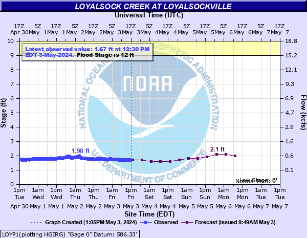
Loyalsock Creek at Loyalsockville
Critical Stages
9' - Action
12' - Flood
13' - Moderate
14' - Major
Latest Observation
Updated: 7:30 AM EST 12/6/25
Status: No Flooding
Stage: 1.29 ft
Flow: 0.205 kcfs
Forecast
| Time | Stage (ft) | Flow (kcfs) |
|---|---|---|
| 1 PM 12/6 | 1.3 | 0.209 |
| 7 PM 12/6 | 1.3 | 0.209 |
| 1 AM 12/7 | 1.3 | 0.209 |
| 7 AM 12/7 | 1.3 | 0.209 |
| 1 PM 12/7 | 1.3 | 0.209 |
| 7 PM 12/7 | 1.3 | 0.209 |
| 1 AM 12/8 | 1.3 | 0.209 |
| 7 AM 12/8 | 1.3 | 0.209 |
| Time | Stage (ft) | Flow (kcfs) |
|---|---|---|
| 7:30 AM 12/6 | 1.29 | 0.205 |
| 7:15 AM 12/6 | 1.29 | 0.205 |
| 7:00 AM 12/6 | 1.29 | 0.205 |
| 6:45 AM 12/6 | 1.29 | 0.205 |
| 6:30 AM 12/6 | 1.28 | 0.201 |
| 6:15 AM 12/6 | 1.28 | 0.201 |
| 6:00 AM 12/6 | 1.28 | 0.201 |
| 5:45 AM 12/6 | 1.29 | 0.205 |
| 5:30 AM 12/6 | 1.29 | 0.205 |
| 5:15 AM 12/6 | 1.28 | 0.201 |
| 5:00 AM 12/6 | 1.28 | 0.201 |
| 4:46 AM 12/6 | 1.28 | 0.201 |
| 4:45 AM 12/6 | 1.28 | 0.201 |
| 4:30 AM 12/6 | 1.28 | 0.201 |
| 4:15 AM 12/6 | 1.28 | 0.201 |
| 4:00 AM 12/6 | 1.28 | 0.201 |
| 3:45 AM 12/6 | 1.28 | 0.201 |
| 3:30 AM 12/6 | 1.28 | 0.201 |
| 3:15 AM 12/6 | 1.28 | 0.201 |
| 3:00 AM 12/6 | 1.28 | 0.201 |
| 2:45 AM 12/6 | 1.28 | 0.201 |
| 2:30 AM 12/6 | 1.28 | 0.201 |
| 2:15 AM 12/6 | 1.28 | 0.201 |
| 2:00 AM 12/6 | 1.28 | 0.201 |
| 1:45 AM 12/6 | 1.28 | 0.201 |
| 1:30 AM 12/6 | 1.28 | 0.201 |
| 1:15 AM 12/6 | 1.28 | 0.201 |
| 1:00 AM 12/6 | 1.27 | 0.197 |
| 12:45 AM 12/6 | 1.27 | 0.197 |
| 12:30 AM 12/6 | 1.27 | 0.197 |
28' -
Flood waters begin to reach the Route 973 Bridge in Loyalsocksville.
20.5' -
Approximate level of the FEMA 0.2 0X0P+0nnual Chance Flood level (500-year flood).
19.8' -
Flood of record from Tropical Storm Lee in 2011.
17' -
Approximate level of the FEMA 0.2 0X0P+0nnual Chance Flood level (500-year flood).
16' -
Approximate level of the FEMA 1 0X0P+0nnual Chance Flood level (100-year flood).
14' -
Numerous homes adjacent to the creek are affected by high water levels.
13' -
Approximate level of the FEMA 10 0X0P+0nnual Chance Flood level (10-year flood). Several homes and the Loyalsock Game Farm are affected by high water levels.
12' -
Several residences are affected by high water levels. Mill Street in Montoursville is flooded by Loyalsock Creek.
11' -
High water prevents access to several homes adjacent to the creek.
9' -
Residents living adjacent to the creek are encouraged to monitor water levels for additional rises. The driveways of several homes are affected by high water.
8' -
Water is on the bike path under Green Bridge at Montoursville.
| Date | Stage (ft) |
|---|---|
| Sep 8, 2011 | 19.78 |
| Jan 19, 1996 | 17.93 |
| Sep 18, 2004 | 15.24 |
| Jun 23, 1972 | 14.74 |
| Sep 26, 1975 | 14.5 |
| Dec 25, 2020 | 12.45 |
| Feb 1, 1982 | 12.45 |
| Mar 11, 2011 | 12.42 |
| Aug 29, 1988 | 12.41 |
| Nov 26, 1950 | 12.32 |
| Aug 24, 1933 | 12.2 |
| May 28, 1946 | 12.2 |
| Nov 16, 1926 | 12.2 |
| Jan 27, 1996 | 12.180000305176 |
| Dec 14, 1983 | 12.18 |
| Oct 21, 2016 | 12.03 |
| Aug 18, 1994 | 11.28 |
Data provided by the National Weather Service.