« Back to Black Forest Trail Rivers
West Branch Susquehanna River at Lewisburg
Critical Stages
14' - Action
18' - Flood
23' - Moderate
28' - Major
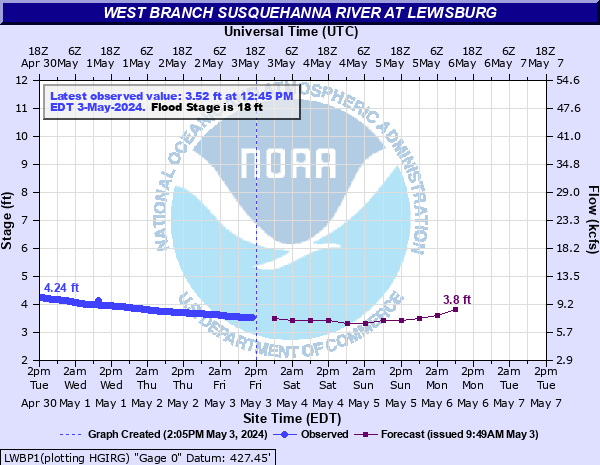
Latest Observation
Updated: 7:45 AM EST 12/6/25
Status: No Flooding
Stage: 2.16 ft
Flow: 3.32 kcfs
Forecast
| Time | Stage (ft) | Flow (kcfs) |
|---|---|---|
| 1 PM 12/6 | 2.1 | 3.18 |
| 7 PM 12/6 | 2.1 | 3.18 |
| 1 AM 12/7 | 2 | 2.95 |
| 7 AM 12/7 | 1.9 | 2.72 |
| 1 PM 12/7 | 1.9 | 2.72 |
| 7 PM 12/7 | 1.9 | 2.72 |
| 1 AM 12/8 | 1.9 | 2.72 |
| 7 AM 12/8 | 1.9 | 2.72 |
| Time | Stage (ft) | Flow (kcfs) |
|---|---|---|
| 8:16 AM 12/6 | 2.16 | 3.32 |
| 7:45 AM 12/6 | 2.16 | 3.32 |
| 7:30 AM 12/6 | 2.16 | 3.32 |
| 7:15 AM 12/6 | 2.16 | 3.32 |
| 7:00 AM 12/6 | 2.16 | 3.32 |
| 6:45 AM 12/6 | 2.17 | 3.35 |
| 6:30 AM 12/6 | 2.17 | 3.35 |
| 6:15 AM 12/6 | 2.17 | 3.35 |
| 6:00 AM 12/6 | 2.17 | 3.35 |
| 5:45 AM 12/6 | 2.17 | 3.35 |
| 5:30 AM 12/6 | 2.17 | 3.35 |
| 5:15 AM 12/6 | 2.18 | 3.37 |
| 5:00 AM 12/6 | 2.18 | 3.37 |
| 4:45 AM 12/6 | 2.18 | 3.37 |
| 4:30 AM 12/6 | 2.18 | 3.37 |
| 4:15 AM 12/6 | 2.18 | 3.37 |
| 4:00 AM 12/6 | 2.18 | 3.37 |
| 3:45 AM 12/6 | 2.18 | 3.37 |
| 3:30 AM 12/6 | 2.18 | 3.37 |
| 3:15 AM 12/6 | 2.19 | 3.39 |
| 3:00 AM 12/6 | 2.19 | 3.39 |
| 2:45 AM 12/6 | 2.19 | 3.39 |
| 2:30 AM 12/6 | 2.19 | 3.39 |
| 2:15 AM 12/6 | 2.19 | 3.39 |
| 2:00 AM 12/6 | 2.19 | 3.39 |
| 1:45 AM 12/6 | 2.2 | 3.42 |
| 1:30 AM 12/6 | 2.2 | 3.42 |
| 1:15 AM 12/6 | 2.2 | 3.42 |
| 1:00 AM 12/6 | 2.2 | 3.42 |
| 12:45 AM 12/6 | 2.2 | 3.42 |
40' -
Approximate level of the FEMA 0.2 0X0P+0nnual Chance Flood level (500-year flood).
34.2' -
Flood of record from Hurricane Agnes in 1972.
32.5' -
Approximate level of the FEMA 1 0X0P+0nnual Chance Flood level (100-year flood).
32' -
Flood waters begin to reach the Market Street Bridge. The intersection of 4th and Catherine Streets is inundated. A significant portion of Lewisburg is inundated.
30' -
Approximate level of the FEMA 2 0X0P+0nnual Chance Flood level (50-year flood).
28' -
The right, or west bank overflows and affects Lewisburg. Widespread inundation on the left bank affects several mobile home parks. Many residences and businesses on both banks are affected by flood waters.
25.5' -
Approximate level of the FEMA 10 0X0P+0nnual Chance Flood level (10-year flood).
25' -
Low lying areas on the right, or west bank are affected. The left bank continues to experience inundation.
23' -
The mobile home park along Route 405 downstream of the bridge will flood.
21' -
The left, or east bank experiences substantial overflow.
19' -
Route 405 is affected downstream of the Lewisburg Bridge.
18' -
The left, or east bank overflows. Low lying areas will flood.
| Date | Stage (ft) |
|---|---|
| Jun 24, 1972 | 34.23 |
| Mar 19, 1936 | 32.1 |
| Jun 1, 1889 | 29.8 |
| May 21, 1894 | 28.5 |
| May 29, 1946 | 28.43 |
| Sep 27, 1975 | 27.62 |
| Mar 11, 1964 | 26.16 |
| Nov 26, 1950 | 26.05 |
| Sep 19, 2004 | 26.01 |
| Jan 20, 1996 | 25.940000534058 |
| Sep 8, 2011 | 25.91 |
| Feb 15, 1984 | 24.26 |
| Mar 6, 1979 | 23.44 |
| Apr 2, 1993 | 21.3 |
| Feb 27, 1961 | 21.17 |
| Apr 1, 1960 | 21 |
| Dec 2, 2010 | 20.9 |
| Mar 12, 2011 | 20.78 |
| Apr 29, 2011 | 20.13 |
| Apr 15, 1948 | 20.07 |
Data provided by the National Weather Service.