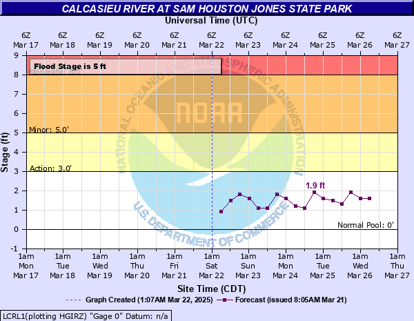
Calcasieu River at Sam Houston Jones State Park
Critical Stages
3' - Action
5' - Flood
8' - Moderate
10' - Major
Latest Observation
Updated: 6:09 PM LMT 12/31/00
Status: Obs Not Current
Stage: -999 ft
Flow: -999 kcfs
Forecast
| Time | Stage (ft) | Flow (kcfs) |
|---|---|---|
| 12 PM 12/8 | 3 | 0.442 |
| 6 PM 12/8 | 2.9 | 0.4 |
| 12 AM 12/9 | 3.2 | 0.536 |
| 6 AM 12/9 | 3.1 | 0.488 |
| 12 PM 12/9 | 3 | 0.442 |
| 6 PM 12/9 | 2.9 | 0.4 |
| 12 AM 12/10 | 3.1 | 0.488 |
| 6 AM 12/10 | 3 | 0.442 |
| 12 PM 12/10 | 3 | 0.442 |
| 6 PM 12/10 | 2.9 | 0.4 |
| 12 AM 12/11 | 3.1 | 0.488 |
| 6 AM 12/11 | 3 | 0.442 |
| 12 PM 12/11 | 3 | 0.442 |
| 6 PM 12/11 | 2.8 | 0.366 |
| 12 AM 12/12 | 3 | 0.442 |
| 6 AM 12/12 | 2.9 | 0.4 |
Observation history not available.
14.4' -
The river is at its flood of record. Catastrophic flooding will occur.
12.8' -
Widespread major flooding occurring. Water levels are near the 2nd highest stage on record.
11.5' -
Major flooding occurs both upstream and downstream from Sam Houston Jones State Park with numerous homes and camps under water. Many roads become impassable.
11' -
Major flooding is occurring. Water levels are near those reached during the flood of July 1989. Extensive flooding of Sam Houston Jones State Park. Water is in some homes in the Cypress Lake and Indian Lake Subdivisions upstream of the park. South Perkins Ferry Road is impassable and many homes along the road are flooded.
10.5' -
Major flooding can be expected. Water levels are near those reached during the storm surge of Hurricane Ike in 2008. Cypress Lake Drive and South Perkins Ferry Road are impassable and water gets into several homes. Water crosses Highway 378 near Sam Houston Jones State Park about two feet in depth.
8.5' -
Water levels are near those reached during the storm surge from Hurricane Rita in 2005. Cypress Lake Drive is impassable and water is up to a few homes along the road. Portions of Sam Houston Park are under water.
8' -
Upstream from Sam Houston Jones State Park, water across low spots of Cypress Lake Drive.
6.5' -
Portions of South Perkins Ferry Road become impassable. Recreational areas in Sam Houston Jones State Park are under water, including the playground and campsites nearest the river.
5' -
Low spots on South Perkins Ferry Road have water on it. Water is over some boat docks on South Perkins Ferry Road and over boat ramps at Sam Houston Jones State Park. Extensive marshland flooding will occur upstream and downstream from the park.
| Date | Stage (ft) |
|---|---|
| Dec 29, 1982 | 14.4 |
| May 22, 1953 | 12.75 |
| May 18, 1980 | 11.82 |
| Aug 31, 2017 | 11.2 |
| Jul 2, 1989 | 11.07 |
| Oct 28, 2006 | 10.9 |
| Dec 27, 1982 | 10.73 |
| Oct 29, 1970 | 10.66 |
| Sep 13, 2008 | 10.5 |
| Sep 23, 1958 | 9.6 |
| Sep 24, 2005 | 8.5 |
| Apr 13, 1995 | 8.35 |
| Dec 1, 2001 | 8 |
| Nov 7, 2002 | 7.9 |
| Mar 23, 2012 | 7.8 |
| May 21, 1989 | 7.8 |
| May 5, 2017 | 7.7 |
| Nov 1, 1985 | 7.3 |
| Oct 30, 2002 | 7 |
| Feb 7, 1955 | 6.7 |
Data provided by the National Weather Service.