« Back to Bloomington Springs Rivers
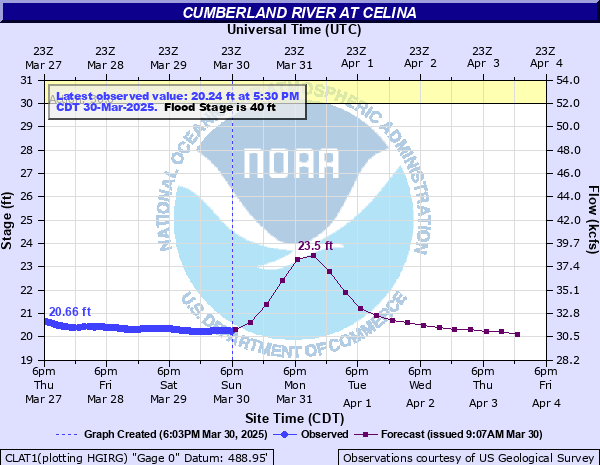
Cumberland River at Celina
Critical Stages
30' - Action
40' - Flood
45' - Moderate
50' - Major
Latest Observation
Updated: 2:30 PM CST 12/6/25
Status: No Flooding
Stage: 12.75 ft
Flow: 9.15 kcfs
Forecast
| Time | Stage (ft) | Flow (kcfs) |
|---|---|---|
| 6 PM 12/6 | 12.9 | 9.68 |
| 12 AM 12/7 | 12 | 5.5 |
| 6 AM 12/7 | 11.4 | 2.81 |
| 12 PM 12/7 | 11.9 | 4.93 |
| 6 PM 12/7 | 12.4 | 8 |
| 12 AM 12/8 | 11.8 | 4.41 |
| 6 AM 12/8 | 11.3 | 2.5 |
| 12 PM 12/8 | 11.9 | 4.93 |
| 6 PM 12/8 | 12.9 | 9.68 |
| 12 AM 12/9 | 12 | 5.5 |
| 6 AM 12/9 | 11.3 | 2.5 |
| 12 PM 12/9 | 12.2 | 6.64 |
| 6 PM 12/9 | 13.5 | 12.1 |
| 12 AM 12/10 | 12.2 | 6.64 |
| 6 AM 12/10 | 11.5 | 3.15 |
| 12 PM 12/10 | 12.2 | 6.64 |
| 6 PM 12/10 | 13.5 | 12.1 |
| 12 AM 12/11 | 12.2 | 6.64 |
| 6 AM 12/11 | 11.5 | 3.15 |
| Time | Stage (ft) | Flow (kcfs) |
|---|---|---|
| 2:30 PM 12/6 | 12.75 | 9.15 |
| 2:00 PM 12/6 | 12.79 | 9.29 |
| 1:30 PM 12/6 | 12.86 | 9.54 |
| 1:00 PM 12/6 | 12.92 | 9.76 |
| 12:30 PM 12/6 | 13 | 10.1 |
| 12:00 PM 12/6 | 13.07 | 10.3 |
| 11:30 AM 12/6 | 13.15 | 10.6 |
| 11:00 AM 12/6 | 13.19 | 10.8 |
| 10:30 AM 12/6 | 13.19 | 10.8 |
| 10:00 AM 12/6 | 13.14 | 10.6 |
| 9:30 AM 12/6 | 13.05 | 10.2 |
| 9:00 AM 12/6 | 12.96 | 9.9 |
| 8:30 AM 12/6 | 12.86 | 9.54 |
| 8:00 AM 12/6 | 12.76 | 9.19 |
| 7:30 AM 12/6 | 12.63 | 8.74 |
| 7:00 AM 12/6 | 12.57 | 8.55 |
| 6:30 AM 12/6 | 12.53 | 8.41 |
| 6:00 AM 12/6 | 12.5 | 8.32 |
| 5:30 AM 12/6 | 12.46 | 8.19 |
| 5:00 AM 12/6 | 12.43 | 8.1 |
| 4:30 AM 12/6 | 12.41 | 8.03 |
| 4:00 AM 12/6 | 12.38 | 7.85 |
| 3:30 AM 12/6 | 12.36 | 7.71 |
| 3:00 AM 12/6 | 12.32 | 7.43 |
| 2:30 AM 12/6 | 12.29 | 7.23 |
| 2:00 AM 12/6 | 12.28 | 7.16 |
| 1:30 AM 12/6 | 12.3 | 7.29 |
| 1:00 AM 12/6 | 12.36 | 7.71 |
| 12:30 AM 12/6 | 12.44 | 8.13 |
| 12:00 AM 12/6 | 12.54 | 8.45 |
53' -
Significant flooding continues to impact the Cumberland River and the adjacent tributaries across Clay County. Numerous residential, commercial, and municipal properties and structures are impacted in and around Celina, and many primary roads are affected by flood waters. This includes Hwy 53 near Mill Creek, and Hwy 52 west of Celina. Water approaches portions of Hwy 53 east of Celina near the Moody Boat Ramp, and may impact travel at higher levels.
50' -
Significant flooding is occurring along the river and the adjacent tributaries, with numerous residential, commercial, and municipal properties and structures impacted across Clay County. Locations include areas north and east of Lake Ave and west of Williamson St in Celina, the Dale Hollow Dam Campground, Clay County High School, Induistrial Dr, Moss Arcot Rd, properties in Weaver Bottom, portions of Hwy 53 near Mill Creek, and farm structures on Old Watson Rd.
48' -
Widespread flooding continues to affect numerous properties and structures along the river and in areas around Celina. Impacted locations include areas north and east of Lake Ave, areas west of Mitchell St, the Dale Hollow Dam Campground, and homes on Inudstrial Dr. Floodwaters have reached the high school building, portions of Moss Arcot Rd, properties in Weaver Bottom, and are approaching portions of Hwy 53 near Mill Creek and farm structures on Old Watson Rd.
45' -
Widespread flooding along the river and the adjacent tributaries is occurring, with many agricultural, residential, commercial, and municipal properties and structures impacted. In Celina, locations north and east of Lake Ave, and west of Mitchell St are impacted, as well as most of the Dale Hollow Dam Campground, and properties and structures on Industrial Dr. Water approaches the high school building, portions of Moss Arcot Rd, and properties on River Bend Dr in Weaver Bottom.
43' -
Agricultural areas and other properties along the river, as well as the adjacent tributaries are flooded. In Celina, residential, commercial, and municipal properties and structures close to the Obey and Cumberland Rivers are impacted, espcially areas north and east of Lake Ave, and west of Mitchell St. Many roads that access these areas are impassable. Water approaches properties on Industrial Dr, and begins to impact the Dale Hollow Dam Campground.
40' -
Flooding begins in and around Celina, affecting homes and properties on West Lake Rd, Clark Cir, Breyer St, Cumberland Dr, Waterview Dr, Waterview Ln, Waste Water Rd, River Dr, Yale Dr, the Riverside neighborhood, River Rd, and Ross Boles Rd. Water approaches the County Circuit Court building, the County Road Commission office, and properties on Spring St and River Ave.
33' -
Water begins to impact low lying areas along the river and the adjacent tributaries, including Kettle Creek, Proctor Creek, Obey River, Knob Creek, and Mill Creek. Water approaches the atheltic fields at Clay County High School, the Clay County Park, and properties along Breyer St and Waste Water Rd.
30' -
Water begins to impact low lying areas along the river and the adjacent tributaries, including Kettle Creek, Proctor Creek, Obey River, Knob Creek, and Mill Creek. Water approaches the atheltic fields at Clay County High School, the Clay County Park, and properties along Breyer St and Waste Water Rd.
| Date | Stage (ft) |
|---|---|
| Mar 1, 1826 | 59.2 |
| Feb 1, 1918 | 57.3 |
| Dec 29, 1926 | 57.25 |
| Mar 27, 1929 | 54.8 |
| Mar 1, 1902 | 54.5 |
| Jan 12, 1946 | 54.09 |
| Jan 23, 1937 | 53.83 |
| Feb 5, 1950 | 52.46 |
| Jan 2, 1943 | 52.02 |
| Feb 17, 1948 | 52.01 |
| Mar 13, 1975 | 38.15 |
| May 3, 2010 | 37.62 |
| May 7, 1984 | 35.4 |
| Mar 6, 1989 | 32.65 |
| May 19, 1983 | 28.32 |
| Feb 23, 2003 | 26.3 |
| Oct 17, 1990 | 26.22 |
| Apr 16, 2015 | 26.17 |
| Feb 17, 2016 | 25.58 |
| Apr 28, 2013 | 25.5 |
Data provided by the National Weather Service.