« Back to Boiling Springs Rivers
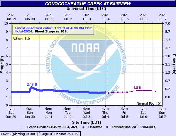
Conococheague Creek at Fairview
Critical Stages
8' - Action
10' - Flood
12' - Moderate
15' - Major
Latest Observation
Updated: 5:45 PM EST 12/15/25
Status: No Flooding
Stage: 1.68 ft
Flow: 0.166 kcfs
Forecast
| Time | Stage (ft) | Flow (kcfs) |
|---|---|---|
| 7 PM 12/15 | 1.5 | 0.123 |
| 1 AM 12/16 | 1.5 | 0.123 |
| 7 AM 12/16 | 1.5 | 0.123 |
| 1 PM 12/16 | 1.5 | 0.123 |
| 7 PM 12/16 | 1.5 | 0.123 |
| 1 AM 12/17 | 1.5 | 0.123 |
| 7 AM 12/17 | 1.5 | 0.123 |
| 1 PM 12/17 | 1.5 | 0.123 |
| 7 PM 12/17 | 1.5 | 0.123 |
| 1 AM 12/18 | 1.6 | 0.146 |
| 7 AM 12/18 | 1.6 | 0.146 |
| Time | Stage (ft) | Flow (kcfs) |
|---|---|---|
| 5:45 PM 12/15 | 1.68 | 0.166 |
| 5:30 PM 12/15 | 1.64 | 0.156 |
| 5:15 PM 12/15 | 1.58 | 0.141 |
| 5:00 PM 12/15 | 1.53 | 0.13 |
| 4:45 PM 12/15 | 1.5 | 0.123 |
| 4:30 PM 12/15 | 1.48 | 0.119 |
| 4:15 PM 12/15 | 1.46 | 0.115 |
| 4:00 PM 12/15 | 1.45 | 0.113 |
| 3:45 PM 12/15 | 1.43 | 0.11 |
| 3:30 PM 12/15 | 1.41 | 0.106 |
| 3:15 PM 12/15 | 1.41 | 0.106 |
| 3:00 PM 12/15 | 1.41 | 0.106 |
| 2:45 PM 12/15 | 1.41 | 0.106 |
| 2:30 PM 12/15 | 1.41 | 0.106 |
| 2:15 PM 12/15 | 1.42 | 0.108 |
| 2:00 PM 12/15 | 1.43 | 0.11 |
| 1:45 PM 12/15 | 1.45 | 0.113 |
| 1:30 PM 12/15 | 1.46 | 0.115 |
| 1:15 PM 12/15 | 1.48 | 0.119 |
| 1:00 PM 12/15 | 1.5 | 0.123 |
| 12:45 PM 12/15 | 1.51 | 0.125 |
| 12:30 PM 12/15 | 1.52 | 0.127 |
| 12:15 PM 12/15 | 1.52 | 0.127 |
| 12:00 PM 12/15 | 1.53 | 0.13 |
| 11:45 AM 12/15 | 1.53 | 0.13 |
| 11:30 AM 12/15 | 1.53 | 0.13 |
| 11:15 AM 12/15 | 1.54 | 0.132 |
| 11:00 AM 12/15 | 1.54 | 0.132 |
| 10:45 AM 12/15 | 1.54 | 0.132 |
| 10:30 AM 12/15 | 1.55 | 0.134 |
21' -
Water reaches the bridge on Fairview Road.
15' -
Water floods several homes north of Williamsport.
13' -
Water reaches backyards of homes near Wilson's Bridge. Numerous roads are flooded.
12' -
Water approaches homes north of Williamsport. Some homes and a campground will also be cut off from access due to flooded roads, but the homes themselves are not flooded.
11' -
Several roads, including Wishard Road, Kemps Mill Road, Independence Road, Cress Pond Road, and Walnut Point Road, are flooded north of Williamsport.
10' -
Wishard Road and Kemp Mill Road are both flooded.
9' -
Water begins to cover Wishard Road and Kemp Mill Road.
8' -
Lowlands near the creek begin to flood. Water approaches Wishard Road and Kemps Mill Road in northern Washington County.
| Date | Stage (ft) |
|---|---|
| Jun 23, 1972 | 24.5 |
| Feb 15, 1984 | 17.97 |
| Jun 1, 1889 | 16.5 |
| Oct 9, 1976 | 16 |
| Mar 29, 1924 | 16 |
| Jun 19, 1996 | 15.23 |
| Nov 22, 1952 | 15.16 |
| Jun 13, 2014 | 14.87 |
| Dec 1, 1934 | 14.8 |
| Sep 26, 1975 | 14.79 |
| Jan 20, 1996 | 14.49 |
| Mar 12, 1952 | 14.44 |
| Nov 28, 1993 | 14.11 |
| Jun 4, 2003 | 14.08 |
| May 24, 2010 | 14.04 |
| Apr 28, 1937 | 13.84 |
| Sep 19, 2004 | 13.75 |
| Apr 17, 2011 | 13.61 |
| Nov 8, 1997 | 13.6 |
| Aug 24, 1933 | 13.3 |
Data provided by the National Weather Service.