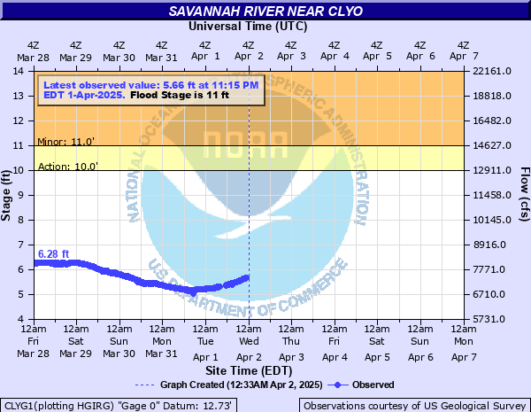
Savannah River near Clyo
Critical Stages
10' - Action
11' - Flood
15' - Moderate
20' - Major
Latest Observation
Updated: 12:15 PM EST 12/8/25
Status: No Flooding
Stage: 6.91 ft
Flow: 8.81 kcfs
Forecast
| Time | Stage (ft) | Flow (kcfs) |
|---|---|---|
| 1 PM 12/8 | 6.9 | 8.8 |
| 7 PM 12/8 | 6.8 | 8.68 |
| 1 AM 12/9 | 6.7 | 8.56 |
| 7 AM 12/9 | 6.5 | 8.33 |
| 1 PM 12/9 | 6.4 | 8.22 |
| 7 PM 12/9 | 6.3 | 8.11 |
| 1 AM 12/10 | 6.2 | 7.99 |
| 7 AM 12/10 | 6.2 | 7.99 |
| 1 PM 12/10 | 6.2 | 7.99 |
| 7 PM 12/10 | 6.2 | 7.99 |
| 1 AM 12/11 | 6.3 | 8.11 |
| 7 AM 12/11 | 6.3 | 8.11 |
| 1 PM 12/11 | 6.4 | 8.22 |
| 7 PM 12/11 | 6.4 | 8.22 |
| 1 AM 12/12 | 6.4 | 8.22 |
| 7 AM 12/12 | 6.5 | 8.33 |
| 1 PM 12/12 | 6.5 | 8.33 |
| 7 PM 12/12 | 6.5 | 8.33 |
| 1 AM 12/13 | 6.5 | 8.33 |
| 7 AM 12/13 | 6.5 | 8.33 |
| Time | Stage (ft) | Flow (kcfs) |
|---|---|---|
| 12:15 PM 12/8 | 6.91 | 8.81 |
| 12:00 PM 12/8 | 6.91 | 8.81 |
| 11:45 AM 12/8 | 6.92 | 8.82 |
| 11:30 AM 12/8 | 6.91 | 8.81 |
| 11:15 AM 12/8 | 6.92 | 8.82 |
| 11:00 AM 12/8 | 6.93 | 8.83 |
| 10:45 AM 12/8 | 6.93 | 8.83 |
| 10:30 AM 12/8 | 6.93 | 8.83 |
| 10:15 AM 12/8 | 6.93 | 8.83 |
| 10:00 AM 12/8 | 6.93 | 8.83 |
| 9:45 AM 12/8 | 6.94 | 8.85 |
| 9:30 AM 12/8 | 6.94 | 8.85 |
| 9:15 AM 12/8 | 6.94 | 8.85 |
| 9:00 AM 12/8 | 6.94 | 8.85 |
| 8:45 AM 12/8 | 6.95 | 8.86 |
| 8:30 AM 12/8 | 6.95 | 8.86 |
| 8:15 AM 12/8 | 6.95 | 8.86 |
| 8:00 AM 12/8 | 6.94 | 8.85 |
| 7:45 AM 12/8 | 6.94 | 8.85 |
| 7:30 AM 12/8 | 6.95 | 8.86 |
| 7:15 AM 12/8 | 6.95 | 8.86 |
| 7:00 AM 12/8 | 6.95 | 8.86 |
| 6:45 AM 12/8 | 6.94 | 8.85 |
| 6:30 AM 12/8 | 6.95 | 8.86 |
| 6:15 AM 12/8 | 6.95 | 8.86 |
| 6:00 AM 12/8 | 6.95 | 8.86 |
| 5:45 AM 12/8 | 6.95 | 8.86 |
| 5:30 AM 12/8 | 6.94 | 8.85 |
| 5:15 AM 12/8 | 6.94 | 8.85 |
| 5:00 AM 12/8 | 6.94 | 8.85 |
22.5' -
water begins to enter the second floor of some riverfront homes along Tom Goethe Road.
21.6' -
one foot of water covers Stokes Bluff Landing Road between River View and Arrowhead Court. Several homes become inaccessible.
18' -
several homes off Arrowhead Court near Stokes Bluff Landing are impacted. Also, Sand Hills Road will be inundated and likely impassable.
14.5' -
the bottom floor of several riverfront homes along Tom Goethe Road begin to flood.
13.3' -
one foot of water covers Tom Goethe Road just after the pavement ends.
11' -
the back yards of several homes on Tom Goethe Road flood.
| Date | Stage (ft) |
|---|---|
| Oct 6, 1929 | 29.7 |
| Apr 13, 1936 | 26 |
| Jan 24, 1925 | 23.9 |
| Mar 11, 1929 | 23.6 |
| Aug 22, 1940 | 23.6 |
| Aug 23, 1928 | 22.3 |
| Dec 6, 1948 | 22.17 |
| Mar 29, 1944 | 21.6 |
| Mar 8, 1939 | 20.4 |
| Apr 18, 1964 | 20.22 |
| Mar 29, 1942 | 20 |
| Jan 27, 1943 | 20 |
| Feb 17, 1948 | 19.66 |
| Jan 16, 1946 | 19.5 |
| Jan 28, 1947 | 19.4 |
| Jan 11, 1937 | 19.4 |
| Jan 4, 1933 | 19.2 |
| Jan 15, 1932 | 19.18 |
| Jan 13, 1993 | 18.51 |
| Apr 2, 1980 | 18.4 |
Data provided by the National Weather Service.