« Back to Bonita Springs Rivers
Fisheating Creek at Palmdale
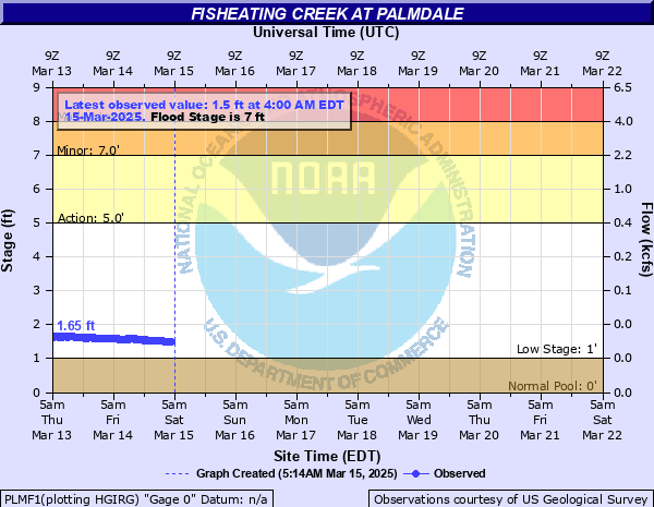
Critical Stages
5' - Action
7' - Flood
8' - Moderate
9' - Major
Latest Observation
Updated: 1:00 AM EST 12/15/25
Status: Low Threshold
Stage: 0.84 ft
Flow: 0.0047 kcfs
Forecast
Forecast not available for this location.
| Time | Stage (ft) | Flow (kcfs) |
|---|---|---|
| 1:00 AM 12/15 | 0.84 | 0.0047 |
| 12:45 AM 12/15 | 0.83 | 0.0045 |
| 12:30 AM 12/15 | 0.85 | 0.0049 |
| 12:15 AM 12/15 | 0.85 | 0.0049 |
| 12:00 AM 12/15 | 0.85 | 0.0049 |
| 11:45 PM 12/14 | 0.85 | 0.0049 |
| 11:30 PM 12/14 | 0.85 | 0.0049 |
| 11:15 PM 12/14 | 0.85 | 0.0049 |
| 11:00 PM 12/14 | 0.85 | 0.0049 |
| 10:45 PM 12/14 | 0.85 | 0.0049 |
| 10:30 PM 12/14 | 0.85 | 0.0049 |
| 10:15 PM 12/14 | 0.85 | 0.0049 |
| 10:00 PM 12/14 | 0.85 | 0.0049 |
| 9:45 PM 12/14 | 0.85 | 0.0049 |
| 9:30 PM 12/14 | 0.85 | 0.0049 |
| 9:15 PM 12/14 | 0.85 | 0.0049 |
| 9:00 PM 12/14 | 0.85 | 0.0049 |
| 8:45 PM 12/14 | 0.85 | 0.0049 |
| 8:30 PM 12/14 | 0.85 | 0.0049 |
| 8:15 PM 12/14 | 0.85 | 0.0049 |
| 8:00 PM 12/14 | 0.85 | 0.0049 |
| 7:45 PM 12/14 | 0.85 | 0.0049 |
| 7:30 PM 12/14 | 0.85 | 0.0049 |
| 7:15 PM 12/14 | 0.85 | 0.0049 |
| 7:00 PM 12/14 | 0.86 | 0.0051 |
| 6:45 PM 12/14 | 0.85 | 0.0049 |
| 6:30 PM 12/14 | 0.85 | 0.0049 |
| 6:15 PM 12/14 | 0.85 | 0.0049 |
| 6:00 PM 12/14 | 0.85 | 0.0049 |
| 5:45 PM 12/14 | 0.85 | 0.0049 |
12.44' -
Record Flood after torrential rains from Tropical Storm How in October, 1951. Extensive severe flooding on both sides of the creek including fishing and recreation camps and river access roads. Access to US 27 bridge washed out. Nicodemous Slough flowed over SR 78 south of Lakeport. Ranch and farm buildings in rural Glades Co isolated by flood waters. Extensive damage to roads and bridges in the county.
11' -
Water could start to cover Highway US 27 on either end of the bridge. Homes in Palmdale could experience flooding, and the railroad track bridge and Fisheating Creek Campground will be completely flooded.
11' -
Water will start to dissipate along Highway US 27 on either end of the bridge and retreat from homes in Palmdale.The railroad track bridge and Fisheating Creek Campground will still remain completely flooded.
10' -
A few houses along Fisheating Creek near Palmdale starts to be affected by the water. The railroad tracks, upstream camprounds and access roads, and buildings in the campground are completely flooded.
10' -
A few houses along Fisheating Creek near Palmdale could still be flooded. The railroad tracks, Upstream campgounds, access roads to the campgound, and buildings in the campground are still completely flooded.
9' -
The railroad tracks bridge beings to be affected by the water, the upstream campground roads, and all buildings in the campground are completely flooded.
9' -
The water starts to retreat from the railroad tracks, the upstream campground roads, and all buildings in the campground are still completely flooded.
8' -
The water begins retreat from inside the main office and store in the campground. The Upstream campground and access roads to the campground are still completely flooded.
8' -
The upstream campground and access roads to the campground completely flooded and water begins to come inside the main office and store in the campground.
7' -
Fisheating Creek is at Flood Stage. Access road to campground and the bath house are flooded.
7' -
Fisheating creek is coming out of flood stage. Access road to campground and the bath house are still Flooded.
6' -
Bankfull Stage. Very minor flooding into adjacent swamps near the creek.
| Date | Stage (ft) |
|---|---|
| Oct 3, 1951 | 12.44 |
| Sep 19, 1947 | 11.06 |
| Sep 24, 1948 | 10.52 |
| Sep 13, 2017 | 10.35 |
| Sep 17, 1945 | 9.18 |
| Sep 6, 1933 | 8.6 |
| Oct 10, 1953 | 8.53 |
| Sep 2, 2006 | 8.46 |
| Sep 29, 2004 | 8.31 |
| Sep 13, 1932 | 8.26 |
| Sep 13, 1960 | 8.19 |
| Jun 16, 1936 | 8.1 |
| Jul 3, 1974 | 8.02 |
| Sep 16, 2001 | 8 |
| Mar 22, 1998 | 7.99 |
| Aug 29, 1949 | 7.86 |
| Jun 26, 1982 | 7.83 |
| Jun 29, 1992 | 7.82 |
| Mar 27, 1970 | 7.79 |
| Mar 15, 1984 | 7.78 |
Data provided by the National Weather Service.