« Back to Brackettville Rivers
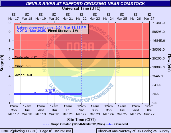
Devils River at Pafford Crossing near Comstock
Critical Stages
4' - Action
5' - Flood
6' - Moderate
12' - Major
Latest Observation
Updated: 2:15 AM CST 12/18/25
Status: No Flooding
Stage: 2.13 ft
Flow: 0.109 kcfs
Forecast
Forecast not available for this location.
| Time | Stage (ft) | Flow (kcfs) |
|---|---|---|
| 2:15 AM 12/18 | 2.13 | 0.109 |
| 2:00 AM 12/18 | 2.13 | 0.109 |
| 1:45 AM 12/18 | 2.13 | 0.109 |
| 1:30 AM 12/18 | 2.13 | 0.109 |
| 1:15 AM 12/18 | 2.13 | 0.109 |
| 1:00 AM 12/18 | 2.13 | 0.109 |
| 12:45 AM 12/18 | 2.13 | 0.109 |
| 12:30 AM 12/18 | 2.13 | 0.109 |
| 12:15 AM 12/18 | 2.13 | 0.109 |
| 12:00 AM 12/18 | 2.13 | 0.109 |
| 11:45 PM 12/17 | 2.13 | 0.109 |
| 11:30 PM 12/17 | 2.13 | 0.109 |
| 11:15 PM 12/17 | 2.13 | 0.109 |
| 11:00 PM 12/17 | 2.13 | 0.109 |
| 10:45 PM 12/17 | 2.13 | 0.109 |
| 10:30 PM 12/17 | 2.13 | 0.109 |
| 10:15 PM 12/17 | 2.13 | 0.109 |
| 10:00 PM 12/17 | 2.13 | 0.109 |
| 9:45 PM 12/17 | 2.13 | 0.109 |
| 9:30 PM 12/17 | 2.13 | 0.109 |
| 9:15 PM 12/17 | 2.13 | 0.109 |
| 9:00 PM 12/17 | 2.13 | 0.109 |
| 8:45 PM 12/17 | 2.13 | 0.109 |
| 8:30 PM 12/17 | 2.13 | 0.109 |
| 8:15 PM 12/17 | 2.13 | 0.109 |
| 8:00 PM 12/17 | 2.14 | 0.113 |
| 7:45 PM 12/17 | 2.13 | 0.109 |
| 7:30 PM 12/17 | 2.14 | 0.113 |
| 7:15 PM 12/17 | 2.14 | 0.113 |
| 7:00 PM 12/17 | 2.14 | 0.113 |
14' -
(4.3 meters), Major flooding. Life threatening flooding for recreationists above Paffords Crossing to Amistad Reservoir. Flow is near 150,000 cfs. Livestock should be moved from areas vulnerable to major flooding.
12' -
(3.7 meters), Major lowland flooding threatens visitors, automobiles and equipment at camp areas downstream to Amistad Reservoir. Livestock can be trapped and potentially drowned.
10' -
(3.0 meters), Widespread flooding is very dangerous to campers in the flood plain below Juno to Amistad Reservoir. Equipment and automobiles should be moved immediately from the flood plain. Livestock should be moved from flood prone areas.
8' -
(2.4 meters), Moderate flooding covers several hundred yards of the flood plain. Campers, automobiles and equipment can be washed downstream below Juno to Amistad Reservoir. Livestock should be moved from flood prone areas of the flood plain.
6' -
(1.8 meters), Moderate lowland flooding over 1/4 mile wide covers the right bank to the canyon walls. The turbulent flow can wash motorists, campers, and equipment downstream from Pafford Crossing to Amistad Reservoir. Livestock are cut off and potentially drowned below Juno to Amistad Reservoir.
5' -
(1.5 meters), Minor lowland flooding one quarter mile wide at Pafford Crossing covers most of the right bank. Turbulent flow above Pafford Crossing to Amistad Reservoir can wash campers, automobiles, and equipment downstream.
| Date | Stage (ft) |
|---|---|
| Sep 18, 1974 | 19.82 |
| Aug 12, 1972 | 16.18 |
| Oct 11, 1981 | 14.47 |
| Aug 15, 1971 | 14.31 |
| Oct 5, 1986 | 13.19 |
| Jul 17, 1976 | 13.02 |
| Sep 25, 1980 | 11.55 |
| Sep 21, 1964 | 11.35 |
| Jun 10, 2007 | 9.38 |
| Oct 20, 1983 | 9.32 |
| Jul 11, 1988 | 8.12 |
| Sep 23, 1990 | 7.91 |
| Oct 19, 2018 | 6.2 |
| Sep 23, 2018 | 5.14 |
Data provided by the National Weather Service.