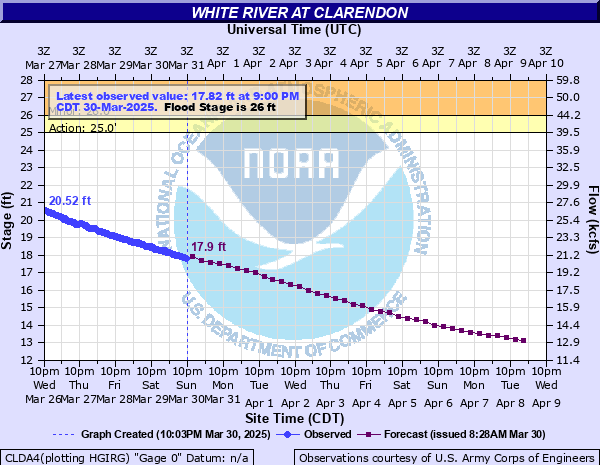
White River at Clarendon
Critical Stages
25' - Action
26' - Flood
30' - Moderate
32' - Major
Latest Observation
Updated: 12:00 AM CST 12/15/25
Status: No Flooding
Stage: 11.86 ft
Flow: 11.1 kcfs
Forecast
| Time | Stage (ft) | Flow (kcfs) |
|---|---|---|
| 6 AM 12/15 | 11.7 | 10.9 |
| 12 PM 12/15 | 11.7 | 10.9 |
| 6 PM 12/15 | 11.6 | 10.8 |
| 12 AM 12/16 | 11.5 | 10.6 |
| 6 AM 12/16 | 11.5 | 10.6 |
| 12 PM 12/16 | 11.4 | 10.5 |
| 6 PM 12/16 | 11.4 | 10.5 |
| 12 AM 12/17 | 11.3 | 10.3 |
| 6 AM 12/17 | 11.3 | 10.3 |
| 12 PM 12/17 | 11.2 | 10.2 |
| 6 PM 12/17 | 11.1 | 10 |
| 12 AM 12/18 | 11.1 | 10 |
| 6 AM 12/18 | 11 | 9.88 |
| 12 PM 12/18 | 10.9 | 9.73 |
| 6 PM 12/18 | 10.8 | 9.59 |
| 12 AM 12/19 | 10.8 | 9.59 |
| 6 AM 12/19 | 10.7 | 9.44 |
| 12 PM 12/19 | 10.6 | 9.3 |
| 6 PM 12/19 | 10.5 | 9.16 |
| 12 AM 12/20 | 10.5 | 9.16 |
| 6 AM 12/20 | 10.4 | 9.02 |
| 12 PM 12/20 | 10.3 | 8.88 |
| 6 PM 12/20 | 10.3 | 8.88 |
| 12 AM 12/21 | 10.2 | 8.74 |
| 6 AM 12/21 | 10.2 | 8.74 |
| 12 PM 12/21 | 10.2 | 8.74 |
| 6 PM 12/21 | 10.1 | 8.6 |
| 12 AM 12/22 | 10.1 | 8.6 |
| 6 AM 12/22 | 10.1 | 8.6 |
| 12 PM 12/22 | 10 | 8.46 |
| 6 PM 12/22 | 10 | 8.46 |
| 12 AM 12/23 | 10 | 8.46 |
| 6 AM 12/23 | 9.9 | 8.32 |
| 12 PM 12/23 | 9.9 | 8.32 |
| 6 PM 12/23 | 9.9 | 8.32 |
| 12 AM 12/24 | 9.9 | 8.32 |
| 6 AM 12/24 | 9.8 | 8.19 |
| Time | Stage (ft) | Flow (kcfs) |
|---|---|---|
| 12:00 AM 12/15 | 11.86 | 11.1 |
| 11:00 PM 12/14 | 11.87 | 11.2 |
| 10:00 PM 12/14 | 11.88 | 11.2 |
| 9:00 PM 12/14 | 11.88 | 11.2 |
| 8:00 PM 12/14 | 11.9 | 11.2 |
| 7:00 PM 12/14 | 11.9 | 11.2 |
| 6:00 PM 12/14 | 11.9 | 11.2 |
| 5:00 PM 12/14 | 11.9 | 11.2 |
| 4:00 PM 12/14 | 11.85 | 11.1 |
| 3:00 PM 12/14 | 11.86 | 11.1 |
| 2:00 PM 12/14 | 11.94 | 11.3 |
| 1:00 PM 12/14 | 11.91 | 11.2 |
| 12:00 PM 12/14 | 11.95 | 11.3 |
| 11:00 AM 12/14 | 11.87 | 11.2 |
| 10:00 AM 12/14 | 11.88 | 11.2 |
| 9:00 AM 12/14 | 11.88 | 11.2 |
| 8:00 AM 12/14 | 11.95 | 11.3 |
| 7:00 AM 12/14 | 11.92 | 11.2 |
| 6:00 AM 12/14 | 11.91 | 11.2 |
| 5:00 AM 12/14 | 11.92 | 11.2 |
| 4:00 AM 12/14 | 11.91 | 11.2 |
| 3:00 AM 12/14 | 11.95 | 11.3 |
| 2:00 AM 12/14 | 11.93 | 11.2 |
| 1:00 AM 12/14 | 11.95 | 11.3 |
| 12:00 AM 12/14 | 11.97 | 11.3 |
| 11:00 PM 12/13 | 11.93 | 11.2 |
| 10:00 PM 12/13 | 12.01 | 11.4 |
| 9:00 PM 12/13 | 11.99 | 11.3 |
| 8:00 PM 12/13 | 11.96 | 11.3 |
| 7:00 PM 12/13 | 11.99 | 11.3 |
43' -
Similar flood contions to flood of record, which occurred prior to the constuction of the flood control reservoirs, was 43.3 feet in April 1927. Evacuations will be necessary.
39' -
River has not been this high since completion of flood control reservoirs. The river crested at 39.1 feet in April 1945. Most cultivated land in floodplain affected by either inundation or isolation. Many county roads near the river in Prairie, Monroe, and Arkansas counties will be affected. Some state highways will also be flooded. Driving at night is especially dangerous due to flooded roads.
35' -
River flooding is very serious. Second highest crest since the completion of the flood control reservoirs was 35 feet in May 1973. River Valley is like a large lake. Many secondary roads are flooded. Most cropland in the floodplain flooded.
33' -
Most all of the land within the levees is inundated. Large portions of the Cache and White River National Wildlife Refuges are flooded. River crested at 33 feet in March 2008, 33.8 feet in April 2008, 35 feet in May 1973. High Mississippi River worsens flooding on the lower White River. Homes and cabins from Clarendon to Saint Charles will be impacted by the high water. Those chosing to remain in their homes should have sufficient supplies for long term isolation.
32' -
State Highway 302 north of Clarendon may be affected. Some industrial property in Clarendon on river side of levee may be flooded. Many access problems for recreational properties downstream of Clarendon. Many downstream areas are accessable by boat only. Height and duration of flooding along the lower White River is greatly dependant on the level of the Mississippi River in combination with the flow rate of the White River.
30' -
Clarendon storm sewer should be closed to keep river from backing up outflow pipe. Extensive flooding in the delta. Most cropland and timber in bottoms are flooded. Much of the National Wildlife Refuge land downstream of Clarendon will be flooded.
28' -
Flooding of cropland and timber is occurring. Roads to homes and cabins in lower Maddox Bay area off Highway 146 south of Clarendon impassible.
28' -
Maddox Bay off Highway 146 will be closed off due to high water. Closure of specific flood prone regions as determined by Arkansas Game and Fish Commission. Some of this area may include the Mike Freeze Wattensaw WMA...Benson Creek Natural Area WMA and the Sheffield Nelson Dagmar WMA.
26' -
River flows in many side channels and creates islands between the river and sloughs and creeks. Flooding of cropland and timber is occurring. Portions of the National Wildlife Refuge downstream of Clarendon flooding.
| Date | Stage (ft) |
|---|---|
| Apr 23, 1927 | 43.3 |
| Apr 24, 1945 | 39.1 |
| Feb 7, 1916 | 38.4 |
| May 10, 2011 | 37.54 |
| Jan 28, 1937 | 35.7 |
| May 3, 1973 | 34.97 |
| May 12, 2017 | 34 |
| Apr 19, 2008 | 33.78 |
| Mar 29, 2008 | 33.04 |
| Apr 5, 1975 | 32.85 |
| Dec 15, 1982 | 32.8 |
| Jan 21, 1950 | 32.6 |
| Feb 8, 1969 | 32 |
| Feb 25, 1989 | 31.96 |
| Jan 7, 2016 | 31.72 |
| Dec 11, 1973 | 31.41 |
| Jun 4, 1946 | 31.4 |
| May 6, 1957 | 31.2 |
| May 17, 1961 | 31 |
| Dec 30, 2009 | 30.79 |
Data provided by the National Weather Service.