« Back to Calhoun County Rivers
Chattahoochee River at George W. Andrews Lock and Dam (USACE)
Critical Stages
92' - Action
106' - Flood
112' - Moderate
124' - Major
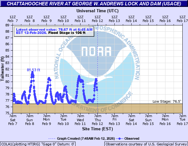
Latest Observation
Updated: 7:00 PM EST 12/4/25
Status: No Flooding
Stage: 78.11 ft
Flow: -999 kcfs
Forecast
Forecast not available for this location.
| Time | Stage (ft) | Flow (kcfs) |
|---|---|---|
| 10:45 PM 12/4 | -9999 | -999 |
| 10:30 PM 12/4 | -9999 | -999 |
| 10:15 PM 12/4 | -9999 | -999 |
| 10:00 PM 12/4 | -9999 | -999 |
| 9:45 PM 12/4 | -9999 | -999 |
| 9:30 PM 12/4 | -9999 | -999 |
| 9:15 PM 12/4 | -9999 | -999 |
| 9:00 PM 12/4 | -9999 | -999 |
| 8:45 PM 12/4 | -9999 | -999 |
| 8:30 PM 12/4 | -9999 | -999 |
| 8:15 PM 12/4 | -9999 | -999 |
| 8:00 PM 12/4 | -9999 | -999 |
| 7:45 PM 12/4 | -9999 | -999 |
| 7:30 PM 12/4 | -9999 | -999 |
| 7:15 PM 12/4 | -9999 | -999 |
| 7:00 PM 12/4 | 78.11 | -999 |
| 6:45 PM 12/4 | 77.61 | -999 |
| 6:30 PM 12/4 | 77.53 | -999 |
| 6:15 PM 12/4 | 77.48 | -999 |
| 6:00 PM 12/4 | 77.01 | -999 |
| 5:45 PM 12/4 | 76.97 | -999 |
| 5:30 PM 12/4 | 76.9 | -999 |
| 5:15 PM 12/4 | 76.88 | -999 |
| 5:00 PM 12/4 | 76.86 | -999 |
| 4:45 PM 12/4 | 76.86 | -999 |
| 4:30 PM 12/4 | 76.87 | -999 |
| 4:15 PM 12/4 | 76.86 | -999 |
| 4:00 PM 12/4 | 76.92 | -999 |
| 3:45 PM 12/4 | -9999 | -999 |
| 3:30 PM 12/4 | -9999 | -999 |
130' -
Georgia State Highway 62 will begin to flood.
125' -
The railroad tracks between Columbia Alabama and the Railroad Bridge will flood.
124' -
The railroad at the Georgia Pacific Plant will begin to flood. Residences along the river at Columbia, Gordon, and the Confederate Naval Yard will experience significant flooding.
122' -
In Houston County, many structures near the river in Columbia and Gordon will have water up to 4 feet deep inside.
120' -
Water will impact numerous structures along the Alabama side of the river in Columbia along River Road and Gordon on Boat Landing Road. Homes not flooded in Gordon will be completely isolated by flood waters. In Jackson County, water will be several feet deep around structures on Old Dothan Road.
119.5' -
In Houston County, significant flood impacts occur at the Lizard Landing Camp. Access is only possible by boat at or above this level.
119' -
Roads near Georgia Pacific Plant will be flooded.
118' -
The State Docks at Columbia in Houston County will flood. There will be significant erosion along the river banks. In 1978, this resulted in caving in of the banks with some damage to walls and outbuildings. Access to the Lizard Landing Camp Clubhouse in Houston County is restricted.
117' -
Water will enter residences on Old Dothan Road in Jackson County.
116' -
In Houston County, water will begin to surround residences on River Road in Columbia and on Boat Landing Road in Gordon. Access to these areas becomes severely restricted at this level.
115' -
In Houston County, campsites and the fish shack at Lizard Landing Camp begin to flood.
114' -
Water will reach the top of the lock walls and the Columbia Lock and Dam will be evacuated. In Jackson County, water will begin to surround structures on Old Dothan Road south of Parramore Road.
112' -
In Houston County, water will begin to flood River Road in Columbia and Jowers and Boat Landing Road in Gordon.
108' -
Low lying areas begin to flood along Omussee Creek in Houston County from Lizard Landing Camp to the Chattahoochee River.
106' -
In Early County, access to private residences will be restricted at the Confederate Naval Landing. Water will be up to 3 feet deep in some areas. In Houston County, the boat dock at Lizard Landing Camp begins to flood.
101' -
Boat ramps at the Confederate Naval Landing will begin to flood.
| Date | Stage (ft) |
|---|---|
| Mar 18, 1929 | 128.28 |
| Mar 19, 1990 | 122.1 |
| Dec 1, 1948 | 121.8 |
| Mar 24, 1943 | 121.7 |
| Dec 27, 2015 | 120.67 |
| Dec 1, 1964 | 119.4 |
| Apr 12, 1936 | 118.9 |
| Jan 20, 1943 | 118.6 |
| Jan 27, 1978 | 118.12 |
| Oct 2, 1929 | 117.28 |
| Jan 21, 1936 | 117.2 |
| Mar 7, 2020 | 112 |
| Mar 10, 2024 | 111.98 |
| Feb 15, 2024 | 110.01 |
| Feb 23, 2020 | 108.22 |
| Apr 20, 2014 | 106.57 |
| Feb 6, 2022 | 106.38 |
| Feb 8, 2020 | 106.3 |
| Apr 8, 2014 | 106.09 |
| Jan 4, 2017 | 104.23 |
Data provided by the National Weather Service.