« Back to Calhoun County Rivers
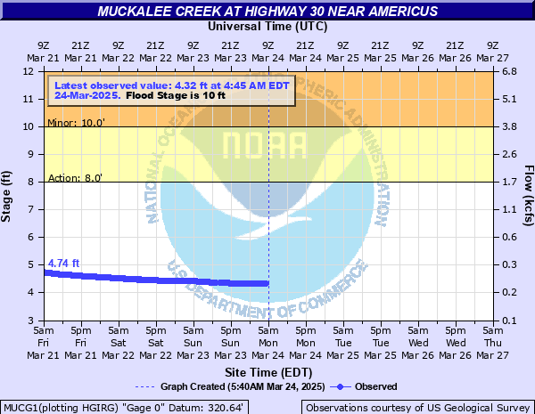
Muckalee Creek at Highway 30 near Americus
Critical Stages
8' - Action
10' - Flood
15' - Moderate
18' - Major
Latest Observation
Updated: 11:45 PM EST 12/4/25
Status: No Flooding
Stage: 4.54 ft
Flow: 0.258 kcfs
Forecast
Forecast not available for this location.
| Time | Stage (ft) | Flow (kcfs) |
|---|---|---|
| 11:45 PM 12/4 | 4.54 | 0.258 |
| 11:30 PM 12/4 | 4.54 | 0.258 |
| 11:15 PM 12/4 | 4.55 | 0.26 |
| 11:00 PM 12/4 | 4.55 | 0.26 |
| 10:45 PM 12/4 | 4.55 | 0.26 |
| 10:30 PM 12/4 | 4.56 | 0.261 |
| 10:15 PM 12/4 | 4.57 | 0.263 |
| 10:00 PM 12/4 | 4.57 | 0.263 |
| 9:45 PM 12/4 | 4.58 | 0.265 |
| 9:30 PM 12/4 | 4.58 | 0.265 |
| 9:15 PM 12/4 | 4.59 | 0.266 |
| 9:00 PM 12/4 | 4.6 | 0.268 |
| 8:45 PM 12/4 | 4.6 | 0.268 |
| 8:30 PM 12/4 | 4.61 | 0.27 |
| 8:15 PM 12/4 | 4.62 | 0.272 |
| 8:00 PM 12/4 | 4.63 | 0.274 |
| 7:45 PM 12/4 | 4.63 | 0.274 |
| 7:30 PM 12/4 | 4.64 | 0.275 |
| 7:15 PM 12/4 | 4.65 | 0.277 |
| 7:00 PM 12/4 | 4.66 | 0.279 |
| 6:45 PM 12/4 | 4.67 | 0.281 |
| 6:30 PM 12/4 | 4.68 | 0.283 |
| 6:15 PM 12/4 | 4.69 | 0.284 |
| 6:00 PM 12/4 | 4.7 | 0.286 |
| 5:45 PM 12/4 | 4.71 | 0.288 |
| 5:30 PM 12/4 | 4.72 | 0.29 |
| 5:15 PM 12/4 | 4.73 | 0.292 |
| 5:00 PM 12/4 | 4.74 | 0.294 |
| 4:45 PM 12/4 | 4.75 | 0.296 |
| 4:30 PM 12/4 | 4.76 | 0.297 |
20' -
Widespread inundation flooding never seen before will expand further from the gage on Georgia Highway 30 or Americus Friendship Road. The water level will continue to hit the bridge causing it to act like a dam. Erosion will likely occur to the sides of the bridge and county officials will have it closed. The water will be 1 to 3 feet deep over the road and up to 5 feet deep in a radio station near the bridge. This flooding will be worse than what occurred with Tropical Storm Alberto in July 1994.
18' -
Major flooding begins. Widespread inundation flooding occurs in the woodlands...fields and pastures upstream and downstream from the gage on Georgia Highway 30 or Americus Friendship Road. The water level will continue to hit the bridge causing it to act like a dam. Erosion will likely occur to the sides of the bridge and county officials will have it closed. The water will be around one foot deep over the road. A radio station near the bridge will be flooded with up to 3 feet of water.
17' -
Significant flooding continues to expand further into the woodlands...fields and pastures upstream and downstream from the gage on Georgia Highway 30 or Americus Friendship Road. The water level hits the bridge causing it to act like a dam. Erosion may occur to the sides of the bridge and county officials will likely have it closed. The water level will begin to flow over the road in low areas. A radio station on the left bank and downstream from the bridge will be flooded with up to two feet of water.
15' -
Moderate flooding begins. Significant flooding expands further into the woodlands...fields and pastures upstream and downstream from the gage on Georgia Highway 30 and Americus Friendship Road. The water level reaches the bottom of the bridge and county officials may close the bridge. Flood waters also begin to reach the foundation of a radio station on the downstream and left bank of the bridge.
14' -
Minor flooding expands further into the woodlands...fields and pastures upstream and downstream from the gage on Georgia Highway 30 or Americus Friendship Road.
12' -
Minor flooding continues in the woodlands...fields and pastures upstream and downstream from the gage on Georgia Highway 30 or Americus Friendship Road.
10' -
Flood stage is reached. Minor flooding of woodlands...fields and pastures begin upstream and downstream from the gage on Georgia Highway 30 or Americus Friendship Road.
8' -
Bankfull conditions are reached upstream and downstream from the gage on Georgia Highway 30 or Americus Friendship Road. The marsh land surrounding the creek begins to flood.
| Date | Stage (ft) |
|---|---|
| Jul 6, 1994 | 19.5 |
| Mar 31, 1970 | 11.51 |
| Mar 4, 1966 | 9.77 |
| Jan 27, 1978 | 9.51 |
| Mar 6, 1983 | 9.41 |
| Dec 25, 2015 | 9.2 |
| Feb 20, 1975 | 9.16 |
Data provided by the National Weather Service.