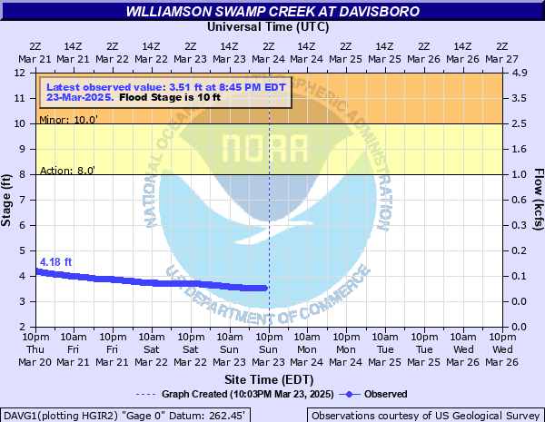
Williamson Swamp Creek at Davisboro
Critical Stages
8' - Action
10' - Flood
13' - Moderate
15' - Major
Latest Observation
Updated: 4:45 PM EST 12/15/25
Status: No Flooding
Stage: 2.94 ft
Flow: 0.043 kcfs
Forecast
Forecast not available for this location.
| Time | Stage (ft) | Flow (kcfs) |
|---|---|---|
| 4:45 PM 12/15 | 2.94 | 0.043 |
| 4:30 PM 12/15 | 2.94 | 0.043 |
| 4:15 PM 12/15 | 2.95 | 0.0435 |
| 4:00 PM 12/15 | 2.95 | 0.0435 |
| 3:45 PM 12/15 | 2.94 | 0.043 |
| 3:30 PM 12/15 | 2.95 | 0.0435 |
| 3:15 PM 12/15 | 2.95 | 0.0435 |
| 3:00 PM 12/15 | 2.95 | 0.0435 |
| 2:45 PM 12/15 | 2.95 | 0.0435 |
| 2:30 PM 12/15 | 2.95 | 0.0435 |
| 2:15 PM 12/15 | 2.95 | 0.0435 |
| 2:00 PM 12/15 | 2.95 | 0.0435 |
| 1:45 PM 12/15 | 2.96 | 0.044 |
| 1:30 PM 12/15 | 2.96 | 0.044 |
| 1:15 PM 12/15 | 2.96 | 0.044 |
| 1:00 PM 12/15 | 2.96 | 0.044 |
| 12:45 PM 12/15 | 2.96 | 0.044 |
| 12:30 PM 12/15 | 2.96 | 0.044 |
| 12:15 PM 12/15 | 2.95 | 0.0435 |
| 12:00 PM 12/15 | 2.96 | 0.044 |
| 11:45 AM 12/15 | 2.96 | 0.044 |
| 11:30 AM 12/15 | 2.97 | 0.0445 |
| 11:15 AM 12/15 | 2.96 | 0.044 |
| 11:00 AM 12/15 | 2.96 | 0.044 |
| 10:45 AM 12/15 | 2.97 | 0.0445 |
| 10:30 AM 12/15 | 2.97 | 0.0445 |
| 10:15 AM 12/15 | 2.97 | 0.0445 |
| 10:00 AM 12/15 | 2.97 | 0.0445 |
| 9:45 AM 12/15 | 2.97 | 0.0445 |
| 9:30 AM 12/15 | 2.97 | 0.0445 |
16' -
Record flooding occurs with widespread inundation of the woodlands and swamp along the creek upstream and downstream from the gage on Georgia Highway 231 or South Main Street. The water level continues to hit the bridge with erosion likely to the sides of the road bed. A few homes on South Main Street and the road will be flooded with at least a foot of water.
15' -
Major flooding begins with widespread inundation of the woodlands and swamp along the creek upstream and downstream from the gage on Georgia Highway 231 or South Main Street. The water level continues to hit the bridge with erosion possible to the sides of the road bed. Residential yards near the bridge on the right bank will be under two feet of water with a few homes beginning to flood.
14' -
Significant flooding continues in the woodlands and swamp along the creek upstream and downstream from the gage on Georgia Highway 231 or South Main Street. The water level hits the bridge and may cause some erosion to the sides of the road bed. County officials will likely close it. Residential yards near the bridge on the right bank will be under a foot of water.
13' -
Moderate flooding begins. Significant flooding occurs in the woodlands and swamp along the creek upstream and downstream from the gage on Georgia Highway 231 or South Main Street. The water level reaches the bottom of the bridge and county officials may need to close it. Residential yards near the bridge on the right bank begin to flood.
12' -
Minor flooding expands into the woodlands and swamp along the creek upstream and downstream from the gage on Georgia Highway 231 or South Main Street.
10' -
Flood stage is reached. Minor flooding beings in the woodlands and swamp along the creek upstream and downstream from the gage on Georgia Highway 231 or South Main Street.
8' -
Bankfull conditions occur along the creek upstream and downstream from the gage on Georgia Highway 231 or South Main Street.
| Date | Stage (ft) |
|---|---|
| Sep 17, 2020 | 14.66 |
| Feb 7, 2020 | 10.29 |
| Apr 3, 2009 | 10.24 |
| Feb 13, 2024 | 10 |
Data provided by the National Weather Service.