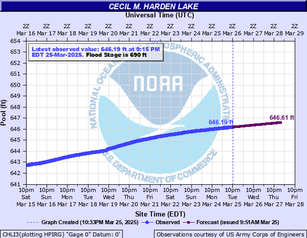
Big Raccoon Creek at Cecil M. Harden Lake
Critical Stages
690' - Action
690' - Flood
690' - Moderate
690' - Major
Latest Observation
Updated: 3:15 AM EST 12/10/25
Status: Low Threshold
Stage: 639.55 ft
Flow: -999 kcfs
Forecast
| Time | Stage (ft) | Flow (kcfs) |
|---|---|---|
| 5 AM 12/10 | 639.55 | -999 |
| 6 AM 12/10 | 639.55 | -999 |
| 7 AM 12/10 | 639.55 | -999 |
| 8 AM 12/10 | 639.55 | -999 |
| 9 AM 12/10 | 639.55 | -999 |
| 10 AM 12/10 | 639.54 | -999 |
| 11 AM 12/10 | 639.54 | -999 |
| 12 PM 12/10 | 639.54 | -999 |
| 1 PM 12/10 | 639.54 | -999 |
| 2 PM 12/10 | 639.54 | -999 |
| 3 PM 12/10 | 639.54 | -999 |
| 4 PM 12/10 | 639.53 | -999 |
| 5 PM 12/10 | 639.53 | -999 |
| 6 PM 12/10 | 639.53 | -999 |
| 7 PM 12/10 | 639.53 | -999 |
| 8 PM 12/10 | 639.53 | -999 |
| 9 PM 12/10 | 639.53 | -999 |
| 10 PM 12/10 | 639.52 | -999 |
| 11 PM 12/10 | 639.52 | -999 |
| 12 AM 12/11 | 639.52 | -999 |
| 1 AM 12/11 | 639.52 | -999 |
| 2 AM 12/11 | 639.52 | -999 |
| 3 AM 12/11 | 639.51 | -999 |
| 4 AM 12/11 | 639.51 | -999 |
| 5 AM 12/11 | 639.51 | -999 |
| 6 AM 12/11 | 639.51 | -999 |
| 7 AM 12/11 | 639.51 | -999 |
| 8 AM 12/11 | 639.51 | -999 |
| 9 AM 12/11 | 639.5 | -999 |
| 10 AM 12/11 | 639.5 | -999 |
| 11 AM 12/11 | 639.5 | -999 |
| 12 PM 12/11 | 639.5 | -999 |
| 1 PM 12/11 | 639.5 | -999 |
| 2 PM 12/11 | 639.5 | -999 |
| 3 PM 12/11 | 639.49 | -999 |
| 4 PM 12/11 | 639.49 | -999 |
| 5 PM 12/11 | 639.49 | -999 |
| 6 PM 12/11 | 639.49 | -999 |
| 7 PM 12/11 | 639.49 | -999 |
| 8 PM 12/11 | 639.48 | -999 |
| 9 PM 12/11 | 639.48 | -999 |
| 10 PM 12/11 | 639.48 | -999 |
| 11 PM 12/11 | 639.48 | -999 |
| 12 AM 12/12 | 639.48 | -999 |
| 1 AM 12/12 | 639.48 | -999 |
| 2 AM 12/12 | 639.47 | -999 |
| 3 AM 12/12 | 639.47 | -999 |
| 4 AM 12/12 | 639.47 | -999 |
| 5 AM 12/12 | 639.47 | -999 |
| Time | Stage (ft) | Flow (kcfs) |
|---|---|---|
| 3:15 AM 12/10 | 639.55 | -999 |
| 3:00 AM 12/10 | 639.55 | -999 |
| 2:45 AM 12/10 | 639.56 | -999 |
| 2:30 AM 12/10 | 639.56 | -999 |
| 2:15 AM 12/10 | 639.56 | -999 |
| 2:00 AM 12/10 | 639.56 | -999 |
| 1:45 AM 12/10 | 639.56 | -999 |
| 1:30 AM 12/10 | 639.56 | -999 |
| 1:15 AM 12/10 | 639.56 | -999 |
| 1:00 AM 12/10 | 639.56 | -999 |
| 12:45 AM 12/10 | 639.56 | -999 |
| 12:30 AM 12/10 | 639.56 | -999 |
| 12:15 AM 12/10 | 639.56 | -999 |
| 12:00 AM 12/10 | 639.56 | -999 |
| 11:45 PM 12/9 | 639.56 | -999 |
| 11:30 PM 12/9 | 639.56 | -999 |
| 11:15 PM 12/9 | 639.56 | -999 |
| 11:00 PM 12/9 | 639.56 | -999 |
| 10:45 PM 12/9 | 639.56 | -999 |
| 10:30 PM 12/9 | 639.56 | -999 |
| 10:15 PM 12/9 | 639.56 | -999 |
| 10:00 PM 12/9 | 639.56 | -999 |
| 9:45 PM 12/9 | 639.56 | -999 |
| 9:30 PM 12/9 | 639.56 | -999 |
| 9:15 PM 12/9 | 639.56 | -999 |
| 9:00 PM 12/9 | 639.56 | -999 |
| 8:45 PM 12/9 | 639.56 | -999 |
| 8:30 PM 12/9 | 639.56 | -999 |
| 8:15 PM 12/9 | 639.56 | -999 |
| 8:00 PM 12/9 | 639.56 | -999 |
712' -
Top of dam and dike.
710' -
Top of dam.
693' -
U.S. Highway 36 road surface under water. Old US 36 flooded. Access roads to Parkwood Hills, Hartman's and Knollwood subdivisions and several county roads flooded. Access to at least 40 trailers and 3 homes blocked by high water.
690' -
Flood Pool - Spillway Crest. Lake covers 3,910 acres and extends for 15.5 miles. There is a 10 0x0p+0nnual chance of occurrence of this level.
685' -
Crooks-Byers subdivision's access road flooded. Corps picnic area under water.
684' -
Knollwood access road under water. Trailers in Nevin's Camp flooded.
683' -
Trailer in Hartman's Camp flooded. Calvert Picnic Shelter at Portland Mills inundated.
681' -
Water at toe of dike.
680' -
Raccoon State Recreation Area Beach House flooded.
678' -
Walker Boat Ramp flooded.
677' -
Hollandsburg and Mansfield ramps closed. Stored Emergency Gate under water. There is a 20 0x0p+0nnual chance of occurrence of this level.
675' -
Hollandsburg ramp flooded. Portland Mills ramp closed. Jib Crane boom is under water.
669' -
Mansfield and Portland Mills ramps flooded. Raccoon State Recreation Area beach, marine, and beach picnic shelter flooded.
664' -
Back platform of tower is under water.
662' -
Summer pool elevation. Lake covers 2,060 acres and extends 10.3 miles. There is a 100 0x0p+0nnual chance of occurrence of this level.
660' -
West Rental Docks at Raccoon State Recreation Area inoperable.
659' -
Diving platform at Racoon State Recreation Area is inoperable. Portland Mills rental boat ties inoperable.
658' -
Portland Mills ramp inoperable. Gas Service dock at Raccoon State Recreational Area inoperable.
657.5' -
Rental Boat Ties at Raccoon State Recreational Area inoperable.
656' -
Beach at Raccoon State Recreational Area inoperable.
655' -
East Rental Docks at Raccoon State Recreational Area are inoperable between 653 and 655 pool elevation.
647' -
Walker Boat Ramp is inoperable between 646 and 647 pool elevation.
646' -
Mansfield and Hollandsburg Boat Ramps are inoperable between 644 and 646 pool elevation.
640' -
Winter pool elevation. Lake covers only 1,100 acres and extends 6.7 miles.
| Date | Stage (ft) |
|---|---|
| Jul 21, 2015 | 690.08 |
| May 14, 2002 | 689.9 |
| Jun 11, 2008 | 687.55 |
| Apr 28, 2013 | 686.27 |
| May 13, 1996 | 684.64 |
| Dec 14, 1985 | 683.5 |
| Nov 30, 1992 | 681 |
| Sep 19, 1989 | 680.7 |
| May 5, 2011 | 678.61 |
| Jun 25, 1998 | 678.4 |
| Jan 18, 2005 | 677.9 |
| Sep 8, 2003 | 676.5 |
| Oct 31, 2001 | 676.5 |
| May 15, 1964 | 676.5 |
| May 21, 2009 | 676.42 |
| Jun 15, 1974 | 676.3 |
| May 8, 2017 | 676.01 |
| Jun 28, 2010 | 675.85 |
| Aug 15, 1979 | 675.3 |
| Apr 15, 1978 | 675.3 |
Data provided by the National Weather Service.