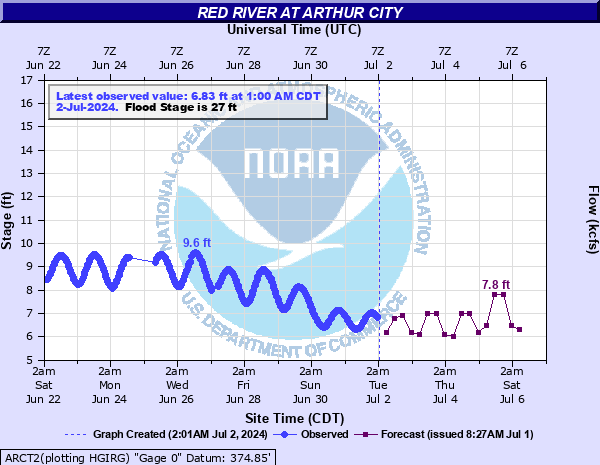
Red River at Arthur City
Critical Stages
25' - Action
27' - Flood
30' - Moderate
33' - Major
Latest Observation
Updated: 4:00 AM CST 12/16/25
Status: No Flooding
Stage: 3.32 ft
Flow: 0.352 kcfs
Forecast
| Time | Stage (ft) | Flow (kcfs) |
|---|---|---|
| 6 AM 12/16 | 3.4 | 0.411 |
| 12 PM 12/16 | 3.3 | 0.339 |
| 6 PM 12/16 | 3.3 | 0.339 |
| 12 AM 12/17 | 3.3 | 0.339 |
| 6 AM 12/17 | 3.3 | 0.339 |
| 12 PM 12/17 | 3.3 | 0.339 |
| 6 PM 12/17 | 3.3 | 0.339 |
| 12 AM 12/18 | 3.3 | 0.339 |
| 6 AM 12/18 | 3.3 | 0.339 |
| 12 PM 12/18 | 3.3 | 0.339 |
| 6 PM 12/18 | 3.3 | 0.339 |
| 12 AM 12/19 | 3.3 | 0.339 |
| 6 AM 12/19 | 3.3 | 0.339 |
| 12 PM 12/19 | 3.3 | 0.339 |
| 6 PM 12/19 | 3.3 | 0.339 |
| 12 AM 12/20 | 3.3 | 0.339 |
| 6 AM 12/20 | 3.3 | 0.339 |
| Time | Stage (ft) | Flow (kcfs) |
|---|---|---|
| 4:00 AM 12/16 | 3.32 | 0.352 |
| 3:30 AM 12/16 | 3.32 | 0.352 |
| 3:00 AM 12/16 | 3.32 | 0.352 |
| 2:30 AM 12/16 | 3.32 | 0.352 |
| 2:00 AM 12/16 | 3.31 | 0.346 |
| 1:30 AM 12/16 | 3.31 | 0.346 |
| 1:00 AM 12/16 | 3.31 | 0.346 |
| 12:30 AM 12/16 | 3.32 | 0.352 |
| 12:00 AM 12/16 | 3.33 | 0.359 |
| 11:30 PM 12/15 | 3.32 | 0.352 |
| 11:00 PM 12/15 | 3.32 | 0.352 |
| 10:30 PM 12/15 | 3.32 | 0.352 |
| 10:00 PM 12/15 | 3.32 | 0.352 |
| 9:30 PM 12/15 | 3.32 | 0.352 |
| 9:00 PM 12/15 | 3.31 | 0.346 |
| 8:30 PM 12/15 | 3.31 | 0.346 |
| 8:00 PM 12/15 | 3.32 | 0.352 |
| 7:30 PM 12/15 | 3.32 | 0.352 |
| 7:00 PM 12/15 | 3.32 | 0.352 |
| 6:30 PM 12/15 | 3.32 | 0.352 |
| 6:00 PM 12/15 | 3.31 | 0.346 |
| 5:30 PM 12/15 | 3.32 | 0.352 |
| 5:00 PM 12/15 | 3.32 | 0.352 |
| 4:30 PM 12/15 | 3.32 | 0.352 |
| 4:00 PM 12/15 | 3.32 | 0.352 |
| 3:30 PM 12/15 | 3.34 | 0.366 |
| 3:00 PM 12/15 | 3.34 | 0.366 |
| 2:30 PM 12/15 | 3.35 | 0.374 |
| 2:00 PM 12/15 | 3.33 | 0.359 |
| 1:30 PM 12/15 | 3.35 | 0.374 |
39' -
expect extremely severe flooding of pastureland between the mouth of the Blue River and Pecan Point. Numerous farmstead homes and barns become flooded or surrounded by high water. Highway 271 just north of the Red River bridge is impassible due to high water. This flood will compare with the flood of May 4, 1990. This is an extremely dangerous and life threatening situation.
37' -
expect very severe flooding of pastureland between the mouth of Blue River and Pecan Point. Numerous farm homes and buildings become flooded or surrounded by high water. Highway 271 may be impassible due to high water just north of the Red River bridge. For comparison purposes, this is how high the river reached on May 31, 2015, and the stage during the flood of May 4, 1990 was about 2 feet higher. This is an extremely dangerous and life threatening situation.
35' -
expect severe flooding of crop and pastureland between the mouth of Blue River and Pecan Point. Some farm homes and barns become flooded or surrounded by high water. High water may impact Highway 271 just north of the Red River bridge. This is similar to the flood crest on May 27, 2015 and is 2 feet lower than the crest on May 31, 2015. This is an extremely dangerous and life threatening situation.
33' -
expect severe flooding of pasturelands between the mouth of the Blue River and Pecan Point. Some barns may experience minor flooding and farmsteads may be surrounded by high water. High water will approach and may begin to affect Highway 271 just north of the Red River bridge. This is a dangerous situation.
31' -
expect moderate flooding of pastureland between the mouth of Blue River and Pecan Point. Land areas may be cut off by high water.
30' -
expect moderate flooding between the mouth of the Blue River and Pecan Point. Extensive areas not flooded become isolated by high water in cutoff channels.
29' -
expect extensive flooding between the mouth of the Blue River and Pecan Point. Extensive areas become isolated by high water in cutoff channels.
28' -
expect extensive flooding between the mouth of the Blue River and Pecan Point.
27' -
expect minor flooding between the mouth of the Blue River and Pecan Point.
25' -
faster flows are expected along the river but no flooding occurs. Interests near the river should continue to monitor later forecasts.
| Date | Stage (ft) |
|---|---|
| May 28, 1908 | 43.2 |
| May 31, 2015 | 36.99 |
| May 27, 2015 | 35.42 |
| May 19, 1892 | 34.8 |
| Feb 19, 1938 | 34.3 |
| May 4, 1990 | 34.21 |
| Jun 23, 2015 | 33.92 |
| Jun 10, 1915 | 33.7 |
| Jun 7, 1908 | 32.1 |
| Jun 17, 1935 | 31.7 |
| Apr 26, 1942 | 31.55 |
| Jun 12, 1941 | 31.27 |
| Oct 20, 1915 | 29.8 |
| Jun 20, 1908 | 28.6 |
| Nov 29, 2015 | 28.38 |
| Jun 6, 1957 | 28.35 |
| Oct 18, 1923 | 28.2 |
| Oct 7, 1941 | 28 |
| Apr 10, 1942 | 27.85 |
| Dec 29, 2015 | 27.75 |
Data provided by the National Weather Service.