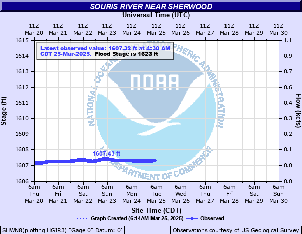
Souris River near Sherwood
Critical Stages
1622' - Action
1623' - Flood
1625' - Moderate
1630' - Major
Latest Observation
Updated: 9:00 PM CST 12/15/25
Status: No Flooding
Stage: 1607.27 ft
Flow: 0.0645 kcfs
Forecast
Forecast not available for this location.
| Time | Stage (ft) | Flow (kcfs) |
|---|---|---|
| 9:00 PM 12/15 | 1607.27 | 0.0645 |
| 8:45 PM 12/15 | 1607.27 | 0.0645 |
| 8:30 PM 12/15 | 1607.26 | 0.0637 |
| 8:15 PM 12/15 | 1607.26 | 0.0637 |
| 8:00 PM 12/15 | 1607.26 | 0.0637 |
| 7:45 PM 12/15 | 1607.25 | 0.0629 |
| 7:30 PM 12/15 | 1607.26 | 0.0637 |
| 7:15 PM 12/15 | 1607.25 | 0.0629 |
| 7:00 PM 12/15 | 1607.25 | 0.0629 |
| 6:45 PM 12/15 | 1607.25 | 0.0629 |
| 6:30 PM 12/15 | 1607.25 | 0.0629 |
| 6:15 PM 12/15 | 1607.24 | 0.0621 |
| 6:00 PM 12/15 | 1607.24 | 0.0621 |
| 5:45 PM 12/15 | 1607.24 | 0.0621 |
| 5:30 PM 12/15 | 1607.24 | 0.0621 |
| 5:15 PM 12/15 | 1607.23 | 0.0613 |
| 5:00 PM 12/15 | 1607.24 | 0.0621 |
| 4:45 PM 12/15 | 1607.23 | 0.0613 |
| 4:30 PM 12/15 | 1607.23 | 0.0613 |
| 4:15 PM 12/15 | 1607.24 | 0.0621 |
| 4:00 PM 12/15 | 1607.23 | 0.0613 |
| 3:45 PM 12/15 | 1607.24 | 0.0621 |
| 3:30 PM 12/15 | 1607.24 | 0.0621 |
| 3:15 PM 12/15 | 1607.24 | 0.0621 |
| 3:00 PM 12/15 | 1607.25 | 0.0629 |
| 2:45 PM 12/15 | 1607.26 | 0.0637 |
| 2:30 PM 12/15 | 1607.27 | 0.0645 |
| 2:15 PM 12/15 | 1607.27 | 0.0645 |
| 2:00 PM 12/15 | 1607.28 | 0.0653 |
| 1:45 PM 12/15 | 1607.29 | 0.0662 |
1630' -
Major flooding occurs at this stage. The entire valley becomes covered with water.
1628' -
Farmhouse at gage site is affected by water.
1625' -
Farms from Sherwood 15W to the northern edge of the upper Souris Wildlife Refuge will flood.
1623.8' -
Water over 95th Street on the northwest side of Mouse River Park.
1622' -
Flood water starts to affect farmstead by gage.
| Date | Stage (ft) |
|---|---|
| Jun 23, 2011 | 1633.15 |
| Apr 1, 1904 | 1630.787 |
| Apr 10, 1976 | 1630.137 |
| Apr 11, 1969 | 1629.707 |
| Apr 30, 1979 | 1628.937 |
| Apr 28, 1948 | 1628.787 |
| May 5, 1975 | 1628.607 |
| Apr 19, 1974 | 1628.507 |
| Apr 12, 1943 | 1628.167 |
| Apr 5, 1955 | 1628.037 |
| Jan 1, 1927 | 1626.987 |
| Apr 18, 1982 | 1626.887 |
| Apr 16, 1956 | 1626.737 |
| Mar 27, 1972 | 1626.697 |
| Apr 12, 2013 | 1626.367 |
| Apr 11, 1949 | 1625.547 |
| Apr 14, 1996 | 1624.707 |
| Apr 2, 1997 | 1624.687 |
| May 17, 1970 | 1624.387 |
| May 10, 1951 | 1624.217 |
Data provided by the National Weather Service.