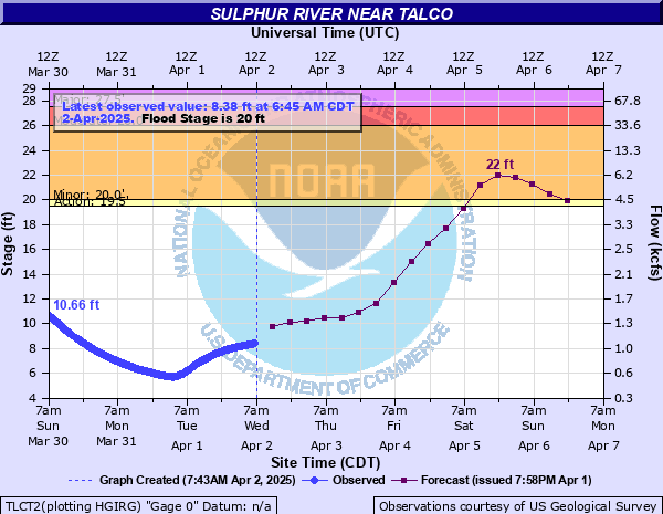
Sulphur River near Talco
Critical Stages
19.5' - Action
20' - Flood
26' - Moderate
27.5' - Major
Latest Observation
Updated: 5:45 PM CST 12/6/25
Status: No Flooding
Stage: 1.53 ft
Flow: 0.0164 kcfs
Forecast
| Time | Stage (ft) | Flow (kcfs) |
|---|---|---|
| 12 AM 12/7 | 1.6 | 0.0203 |
| 6 AM 12/7 | 1.6 | 0.0203 |
| 12 PM 12/7 | 1.6 | 0.0203 |
| 6 PM 12/7 | 1.6 | 0.0203 |
| 12 AM 12/8 | 1.6 | 0.0203 |
| 6 AM 12/8 | 1.6 | 0.0203 |
| 12 PM 12/8 | 1.6 | 0.0203 |
| 6 PM 12/8 | 1.6 | 0.0203 |
| 12 AM 12/9 | 1.6 | 0.0203 |
| 6 AM 12/9 | 1.5 | 0.0149 |
| 12 PM 12/9 | 1.5 | 0.0149 |
| 6 PM 12/9 | 1.5 | 0.0149 |
| 12 AM 12/10 | 1.5 | 0.0149 |
| 6 AM 12/10 | 1.5 | 0.0149 |
| 12 PM 12/10 | 1.5 | 0.0149 |
| 6 PM 12/10 | 1.5 | 0.0149 |
| 12 AM 12/11 | 1.5 | 0.0149 |
| 6 AM 12/11 | 1.5 | 0.0149 |
| Time | Stage (ft) | Flow (kcfs) |
|---|---|---|
| 5:45 PM 12/6 | 1.53 | 0.0164 |
| 5:30 PM 12/6 | 1.53 | 0.0164 |
| 5:15 PM 12/6 | 1.53 | 0.0164 |
| 5:00 PM 12/6 | 1.54 | 0.0169 |
| 4:45 PM 12/6 | 1.53 | 0.0164 |
| 4:30 PM 12/6 | 1.53 | 0.0164 |
| 4:15 PM 12/6 | 1.54 | 0.0169 |
| 4:00 PM 12/6 | 1.53 | 0.0164 |
| 3:45 PM 12/6 | 1.53 | 0.0164 |
| 3:30 PM 12/6 | 1.54 | 0.0169 |
| 3:15 PM 12/6 | 1.54 | 0.0169 |
| 3:00 PM 12/6 | 1.54 | 0.0169 |
| 2:45 PM 12/6 | 1.53 | 0.0164 |
| 2:30 PM 12/6 | 1.53 | 0.0164 |
| 2:15 PM 12/6 | 1.54 | 0.0169 |
| 2:00 PM 12/6 | 1.54 | 0.0169 |
| 1:45 PM 12/6 | 1.54 | 0.0169 |
| 1:30 PM 12/6 | 1.55 | 0.0174 |
| 1:15 PM 12/6 | 1.55 | 0.0174 |
| 1:00 PM 12/6 | 1.54 | 0.0169 |
| 12:45 PM 12/6 | 1.55 | 0.0174 |
| 12:30 PM 12/6 | 1.54 | 0.0169 |
| 12:15 PM 12/6 | 1.55 | 0.0174 |
| 12:00 PM 12/6 | 1.55 | 0.0174 |
| 11:45 AM 12/6 | 1.55 | 0.0174 |
| 11:30 AM 12/6 | 1.55 | 0.0174 |
| 11:15 AM 12/6 | 1.56 | 0.018 |
| 11:00 AM 12/6 | 1.55 | 0.0174 |
| 10:45 AM 12/6 | 1.55 | 0.0174 |
| 10:30 AM 12/6 | 1.56 | 0.018 |
28.5' -
Expect floodwaters to flood and close the bridge approaches of Texas Highway 37 between Hagansport and Bogota, Texas.
27' -
Expect moderate flooding of lowland areas with some secondary roadways closed. All cattle and equipment nearby the river should be moved to higher ground.
26' -
Expect moderate flooding of lowland areas with some secondary roadways closed. All cattle and equipment nearby the river should be moved to higher ground.
25' -
Expect minor flooding of lowland areas with a few secondary roadways closed. All cattle and equipment nearby the river should be moved to higher ground.
20' -
Expect minor lowland flooding of the heavily wooded floodplain. Ranchers that may have cattle and equipment in the river bottoms should move them to higher ground.
| Date | Stage (ft) |
|---|---|
| Dec 18, 2001 | 30.99 |
| Nov 29, 2015 | 30.34 |
| Dec 29, 2015 | 30.17 |
| Dec 28, 2000 | 29.17 |
| May 1, 2016 | 28.69 |
| Mar 22, 2012 | 28.5 |
| Oct 21, 2002 | 27.51 |
| Dec 15, 2015 | 27.5 |
| Oct 11, 2009 | 27.48 |
| Mar 2, 2001 | 27.3 |
| Mar 10, 2016 | 26.99 |
| Feb 22, 2018 | 26.81 |
| May 27, 2015 | 26.8 |
| Mar 22, 2015 | 26.7 |
| Feb 10, 2010 | 26.6 |
| Mar 19, 2020 | 26.51 |
| Dec 6, 1998 | 26.5 |
| Jan 27, 2012 | 26.3 |
| May 8, 1969 | 26.25 |
| Feb 22, 1997 | 25.78 |
Data provided by the National Weather Service.