« Back to Cashion Community Rivers
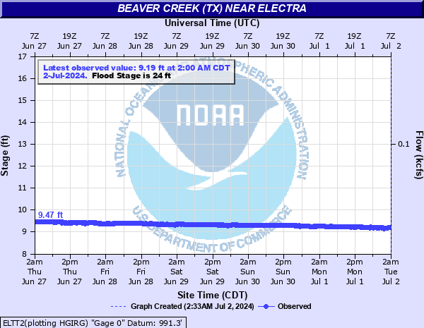
Beaver Creek (TX) near Electra
Critical Stages
22' - Action
24' - Flood
26' - Moderate
28' - Major
Latest Observation
Updated: 3:00 PM CST 12/16/25
Status: No Flooding
Stage: 8.67 ft
Flow: 0.0015 kcfs
Forecast
Forecast not available for this location.
| Time | Stage (ft) | Flow (kcfs) |
|---|---|---|
| 3:00 PM 12/16 | 8.67 | 0.0015 |
| 2:45 PM 12/16 | 8.67 | 0.0015 |
| 2:30 PM 12/16 | 8.66 | 0.0015 |
| 2:15 PM 12/16 | 8.66 | 0.0015 |
| 2:00 PM 12/16 | 8.66 | 0.0015 |
| 1:45 PM 12/16 | 8.66 | 0.0015 |
| 1:30 PM 12/16 | 8.66 | 0.0015 |
| 1:15 PM 12/16 | 8.66 | 0.0015 |
| 11:00 AM 12/16 | 8.67 | 0.0015 |
| 10:45 AM 12/16 | 8.67 | 0.0015 |
| 10:30 AM 12/16 | 8.67 | 0.0015 |
| 10:15 AM 12/16 | 8.67 | 0.0015 |
| 10:00 AM 12/16 | 8.67 | 0.0015 |
| 9:45 AM 12/16 | 8.67 | 0.0015 |
| 9:30 AM 12/16 | 8.67 | 0.0015 |
| 9:15 AM 12/16 | 8.68 | 0.0016 |
| 9:00 AM 12/16 | 8.68 | 0.0016 |
| 8:45 AM 12/16 | 8.68 | 0.0016 |
| 8:30 AM 12/16 | 8.68 | 0.0016 |
| 8:15 AM 12/16 | 8.68 | 0.0016 |
| 8:00 AM 12/16 | 8.68 | 0.0016 |
| 7:45 AM 12/16 | 8.68 | 0.0016 |
| 7:30 AM 12/16 | 8.68 | 0.0016 |
| 7:15 AM 12/16 | 8.68 | 0.0016 |
| 7:00 AM 12/16 | 8.68 | 0.0016 |
| 6:45 AM 12/16 | 8.68 | 0.0016 |
| 6:30 AM 12/16 | 8.68 | 0.0016 |
| 6:15 AM 12/16 | 8.68 | 0.0016 |
| 6:00 AM 12/16 | 8.68 | 0.0016 |
| 5:45 AM 12/16 | 8.68 | 0.0016 |
38' -
The floodwaters will 2 feet higher than the flood crest which occurred on October 2...1941... and 4 feet higher than the flood crest which occurred on June 28...2007. Widespread flood levels varying up to 14 feet in depth will cover farm and range lands... and possibly inundate some oil and gas facilities... along and near the creek in southern Wilbarger County and southwestern Wichita County.
37' -
The floodwaters will 1 foot higher than the flood which occurred on October 2...1941... and 3 feet higher than the flood crest which occurred on June 28...2007. Widespread flood levels varying up to 13 feet in depth will cover farm and range lands... and possibly inundate some oil and gas facilities... along and near the creek in southern Wilbarger County and southwestern Wichita County.
36' -
The floodwaters will be as high as the flood which occurred on October 2...1941... and 2 feet higher than the flood crest which occurred on June 28...2007. Widespread flood levels varying up to 12 feet in depth will cover farm and range lands... and possibly inundate some oil and gas facilities... along and near the creek in southern Wilbarger County and southwestern Wichita County.
35' -
The floodwaters will be as high as the floods which occurred on May 29...1987... and August 3...1995...and 1 foot higher than the flood crest which occurred on June 28...2007. Widespread flood levels varying up to 11 feet in depth will cover farm and range lands... and possibly inundate some oil and gas facilities... along and near the creek in southern Wilbarger County and southwestern Wichita County.
34' -
The floodwaters will be as high as the flood crest which occurred on June 28...2007. Widespread flood levels up to 10 feet in depth cover farm and range lands... and may inundate some oil and gas facilities... along and near the creek in southern Wilbarger County and southwestern Wichita County.
33' -
The floodwaters begin to approach levels which occurred during the flood crest of June 28...2007. Widespread flood levels up to 9 feet in depth cover farm and range lands... and may inundate some oil and gas facilities... along and near the creek in southern Wilbarger County and southwestern Wichita County.
32' -
Widespread flood levels up to 8 feet in depth cover farm and range lands... and may inundate some oil and gas facilities... along and near the creek in southern Wilbarger County and southwestern Wichita County.
31' -
Widespread flood levels up to 7 feet in depth cover farm and range lands... and may inundate some oil and gas facilities... along and near the creek in southern Wilbarger County and southwestern Wichita County.
30' -
Widespread flood levels up to 6 feet in depth cover farm and range lands... and may inundate some oil and gas facilities... along and near the creek in southern Wilbarger County and southwestern Wichita County.
29' -
Widespread flood levels up to 5 feet in depth cover farm and range lands... and may inundate some oil and gas facilities... along and near the creek in southern Wilbarger County and southwestern Wichita County.
28' -
Widespread flood levels up to 4 feet in depth cover farm and range lands... and may inundate some oil and gas facilities... along and near the creek in southern Wilbarger County and southwestern Wichita County.
27' -
Widespread flood levels up to 3 feet in depth cover farm and range lands... and may inundate some oil and gas facilities... along and near the creek in southern Wilbarger County and southwestern Wichita County.
26' -
Flood levels up to 2 feet in depth cover farm and range lands... and may inundate some oil and gas facilities... along and near the creek in southern Wilbarger County and southwestern Wichita County.
25' -
Flood levels up to about a foot in depth produce shallow... short duration agricultural flooding along and near the creek in southern Wilbarger County and southwestern Wichita County.
24' -
Shallow and short duration flooding of lowlands occurs along and near the creek in southern Wilbarger County and southwestern Wichita County.
23' -
Shallow and short duration flooding of lowlands along and near the creek may occur in southern Wilbarger County and southwestern Wichita County.
22' -
Shallow and short duration flooding of lowlands along and near the creek may occur in southern Wilbarger County and southwestern Wichita County.
| Date | Stage (ft) |
|---|---|
| May 29, 1987 | 34.94 |
| Aug 3, 1995 | 34.87 |
| Oct 21, 1983 | 33.8 |
| Jun 28, 2007 | 33.74 |
| Mar 17, 1961 | 33.57 |
| Sep 6, 1986 | 33.24 |
| May 23, 1975 | 31.31 |
| May 23, 2019 | 30.81 |
| May 1, 2025 | 30.49 |
| May 21, 2015 | 30.11 |
| Oct 7, 2018 | 29.82 |
| Jun 9, 1992 | 29.64 |
| Sep 28, 2017 | 29.61 |
| Feb 16, 1993 | 29.6 |
| Jan 1, 1985 | 29.32 |
| May 22, 2015 | 29.27 |
| Apr 20, 1990 | 28.96 |
| Oct 24, 1983 | 28.86 |
| Nov 1, 1972 | 28.8 |
| Feb 23, 1985 | 28.75 |
Data provided by the National Weather Service.