« Back to Cashion Community Rivers
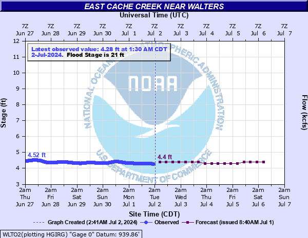
East Cache Creek near Walters
Critical Stages
15' - Action
21' - Flood
22' - Moderate
26' - Major
Latest Observation
Updated: 3:30 PM CST 12/16/25
Status: No Flooding
Stage: 4.61 ft
Flow: 0.0247 kcfs
Forecast
| Time | Stage (ft) | Flow (kcfs) |
|---|---|---|
| 6 PM 12/16 | 4.6 | 0.0242 |
| 12 AM 12/17 | 4.6 | 0.0242 |
| 6 AM 12/17 | 4.6 | 0.0242 |
| 12 PM 12/17 | 4.6 | 0.0242 |
| 6 PM 12/17 | 4.6 | 0.0242 |
| 12 AM 12/18 | 4.6 | 0.0242 |
| 6 AM 12/18 | 4.6 | 0.0242 |
| 12 PM 12/18 | 4.6 | 0.0242 |
| 6 PM 12/18 | 4.6 | 0.0242 |
| 12 AM 12/19 | 4.6 | 0.0242 |
| 6 AM 12/19 | 4.6 | 0.0242 |
| 12 PM 12/19 | 4.6 | 0.0242 |
| 6 PM 12/19 | 4.6 | 0.0242 |
| 12 AM 12/20 | 4.6 | 0.0242 |
| 6 AM 12/20 | 4.6 | 0.0242 |
| 12 PM 12/20 | 4.6 | 0.0242 |
| 6 PM 12/20 | 4.6 | 0.0242 |
| 12 AM 12/21 | 4.6 | 0.0242 |
| 6 AM 12/21 | 4.6 | 0.0242 |
| Time | Stage (ft) | Flow (kcfs) |
|---|---|---|
| 3:30 PM 12/16 | 4.61 | 0.0247 |
| 3:00 PM 12/16 | 4.61 | 0.0247 |
| 2:30 PM 12/16 | 4.61 | 0.0247 |
| 2:00 PM 12/16 | 4.62 | 0.0252 |
| 1:30 PM 12/16 | 4.62 | 0.0252 |
| 1:00 PM 12/16 | 4.62 | 0.0252 |
| 11:30 AM 12/16 | 4.64 | 0.0262 |
| 11:00 AM 12/16 | 4.64 | 0.0262 |
| 10:30 AM 12/16 | 4.64 | 0.0262 |
| 10:00 AM 12/16 | 4.64 | 0.0262 |
| 9:30 AM 12/16 | 4.64 | 0.0262 |
| 9:00 AM 12/16 | 4.64 | 0.0262 |
| 8:30 AM 12/16 | 4.64 | 0.0262 |
| 8:00 AM 12/16 | 4.63 | 0.0257 |
| 7:30 AM 12/16 | 4.63 | 0.0257 |
| 7:00 AM 12/16 | 4.63 | 0.0257 |
| 6:30 AM 12/16 | 4.63 | 0.0257 |
| 6:00 AM 12/16 | 4.63 | 0.0257 |
| 5:30 AM 12/16 | 4.63 | 0.0257 |
| 5:00 AM 12/16 | 4.62 | 0.0252 |
| 4:30 AM 12/16 | 4.62 | 0.0252 |
| 4:00 AM 12/16 | 4.62 | 0.0252 |
| 3:30 AM 12/16 | 4.62 | 0.0252 |
| 3:00 AM 12/16 | 4.62 | 0.0252 |
| 2:30 AM 12/16 | 4.61 | 0.0247 |
| 2:00 AM 12/16 | 4.61 | 0.0247 |
| 1:30 AM 12/16 | 4.61 | 0.0247 |
| 1:00 AM 12/16 | 4.61 | 0.0247 |
| 12:30 AM 12/16 | 4.61 | 0.0247 |
| 12:00 AM 12/16 | 4.61 | 0.0247 |
31' -
Valley-wide flooding of croplands... pastures... and local roads occurs in southern Comanche County and Cotton County and is accompanied by flood depths up to 10 feet with very dangerous currents.
30' -
Valley-wide flooding of croplands... pastures... and local roads occurs in southern Comanche County and Cotton County and is accompanied by flood depths up to 9 feet with very dangerous currents.
29' -
Valley-wide flooding of croplands... pastures... and local roads occurs in southern Comanche County and Cotton County and is accompanied by flood depths up to 8 feet with very dangerous currents.
28' -
Valley-wide flooding of croplands... pastures... and local roads occurs in southern Comanche County and Cotton County and is accompanied by flood depths up to 7 feet with very dangerous currents.
27' -
Valley-wide flooding of croplands... pastures... and local roads occurs in southern Comanche County and Cotton County and is accompanied by flood depths up to 6 feet with very dangerous currents.
26' -
Valley-wide flooding of croplands... pastures... and local roads occurs in southern Comanche County and Cotton County and is accompanied by flood depths up to 5 feet with dangerous currents.
25' -
Valley-wide flooding of croplands... pastures... and local roads occurs in southern Comanche County and Cotton County and is accompanied by flood depths up to 4 feet with swift currents.
24' -
Valley-wide flooding of croplands... pastures... and local roads occurs in southern Comanche County and Cotton County and is accompanied by flood depths up to 3 feet with swift currents.
23' -
Flood depths up to 2 feet occur over croplands... pastures... and low-lying local roads along and near the creek in southern Comanche County and Cotton County.
22' -
Flood depths to 1 foot occur over croplands... pastures... and low-lying local roads along and near the creek in southern Comanche County and Cotton County.
21' -
Shallow flooding occurs over croplands... pastures... and low-lying local roads along and near the creek in southern Comanche County and Cotton County.
20' -
Some flooding of bottomlands may occur along and near the creek in southern Comanche County and Cotton County.
19' -
Some inundation of bottomlands may occur along and near the creek in southern Comanche County and Cotton County.
18' -
Some inundation of bottomlands may occur along and near the creek in southern Comanche County and Cotton County.
17' -
Some inundation of bottomlands may occur along and near the creek in southern Comanche County and Cotton County.
16' -
Some inundation of bottomlands may occur along and near the creek in southern Comanche County and Cotton County.
15' -
Some inundation of bottomlands may occur along and near the creek in southern Comanche County and Cotton County.
| Date | Stage (ft) |
|---|---|
| Oct 21, 1983 | 30.66 |
| May 25, 2015 | 29.77 |
| Jan 1, 1906 | 29.7 |
| Apr 30, 2025 | 29.51 |
| Jun 6, 1995 | 29.5 |
| Jun 13, 2016 | 29.39 |
| Jun 30, 2007 | 29.35 |
| May 26, 1957 | 28.8 |
| Apr 27, 2025 | 28.73 |
| Jun 9, 1962 | 28.5 |
| Jun 5, 1995 | 28.49 |
| May 20, 1955 | 28.38 |
| May 29, 1975 | 28.38 |
| Oct 26, 2000 | 28.32 |
| Mar 16, 1998 | 28.32 |
| Oct 26, 2001 | 28.32 |
| May 3, 1990 | 28.21 |
| Jun 8, 1941 | 28.18 |
| May 24, 1975 | 28.16 |
| Jun 26, 2007 | 28.1 |
Data provided by the National Weather Service.