« Back to Center Lovell Rivers
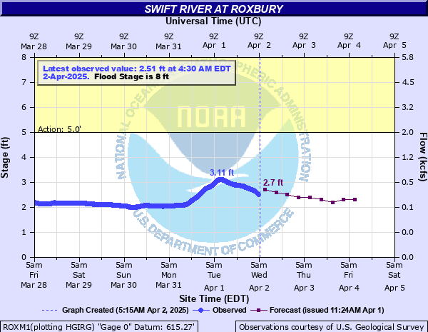
Swift River at Roxbury
Critical Stages
5' - Action
8' - Flood
9.5' - Moderate
12' - Major
Latest Observation
Updated: 3:00 PM EST 12/5/25
Status: No Flooding
Stage: 1.55 ft
Flow: 0.0628 kcfs
Forecast
| Time | Stage (ft) | Flow (kcfs) |
|---|---|---|
| 7 PM 12/5 | 1.6 | 0.069 |
| 1 AM 12/6 | 1.6 | 0.069 |
| 7 AM 12/6 | 1.6 | 0.069 |
| 1 PM 12/6 | 1.6 | 0.069 |
| 7 PM 12/6 | 1.6 | 0.069 |
| 1 AM 12/7 | 1.6 | 0.069 |
| 7 AM 12/7 | 1.6 | 0.069 |
| 1 PM 12/7 | 1.6 | 0.069 |
| 7 PM 12/7 | 1.6 | 0.069 |
| 1 AM 12/8 | 1.6 | 0.069 |
| 7 AM 12/8 | 1.6 | 0.069 |
| Time | Stage (ft) | Flow (kcfs) |
|---|---|---|
| 3:15 PM 12/5 | 1.55 | 0.0628 |
| 3:00 PM 12/5 | 1.55 | 0.0628 |
| 2:45 PM 12/5 | 1.55 | 0.0628 |
| 2:30 PM 12/5 | 1.55 | 0.0628 |
| 2:15 PM 12/5 | 1.55 | 0.0628 |
| 2:00 PM 12/5 | 1.56 | 0.064 |
| 1:45 PM 12/5 | 1.57 | 0.0652 |
| 1:30 PM 12/5 | 1.59 | 0.0677 |
| 1:15 PM 12/5 | 1.62 | 0.0718 |
| 1:00 PM 12/5 | 1.66 | 0.0778 |
| 12:45 PM 12/5 | 1.7 | 0.084 |
| 12:30 PM 12/5 | 1.69 | 0.0824 |
| 12:15 PM 12/5 | 1.67 | 0.0793 |
| 12:00 PM 12/5 | 1.67 | 0.0793 |
| 11:45 AM 12/5 | 1.64 | 0.0748 |
| 11:30 AM 12/5 | -9999 | -999 |
| 11:15 AM 12/5 | 1.66 | 0.0778 |
| 11:00 AM 12/5 | 1.7 | 0.084 |
| 10:45 AM 12/5 | 1.69 | 0.0824 |
| 10:30 AM 12/5 | 1.62 | 0.0718 |
| 10:15 AM 12/5 | 1.63 | 0.0733 |
| 10:00 AM 12/5 | 1.62 | 0.0718 |
| 9:45 AM 12/5 | 1.63 | 0.0733 |
| 9:30 AM 12/5 | 1.64 | 0.0748 |
| 9:15 AM 12/5 | 1.64 | 0.0748 |
| 9:00 AM 12/5 | 1.64 | 0.0748 |
| 8:45 AM 12/5 | 1.64 | 0.0748 |
| 8:30 AM 12/5 | 1.6 | 0.069 |
| 8:15 AM 12/5 | 1.6 | 0.069 |
| 8:00 AM 12/5 | 1.63 | 0.0733 |
14' -
Flooding comparable to record levels observed in December 2023. Severe flooding at the confluence with the Androscoggin River in Rumford and Mexico where homes and businesses are impacted. Roadways will remain unsafe during and after the storm.
12.5' -
Approaching levels seen during the April 1987 flood. Route 17 likely washed out in multiple areas making travel extremely dangerous.
12' -
Major flooding occurs. Water surrounds homes in Byron and Roxbury. Travel in and out of the region is cut off.
10' -
Moderate flooding occurs. Properties near Houghton Road in northern parts of Byron surrounded by flood waters. Further downstream in Rumford and Mexico flooding from the Swift River can occur if the Androscoggin River is also in flood including several parks and river access areas.
9.5' -
Moderate flooding occurs. Closure of Route 17 likely from flood waters, significantly impacting travel in and out of the area. Numerous locations on Route 17 likely to flood due to a combination of high water on the Swift River and backwater from smaller tributaries along Easter Hill Road in Roxbury and along what is known as the Byron Flats.
9' -
Flood waters inundate Route 17 a few miles north of Byron Village Road.
8' -
Minor flooding occurs. River encroaches on Route 17 and some properties along the Swift River in and around Byron. 7 Swift River comes out of banks and inundates lowlands in Roxbury and Byron.
7' -
River at bankfull with minor flooding of agricultural fields possible between Farmington Falls and New Sharon.
| Date | Stage (ft) |
|---|---|
| Dec 18, 2023 | 14.2 |
| Oct 24, 1959 | 12.87 |
| Sep 17, 1932 | 12.58 |
| Apr 1, 1987 | 12.54 |
| Jun 15, 1942 | 12.42 |
| May 12, 1989 | 11.6 |
| Mar 19, 1936 | 11.2 |
| Mar 12, 1936 | 11.02 |
| Jan 27, 1986 | 10.98 |
| Dec 18, 2003 | 10.91 |
| Jan 19, 1996 | 10.84 |
| May 1, 2023 | 10.8 |
| Nov 26, 1950 | 10.76 |
| Apr 17, 1993 | 10.64 |
| Aug 28, 2011 | 10.62 |
| Dec 21, 1973 | 10.58 |
| Sep 17, 1999 | 10.54 |
| Jul 1, 1973 | 10.51 |
| Apr 21, 1950 | 10.48 |
| Nov 3, 1966 | 10.46 |
Data provided by the National Weather Service.