« Back to Charlton County Rivers
Satilla River near Waycross
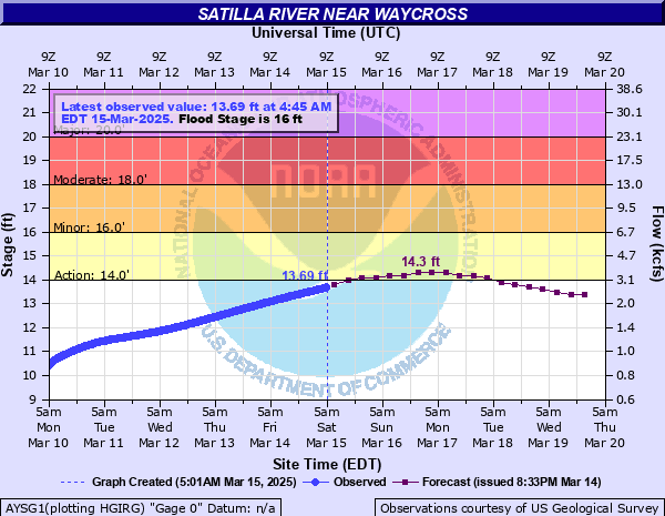
Critical Stages
14' - Action
16' - Flood
18' - Moderate
20' - Major
Latest Observation
Updated: 11:30 PM EST 12/4/25
Status: No Flooding
Stage: 5.05 ft
Flow: 0.0884 kcfs
Forecast
| Time | Stage (ft) | Flow (kcfs) |
|---|---|---|
| 1 AM 12/5 | 4.9 | 0.078 |
| 7 AM 12/5 | 5 | 0.085 |
| 1 PM 12/5 | 5 | 0.085 |
| 7 PM 12/5 | 5.1 | 0.092 |
| 1 AM 12/6 | 5.3 | 0.107 |
| 7 AM 12/6 | 5.5 | 0.123 |
| 1 PM 12/6 | 5.7 | 0.141 |
| 7 PM 12/6 | 5.9 | 0.16 |
| 1 AM 12/7 | 6 | 0.17 |
| 7 AM 12/7 | 6.1 | 0.18 |
| 1 PM 12/7 | 6.3 | 0.202 |
| 7 PM 12/7 | 6.4 | 0.213 |
| 1 AM 12/8 | 6.5 | 0.224 |
| 7 AM 12/8 | 6.7 | 0.248 |
| 1 PM 12/8 | 6.8 | 0.261 |
| 7 PM 12/8 | 6.9 | 0.273 |
| 1 AM 12/9 | 7 | 0.285 |
| 7 AM 12/9 | 7.2 | 0.311 |
| Time | Stage (ft) | Flow (kcfs) |
|---|---|---|
| 11:30 PM 12/4 | 5.05 | 0.0884 |
| 11:15 PM 12/4 | 5.05 | 0.0884 |
| 11:00 PM 12/4 | 5.06 | 0.0892 |
| 10:45 PM 12/4 | 5.05 | 0.0884 |
| 10:30 PM 12/4 | 5.05 | 0.0884 |
| 10:15 PM 12/4 | 5.04 | 0.0878 |
| 10:00 PM 12/4 | 5.02 | 0.0864 |
| 9:45 PM 12/4 | 4.99 | 0.0843 |
| 9:30 PM 12/4 | 4.95 | 0.0814 |
| 9:15 PM 12/4 | 4.88 | 0.0768 |
| 9:00 PM 12/4 | 4.82 | 0.0732 |
| 8:45 PM 12/4 | 4.79 | 0.0714 |
| 8:30 PM 12/4 | 4.79 | 0.0714 |
| 8:15 PM 12/4 | 4.78 | 0.0708 |
| 8:00 PM 12/4 | 4.78 | 0.0708 |
| 7:45 PM 12/4 | 4.78 | 0.0708 |
| 7:30 PM 12/4 | 4.77 | 0.0702 |
| 7:15 PM 12/4 | 4.77 | 0.0702 |
| 7:00 PM 12/4 | 4.71 | 0.0666 |
| 6:45 PM 12/4 | 4.74 | 0.0684 |
| 6:30 PM 12/4 | 4.74 | 0.0684 |
| 6:15 PM 12/4 | 4.74 | 0.0684 |
| 6:00 PM 12/4 | 4.74 | 0.0684 |
| 5:45 PM 12/4 | 4.74 | 0.0684 |
| 5:30 PM 12/4 | 4.74 | 0.0684 |
| 5:15 PM 12/4 | 4.73 | 0.0678 |
| 5:00 PM 12/4 | 4.73 | 0.0678 |
| 4:45 PM 12/4 | 4.73 | 0.0678 |
| 4:30 PM 12/4 | 4.73 | 0.0678 |
| 4:15 PM 12/4 | 4.73 | 0.0678 |
20' -
Effects railroad bridge. Rail traffic must be rerouted. On the Pierce County side, low lying roads are flooded and homes are threatened in the Riverwoods Drive community and in the Okefenokee Country Club.
18' -
On the Pierce County side, the Okefenokee Country Club Golf Course is generally closed. Riverwoods Drive low lying properties begin to flood.
17' -
On the Ware County side, the Jamestown Road Boat Ramp parking lot and access road is flooded and Simmons Trail is flooded cutting off one residence. On the Pierce County side, the Okefenokee Country Club Course Holes 14 through 16 begin to flood.
16' -
Flooding of agriculture and timberlands begins. On the Ware County side, the Jamestown Road Boat Ramp is flooded. On the Pierce/Brantley county line at the State Road 121 Bridge the boat ramp and dirt access roads are flooded.
| Date | Stage (ft) |
|---|---|
| Apr 4, 1948 | 22.4 |
| Apr 5, 2009 | 22.36 |
| May 1, 1928 | 22.2 |
| Mar 6, 1991 | 21.52 |
| Mar 10, 1984 | 20.29 |
| Mar 12, 1998 | 20.23 |
| Dec 8, 1964 | 20.1 |
| Feb 13, 1986 | 20.03 |
| Feb 2, 1991 | 19.77 |
| Apr 8, 1960 | 19.72 |
| Mar 1, 2013 | 19.37 |
| Mar 9, 1959 | 19.3 |
| Apr 20, 1961 | 19.3 |
| Mar 16, 1980 | 19.01 |
| Mar 6, 1964 | 19 |
| Feb 16, 1995 | 18.76 |
| Oct 19, 1947 | 18.76 |
| Apr 7, 1973 | 18.75 |
| Mar 9, 2020 | 18.49 |
| Feb 8, 2016 | 18.43 |
Data provided by the National Weather Service.