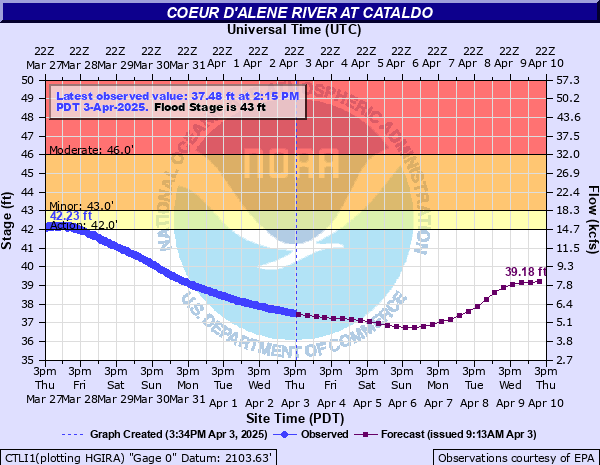
Coeur d'Alene River at Cataldo
Critical Stages
42' - Action
43' - Flood
46' - Moderate
50' - Major
Latest Observation
Updated: 6:15 AM PST 12/5/25
Status: No Flooding
Stage: 33.11 ft
Flow: 0.757 kcfs
Forecast
| Time | Stage (ft) | Flow (kcfs) |
|---|---|---|
| 10 AM 12/5 | 33.11 | 0.757 |
| 4 PM 12/5 | 33.15 | 0.792 |
| 10 PM 12/5 | 33.32 | 0.949 |
| 4 AM 12/6 | 33.67 | 1.3 |
| 10 AM 12/6 | 34.2 | 1.84 |
| 4 PM 12/6 | 34.75 | 2.41 |
| 10 PM 12/6 | 35.15 | 2.85 |
| 4 AM 12/7 | 35.37 | 3.1 |
| 10 AM 12/7 | 35.43 | 3.17 |
| 4 PM 12/7 | 35.42 | 3.15 |
| 10 PM 12/7 | 35.44 | 3.18 |
| 4 AM 12/8 | 35.62 | 3.39 |
| 10 AM 12/8 | 35.89 | 3.71 |
| 4 PM 12/8 | 36.1 | 3.96 |
| 10 PM 12/8 | 36.25 | 4.15 |
| 4 AM 12/9 | 36.51 | 4.47 |
| 10 AM 12/9 | 37.08 | 5.2 |
| 4 PM 12/9 | 37.85 | 6.21 |
| 10 PM 12/9 | 38.52 | 7.12 |
| 4 AM 12/10 | 38.93 | 7.7 |
| 10 AM 12/10 | 39.13 | 7.98 |
| 4 PM 12/10 | 39.22 | 8.11 |
| 10 PM 12/10 | 39.28 | 8.2 |
| 4 AM 12/11 | 39.36 | 8.32 |
| 10 AM 12/11 | 39.47 | 8.47 |
| 4 PM 12/11 | 39.55 | 8.59 |
| 10 PM 12/11 | 39.55 | 8.59 |
| 4 AM 12/12 | 39.5 | 8.52 |
| 10 AM 12/12 | 39.47 | 8.47 |
| 4 PM 12/12 | 39.44 | 8.43 |
| 10 PM 12/12 | 39.38 | 8.34 |
| 4 AM 12/13 | 39.28 | 8.2 |
| 10 AM 12/13 | 39.1 | 7.94 |
| 4 PM 12/13 | 38.83 | 7.56 |
| 10 PM 12/13 | 38.49 | 7.08 |
| 4 AM 12/14 | 38.13 | 6.59 |
| Time | Stage (ft) | Flow (kcfs) |
|---|---|---|
| 6:15 AM 12/5 | 33.11 | 0.757 |
| 6:00 AM 12/5 | 33.11 | 0.757 |
| 5:45 AM 12/5 | 33.11 | 0.757 |
| 5:30 AM 12/5 | 33.11 | 0.757 |
| 5:15 AM 12/5 | 33.11 | 0.757 |
| 5:00 AM 12/5 | 33.11 | 0.757 |
| 4:45 AM 12/5 | 33.11 | 0.757 |
| 4:30 AM 12/5 | 33.11 | 0.757 |
| 4:15 AM 12/5 | 33.11 | 0.757 |
| 4:00 AM 12/5 | 33.11 | 0.757 |
| 3:45 AM 12/5 | 33.11 | 0.757 |
| 3:30 AM 12/5 | 33.11 | 0.757 |
| 3:15 AM 12/5 | 33.11 | 0.757 |
| 3:00 AM 12/5 | 33.11 | 0.757 |
| 2:45 AM 12/5 | 33.12 | 0.765 |
| 2:30 AM 12/5 | 33.12 | 0.765 |
| 2:15 AM 12/5 | 33.12 | 0.765 |
| 2:00 AM 12/5 | 33.12 | 0.765 |
| 1:45 AM 12/5 | 33.12 | 0.765 |
| 1:30 AM 12/5 | 33.12 | 0.765 |
| 1:15 AM 12/5 | 33.12 | 0.765 |
| 1:00 AM 12/5 | 33.12 | 0.765 |
| 12:45 AM 12/5 | 33.12 | 0.765 |
| 12:30 AM 12/5 | 33.12 | 0.765 |
| 12:15 AM 12/5 | 33.12 | 0.765 |
| 12:00 AM 12/5 | 33.12 | 0.765 |
| 11:45 PM 12/4 | 33.12 | 0.765 |
| 11:30 PM 12/4 | 33.13 | 0.774 |
| 11:15 PM 12/4 | 33.12 | 0.765 |
| 11:00 PM 12/4 | 33.12 | 0.765 |
55' -
The main Coeur d'Alene River Road between Kingston and Prichard will be flooded.
47' -
Significant flooding can be expected from Cataldo to Harrison. Cataldo will be completely flooded. The I-90 west-bound exit and entrance at Cataldo will likely be flooded.
46' -
The east-bound I-90 exit and entrance near Cataldo may be flooded. Latour Creek Road will be flooded and impassable. The Old Coeur d'Alene River Road along the North Fork of the Couer d'Alene River will be flooded.
45' -
The County may begin pumping operations behind levels above this stage if the river is expected to remain over flood stage for a long duration.
44' -
Homes near the river may experience some flooding of basements. Water will begin to cover CCC Road near the Mennonite Church. Some water will be over the section of Latour Creek Road immediately south of Interstate 90, near the campground. Due to the high water table some homes behind the Cataldo levee will be surrounded by water.
43' -
Minor flooding of farmland from Cataldo downstream to Rose Lake and Harrison is likely. The campground at Cataldo will also begin to flood. Portions of Dudley Road, west of Latour Creek, will likely be underwater and impassable. If there is significant water already in the floodplain, these impacts may occur at lower stages. Old Coeur d'Alene River Road on the North Fork of the Coeur d'Alene River near Enaville may begin to flood north of the Bumblebee Bridge.
42.5' -
Portions of Riverview Road between Cataldo and Kingston will be flooded, especially near Abbey Road and below Fast Hill Road. Lowlands around Latour Creek Road will fill with water.
42' -
Portions of the campground south of I-90 and Dudley Road, downstream of Cataldo, may be underwater if floodplain storage areas are already full of water. This includes areas around Cataldo Mission exit.
| Date | Stage (ft) |
|---|---|
| Jan 16, 1974 | 58.23 |
| Dec 23, 1933 | 56.9 |
| Apr 19, 1938 | 55.15 |
| Feb 9, 1996 | 51.62 |
| Dec 23, 1964 | 48.46 |
| Feb 22, 1961 | 47.52 |
| Nov 30, 1995 | 47.3 |
| Dec 15, 1980 | 47 |
| Dec 15, 1946 | 46.57 |
| Apr 15, 2002 | 46.51 |
| Feb 11, 1951 | 46.35 |
| Nov 12, 1990 | 46.2 |
| Mar 16, 2017 | 46.13 |
| Jan 18, 2011 | 45.96 |
| May 19, 2008 | 45.96 |
| Mar 31, 2012 | 45.22 |
| Mar 10, 2014 | 45.18 |
| Jan 10, 1990 | 45.07 |
| Apr 15, 2000 | 44.8 |
| Feb 3, 1982 | 44.8 |
Data provided by the National Weather Service.