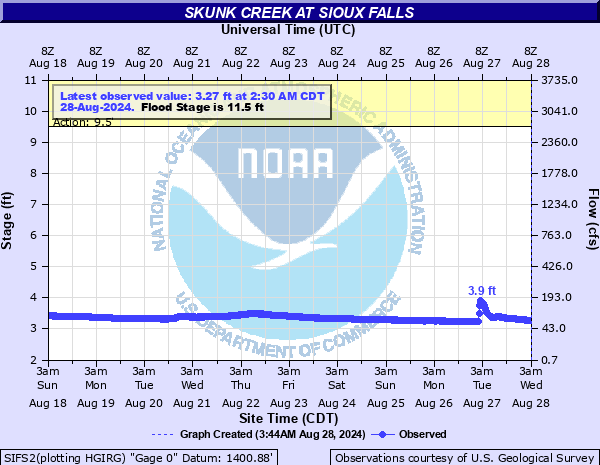
Skunk Creek at Sioux Falls
Critical Stages
9.5' - Action
11.5' - Flood
15' - Moderate
17' - Major
Latest Observation
Updated: 9:30 PM CST 12/14/25
Status: No Flooding
Stage: 2.32 ft
Flow: 0.0105 kcfs
Forecast
Forecast not available for this location.
| Time | Stage (ft) | Flow (kcfs) |
|---|---|---|
| 9:30 PM 12/14 | 2.32 | 0.0105 |
| 9:15 PM 12/14 | 2.32 | 0.0105 |
| 9:00 PM 12/14 | 2.32 | 0.0105 |
| 8:45 PM 12/14 | 2.32 | 0.0105 |
| 8:30 PM 12/14 | 2.32 | 0.0105 |
| 8:15 PM 12/14 | 2.31 | 0.0103 |
| 8:00 PM 12/14 | 2.31 | 0.0103 |
| 7:45 PM 12/14 | 2.32 | 0.0105 |
| 7:30 PM 12/14 | 2.31 | 0.0103 |
| 7:15 PM 12/14 | 2.31 | 0.0103 |
| 7:00 PM 12/14 | 2.31 | 0.0103 |
| 6:45 PM 12/14 | 2.31 | 0.0103 |
| 6:30 PM 12/14 | 2.31 | 0.0103 |
| 6:15 PM 12/14 | 2.32 | 0.0105 |
| 6:00 PM 12/14 | 2.32 | 0.0105 |
| 5:45 PM 12/14 | 2.32 | 0.0105 |
| 5:30 PM 12/14 | 2.32 | 0.0105 |
| 5:15 PM 12/14 | 2.31 | 0.0103 |
| 5:00 PM 12/14 | 2.32 | 0.0105 |
| 4:45 PM 12/14 | 2.31 | 0.0103 |
| 4:30 PM 12/14 | 2.32 | 0.0105 |
| 4:15 PM 12/14 | 2.31 | 0.0103 |
| 4:00 PM 12/14 | 2.31 | 0.0103 |
| 3:45 PM 12/14 | 2.31 | 0.0103 |
| 3:30 PM 12/14 | 2.31 | 0.0103 |
| 3:15 PM 12/14 | 2.32 | 0.0105 |
| 3:00 PM 12/14 | 2.32 | 0.0105 |
| 2:45 PM 12/14 | 2.32 | 0.0105 |
| 2:30 PM 12/14 | 2.31 | 0.0103 |
| 2:15 PM 12/14 | 2.32 | 0.0105 |
26' -
The levees near the gauge may be overtopped.
24' -
The parking lot for the apartments southeast of the gage is under water.
22' -
Portions of Marion Road begin to flood without sandbagging and levee protection.
21' -
Silver Valley Drive is flooded and some homes along Skunk Creek are threatened.
18' -
Dunham Park is flooded.
17' -
The flow from Skunk Creek alone, even with all Big Sioux River flow diverted, can begin to cause flooding along the Big Sioux channel in southern Sioux Falls.
16' -
The bridge on W 12th St is overtopped.
15' -
The lowest portion of the bike trail under Marion Rd begins to flood.
13' -
West Madison Street near Le Mesa Drive begins flooding.
12' -
West 12th Street east of Sertoma Drive begins to flood.
11.5' -
Minor flooding of rural agricultural land begins, along with some flooding in the parks in Sioux Falls.
9.5' -
Legacy Park begins to flood.
7.5' -
The lowest portion of the bike trail under 12th St may begin to flood.
| Date | Stage (ft) |
|---|---|
| Mar 14, 2019 | 18.23 |
| Jun 17, 1957 | 17.78 |
| Jun 22, 2024 | 16.53 |
| Jun 21, 1984 | 15.54 |
| Mar 30, 1960 | 13.64 |
| Apr 6, 1969 | 13.24 |
| Apr 7, 2006 | 13.21 |
| May 30, 2004 | 13.1 |
| Jul 30, 2010 | 12.96 |
| Sep 21, 2018 | 12.5 |
| Mar 28, 1962 | 12.43 |
| Aug 27, 2015 | 12.31 |
| Mar 29, 1952 | 12.16 |
| Mar 22, 1979 | 11.81 |
| Mar 17, 2011 | 11.22 |
| Jul 11, 1993 | 10.81 |
| Mar 7, 1983 | 10.62 |
| Jun 23, 1986 | 10.23 |
| Mar 12, 2007 | 10.16 |
| Mar 19, 1978 | 10.02 |
Data provided by the National Weather Service.