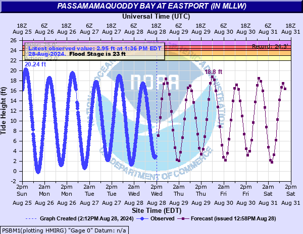
Passamamaquoddy Bay at Eastport (IN MLLW)
Critical Stages
21.5' - Action
22' - Flood
24' - Moderate
25' - Major
Latest Observation
Updated: 5:06 AM EST 12/16/25
Status: No Flooding
Stage: 10.09 ft
Flow: -999 kcfs
Forecast
| Time | Stage (ft) | Flow (kcfs) |
|---|---|---|
| 7 AM 12/16 | 16.2 | -999 |
| 8 AM 12/16 | 17.5 | -999 |
| 9 AM 12/16 | 16.7 | -999 |
| 10 AM 12/16 | 14.7 | -999 |
| 11 AM 12/16 | 11.6 | -999 |
| 12 PM 12/16 | 7.7 | -999 |
| 1 PM 12/16 | 4.3 | -999 |
| 2 PM 12/16 | 2.1 | -999 |
| 3 PM 12/16 | 2 | -999 |
| 4 PM 12/16 | 3.5 | -999 |
| 5 PM 12/16 | 6.4 | -999 |
| 6 PM 12/16 | 10.2 | -999 |
| 7 PM 12/16 | 13.9 | -999 |
| 8 PM 12/16 | 16.1 | -999 |
| 9 PM 12/16 | 16.3 | -999 |
| 10 PM 12/16 | 15.1 | -999 |
| 11 PM 12/16 | 12.7 | -999 |
| 12 AM 12/17 | 9.5 | -999 |
| 1 AM 12/17 | 6.1 | -999 |
| 2 AM 12/17 | 3.7 | -999 |
| 3 AM 12/17 | 3.1 | -999 |
| 4 AM 12/17 | 4.5 | -999 |
| 5 AM 12/17 | 7.2 | -999 |
| 6 AM 12/17 | 11 | -999 |
| 7 AM 12/17 | 14.8 | -999 |
| 8 AM 12/17 | 17.5 | -999 |
| 9 AM 12/17 | 18.3 | -999 |
| 10 AM 12/17 | 17.1 | -999 |
| 11 AM 12/17 | 14.6 | -999 |
| 12 PM 12/17 | 11.1 | -999 |
| 1 PM 12/17 | 7.2 | -999 |
| 2 PM 12/17 | 3.7 | -999 |
| 3 PM 12/17 | 1.7 | -999 |
| 4 PM 12/17 | 1.9 | -999 |
| 5 PM 12/17 | 3.9 | -999 |
| 6 PM 12/17 | 7.1 | -999 |
| 7 PM 12/17 | 11 | -999 |
| 8 PM 12/17 | 14.4 | -999 |
| 9 PM 12/17 | 16.2 | -999 |
| 10 PM 12/17 | 16 | -999 |
| 11 PM 12/17 | 14.1 | -999 |
| 12 AM 12/18 | 11.2 | -999 |
| 1 AM 12/18 | 7.6 | -999 |
| 2 AM 12/18 | 4 | -999 |
| 3 AM 12/18 | 1.6 | -999 |
| 4 AM 12/18 | 1.4 | -999 |
| 5 AM 12/18 | 3 | -999 |
| 6 AM 12/18 | 6.2 | -999 |
| 7 AM 12/18 | 10.2 | -999 |
| 8 AM 12/18 | 14.2 | -999 |
| 9 AM 12/18 | 16.9 | -999 |
| 10 AM 12/18 | 17.4 | -999 |
| 11 AM 12/18 | 15.8 | -999 |
| 12 PM 12/18 | 13.1 | -999 |
| 1 PM 12/18 | 9.6 | -999 |
| 2 PM 12/18 | 5.3 | -999 |
| 3 PM 12/18 | 2.2 | -999 |
| 4 PM 12/18 | 0.9 | -999 |
| 5 PM 12/18 | 1.7 | -999 |
| 6 PM 12/18 | 4.4 | -999 |
| 7 PM 12/18 | 8.3 | -999 |
| 8 PM 12/18 | 12.4 | -999 |
| 9 PM 12/18 | 15.9 | -999 |
| 10 PM 12/18 | 17.5 | -999 |
| 11 PM 12/18 | 17 | -999 |
| 12 AM 12/19 | 14.9 | -999 |
| 1 AM 12/19 | 11.6 | -999 |
| 2 AM 12/19 | 8 | -999 |
| 3 AM 12/19 | 4.8 | -999 |
| Time | Stage (ft) | Flow (kcfs) |
|---|---|---|
| 5:18 AM 12/16 | 10.84 | -999 |
| 5:12 AM 12/16 | 10.46 | -999 |
| 5:06 AM 12/16 | 10.09 | -999 |
| 5:00 AM 12/16 | 9.72 | -999 |
| 4:54 AM 12/16 | 9.35 | -999 |
| 4:48 AM 12/16 | 8.96 | -999 |
| 4:42 AM 12/16 | 8.56 | -999 |
| 4:36 AM 12/16 | 8.21 | -999 |
| 4:30 AM 12/16 | 7.85 | -999 |
| 4:24 AM 12/16 | 7.48 | -999 |
| 4:18 AM 12/16 | 7.12 | -999 |
| 4:12 AM 12/16 | 6.76 | -999 |
| 4:06 AM 12/16 | 6.42 | -999 |
| 4:00 AM 12/16 | 6.08 | -999 |
| 3:54 AM 12/16 | 5.76 | -999 |
| 3:48 AM 12/16 | 5.44 | -999 |
| 3:42 AM 12/16 | 5.11 | -999 |
| 3:36 AM 12/16 | 4.81 | -999 |
| 3:30 AM 12/16 | 4.51 | -999 |
| 3:24 AM 12/16 | 4.24 | -999 |
| 3:18 AM 12/16 | 3.98 | -999 |
| 3:12 AM 12/16 | 3.75 | -999 |
| 3:06 AM 12/16 | 3.52 | -999 |
| 3:00 AM 12/16 | 3.3 | -999 |
| 2:54 AM 12/16 | 3.08 | -999 |
| 2:48 AM 12/16 | 2.9 | -999 |
| 2:42 AM 12/16 | 2.73 | -999 |
| 2:36 AM 12/16 | 2.58 | -999 |
| 2:30 AM 12/16 | 2.45 | -999 |
| 2:24 AM 12/16 | 2.35 | -999 |
26' -
3 Feet of water covering Boot Cove Road. South Lubec Road and Pop Joy Lane completely inundated with private properties becoming surrounded by water with possible outbuildings becoming flooded.
25' -
Numerous roads around Eastport and Lubec become inundated and impassable with up to 3 feet of water. Flooding of residential buildings along North and South Lubec Rd in Lubec. 3 feet or more water across Lower Water Street with inundation into buildings. Water completely over Water Street.
24.5' -
Boot Cove Road becomes flooded.
24' -
Flooding of low lying areas along Eastport Pier and waterfront in addition to other vulnerable low lying areas. Up to 2 feet of inundation along North and South Lubec Rd in Lubec. Up to 2 feet of inundation on Toll Bridge Rd in Eastport.
23' -
Minor low lying coastal flooding begins to occur on Eastport Pier and other vulnerable low lying areas, including Toll Bridge Rd. Flooding begins on North and South Lubec Rd in Lubec. In the Lubec Narrows area Pleasant Street, Lower Water Street and Mowry Street go underwater cutting off access to properties to the south. Water will be across a private road in Boot Cove area approaching the Boot Cove Road.
22' -
Minor flooding in Lubec with water onto Lower Water Street and in parking lots.
| Date | Stage (ft) |
|---|---|
| Apr 10, 2020 | 24.34 |
| Jan 10, 1997 | 24.21 |
| Apr 6, 1977 | 24.07 |
| Jan 13, 2024 | 23.92 |
| Jan 29, 1979 | 23.87 |
| Nov 22, 1976 | 23.84 |
| Jan 9, 1978 | 23.71 |
| Sep 7, 1979 | 23.63 |
| Dec 21, 1976 | 23.61 |
| Feb 19, 2015 | 23.57 |
Data provided by the National Weather Service.