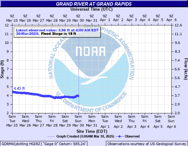
Grand River at Grand Rapids
Critical Stages
12' - Action
18' - Flood
21' - Moderate
23' - Major
Latest Observation
Updated: 12:00 PM EST 12/11/25
Status: No Flooding
Stage: 1.39 ft
Flow: 1.58 kcfs
Forecast
Forecast not available for this location.
| Time | Stage (ft) | Flow (kcfs) |
|---|---|---|
| 12:00 PM 12/11 | 1.39 | 1.58 |
| 11:45 AM 12/11 | 1.4 | 1.59 |
| 11:30 AM 12/11 | 1.39 | 1.58 |
| 11:15 AM 12/11 | 1.4 | 1.59 |
| 11:00 AM 12/11 | 1.4 | 1.59 |
| 10:45 AM 12/11 | 1.39 | 1.58 |
| 10:30 AM 12/11 | 1.4 | 1.59 |
| 10:15 AM 12/11 | 1.39 | 1.58 |
| 10:00 AM 12/11 | 1.38 | 1.57 |
| 9:45 AM 12/11 | 1.39 | 1.58 |
| 9:30 AM 12/11 | 1.39 | 1.58 |
| 9:15 AM 12/11 | 1.39 | 1.58 |
| 9:00 AM 12/11 | 1.38 | 1.57 |
| 8:45 AM 12/11 | 1.39 | 1.58 |
| 8:30 AM 12/11 | 1.39 | 1.58 |
| 8:15 AM 12/11 | 1.41 | 1.59 |
| 8:00 AM 12/11 | 1.39 | 1.58 |
| 7:45 AM 12/11 | 1.39 | 1.58 |
| 7:30 AM 12/11 | 1.39 | 1.58 |
| 7:15 AM 12/11 | 1.39 | 1.58 |
| 7:00 AM 12/11 | 1.38 | 1.57 |
| 6:45 AM 12/11 | 1.39 | 1.58 |
| 6:30 AM 12/11 | 1.38 | 1.57 |
| 6:15 AM 12/11 | 1.39 | 1.58 |
| 6:00 AM 12/11 | 1.39 | 1.58 |
| 5:45 AM 12/11 | 1.37 | 1.56 |
| 5:30 AM 12/11 | 1.38 | 1.57 |
| 5:15 AM 12/11 | 1.38 | 1.57 |
| 5:00 AM 12/11 | 1.38 | 1.57 |
| 4:45 AM 12/11 | 1.38 | 1.57 |
25.5' -
Expect major flooding downtown with high water impacting the Van Andel Museum.
23' -
Expect major flooding of residential areas above and below Downtown Grand Rapids.
21.69' -
High water impacts the Waste Water Treatment Plant in Grand Rapids.
21' -
Expect moderate to major flooding in the area, Ann Street, and the city dikes. Major flooding of homes and structures occurs upstream in Comstock Park and downstream of Grand Rapids to Robinson Township.
18' -
Expect minor flooding of basements in low lying areas in Grand Rapids. Moderate flooding of homes and structures occurs upstream at Comstock Park and downstream in Robinson Township.
16.5' -
Expect minor flooding in Grandville.
15' -
Expect minor flooding to occur in low lying areas upstream and downstream of Grand Rapids, especially in the areas of North Park, Comstock Park, and Robinson Township. Some seepage into basements of businesses in Grand Rapids occurs.
14' -
Expect minor flooding to occur in low lying areas upstream and downstream of Grand Rapids, especially in the areas of North Park and Comstock Park.
12' -
River is bankfull upstream and downstream of flood walls in Downtown Grand Rapids. Portions of the Kent Trail and Indian Mounds Drive flooded in Grandville.
| Date | Stage (ft) |
|---|---|
| Apr 21, 2013 | 21.85 |
| Feb 25, 2018 | 20.67 |
| Mar 1, 1985 | 19.64 |
| May 22, 2020 | 19.55 |
| May 27, 2004 | 19.54 |
| Mar 28, 1904 | 19.5 |
| Mar 8, 1976 | 19.29 |
| Oct 4, 1986 | 19.25 |
| Apr 3, 1960 | 19.25 |
| Apr 8, 2023 | 18.86 |
| Mar 19, 1982 | 18.83 |
| Jun 9, 1905 | 18.6 |
| Apr 10, 2017 | 17.9 |
| Feb 25, 1997 | 17.87 |
| Dec 31, 2008 | 17.84 |
| May 13, 1956 | 17.7 |
| May 22, 2000 | 17.42 |
| Mar 17, 1986 | 17.42 |
| May 1, 2009 | 17.29 |
| Mar 23, 1948 | 17.03 |
Data provided by the National Weather Service.