Rio Chama below Abiquiu
Critical Stages
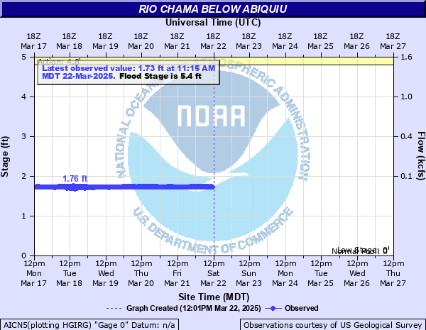
4.8' - Action
5.4' - Flood
5.8' - Moderate
6.3' - Major
Latest Observation
Updated: 7:15 PM MST 12/15/25
Status: No Flooding
Stage: 3.14 ft
Flow: 0.479 kcfs
Forecast
Forecast not available for this location.
| Time | Stage (ft) | Flow (kcfs) |
|---|---|---|
| 7:15 PM 12/15 | 3.14 | 0.479 |
| 7:00 PM 12/15 | 3.14 | 0.479 |
| 6:45 PM 12/15 | 3.15 | 0.484 |
| 6:30 PM 12/15 | 3.14 | 0.479 |
| 6:15 PM 12/15 | 3.14 | 0.479 |
| 6:00 PM 12/15 | 3.14 | 0.479 |
| 5:45 PM 12/15 | 3.14 | 0.479 |
| 5:30 PM 12/15 | 3.14 | 0.479 |
| 5:15 PM 12/15 | 3.14 | 0.479 |
| 5:00 PM 12/15 | 3.15 | 0.484 |
| 4:45 PM 12/15 | 3.14 | 0.479 |
| 4:30 PM 12/15 | 3.15 | 0.484 |
| 4:15 PM 12/15 | 3.14 | 0.479 |
| 4:00 PM 12/15 | 3.14 | 0.479 |
| 3:45 PM 12/15 | 3.14 | 0.479 |
| 3:30 PM 12/15 | 3.14 | 0.479 |
| 3:15 PM 12/15 | 3.14 | 0.479 |
| 3:00 PM 12/15 | 3.14 | 0.479 |
| 2:45 PM 12/15 | 3.14 | 0.479 |
| 2:30 PM 12/15 | 3.14 | 0.479 |
| 2:15 PM 12/15 | 3.14 | 0.479 |
| 2:00 PM 12/15 | 3.14 | 0.479 |
| 1:45 PM 12/15 | 3.14 | 0.479 |
| 1:30 PM 12/15 | 3.14 | 0.479 |
| 1:15 PM 12/15 | 3.14 | 0.479 |
| 1:00 PM 12/15 | 3.14 | 0.479 |
| 12:45 PM 12/15 | 3.14 | 0.479 |
| 12:30 PM 12/15 | 3.14 | 0.479 |
| 12:15 PM 12/15 | 3.14 | 0.479 |
| 12:00 PM 12/15 | 3.38 | 0.613 |
5.4' -
Initial flood stage. Approximately 1900cfs Farms and properties along the river will see overbank flooding and encroachment of water into low lying areas. If Rio Ojo Caliente is running at 550cfs or greater properties near the confluence with Rio Chama will see overbank flooding, bank erosion and impacts to structures immediately adjacent to the river. Fishing spots and picnic areas below Abiquiu Dam will be inaccessible.
4.8' -
Bankfull Stage. Approximately 1460 cfs. Houses near Highway 84 along river will see water begin to encroach their yards. Cattle that cross the river at lower flows may be trapped on one side or the other. If flows out of the Rio Ojo Caliente are 550 cfs or higher properties near and below the confluence with the Rio Chama may encroachment of water onto land immediately adjacent to the river along with bank erosion.
| Date | Stage (ft) |
|---|---|
| May 14, 1985 | 5.52 |
| Jun 12, 1970 | 5.45 |
| Apr 25, 1989 | 5.16 |
| Jun 28, 1995 | 5.01 |
| May 15, 2004 | 4.83 |
| Apr 27, 2010 | 4.82 |
| Apr 19, 2005 | 4.8 |
| May 29, 1998 | 4.8 |
| Apr 16, 2008 | 4.76 |
| May 29, 2009 | 4.73 |
| May 17, 2007 | 4.7 |
| Jun 6, 2011 | 4.51 |
Data provided by the National Weather Service.