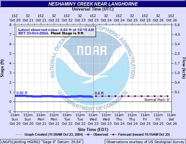
Neshaminy Creek near Langhorne
Critical Stages
8' - Action
9' - Flood
12' - Moderate
14' - Major
Latest Observation
Updated: 12:15 PM EST 12/6/25
Status: No Flooding
Stage: 1.07 ft
Flow: 0.11 kcfs
Forecast
| Time | Stage (ft) | Flow (kcfs) |
|---|---|---|
| 7 PM 12/6 | 1.1 | 0.116 |
| 1 AM 12/7 | 1 | 0.096 |
| 7 AM 12/7 | 1 | 0.096 |
| 1 PM 12/7 | 1 | 0.096 |
| 7 PM 12/7 | 1 | 0.096 |
| 1 AM 12/8 | 0.9 | 0.079 |
| 7 AM 12/8 | 0.9 | 0.079 |
| 1 PM 12/8 | 0.9 | 0.079 |
| 7 PM 12/8 | 0.9 | 0.079 |
| 1 AM 12/9 | 0.9 | 0.079 |
| 7 AM 12/9 | 0.9 | 0.079 |
| Time | Stage (ft) | Flow (kcfs) |
|---|---|---|
| 12:15 PM 12/6 | 1.07 | 0.11 |
| 12:00 PM 12/6 | 1.07 | 0.11 |
| 11:45 AM 12/6 | 1.07 | 0.11 |
| 11:30 AM 12/6 | 1.07 | 0.11 |
| 11:15 AM 12/6 | 1.07 | 0.11 |
| 11:00 AM 12/6 | 1.07 | 0.11 |
| 10:45 AM 12/6 | 1.07 | 0.11 |
| 10:30 AM 12/6 | 1.06 | 0.108 |
| 10:15 AM 12/6 | 1.07 | 0.11 |
| 10:00 AM 12/6 | 1.06 | 0.108 |
| 9:45 AM 12/6 | 1.07 | 0.11 |
| 9:30 AM 12/6 | 1.06 | 0.108 |
| 9:15 AM 12/6 | 1.06 | 0.108 |
| 9:00 AM 12/6 | 1.06 | 0.108 |
| 8:45 AM 12/6 | 1.06 | 0.108 |
| 8:30 AM 12/6 | 1.06 | 0.108 |
| 8:15 AM 12/6 | 1.07 | 0.11 |
| 8:00 AM 12/6 | 1.07 | 0.11 |
| 7:45 AM 12/6 | 1.07 | 0.11 |
| 7:30 AM 12/6 | 1.07 | 0.11 |
| 7:15 AM 12/6 | 1.06 | 0.108 |
| 7:00 AM 12/6 | 1.06 | 0.108 |
| 6:45 AM 12/6 | 1.06 | 0.108 |
| 6:30 AM 12/6 | 1.06 | 0.108 |
| 6:15 AM 12/6 | 1.07 | 0.11 |
| 6:00 AM 12/6 | 1.07 | 0.11 |
| 5:45 AM 12/6 | 1.07 | 0.11 |
| 5:30 AM 12/6 | 1.07 | 0.11 |
| 5:15 AM 12/6 | 1.07 | 0.11 |
| 5:00 AM 12/6 | 1.07 | 0.11 |
14' -
Residential properties are flooded on Bridle Drive in Middletown Township. Flooding also occurs on Business US 1 in Middletown Township near Rising Sun Avenue. Flooding is also possible further downstream in the Croydon Section of Bristol Township, especially when the Delaware River tides are high.
13' -
Periwinkle Avenue in Middletown Township begins to flood. Flooding in also possible further downstream in the Croyden Section of Bristol Township, especially when the Delaware River tides are high.
12' -
Widespread flooding occurs on Bridle Drive in Middletown Township. The road becomes impassable.
10.5' -
Route 413, near Bridgeton Pike in Middletown Township, is subject to closures due to flooding.
9' -
Flooding begins on Bridle Drive in Middletown Township.
7' -
Water begins to overflow the lowest banks, on both sides of the creek, into adjacent wooded areas.
| Date | Stage (ft) |
|---|---|
| Aug 19, 1955 | 22.84 |
| Sep 16, 1999 | 21.91 |
| Sep 2, 2021 | 20.81 |
| Aug 28, 2011 | 19.56 |
| Jun 30, 1973 | 18.99 |
| Aug 23, 1933 | 17.3 |
| Jun 17, 2001 | 16.87 |
| Jul 23, 1938 | 15.94 |
| Oct 19, 1996 | 15.86 |
| Nov 9, 1972 | 15.01 |
| Jan 19, 1996 | 14.99 |
| Nov 26, 1950 | 14.92 |
| Aug 28, 1971 | 14.8 |
| Apr 16, 2007 | 14.68 |
| May 1, 2014 | 14.64 |
| Jun 2, 1946 | 14.54 |
| Sep 13, 1960 | 14.36 |
| Aug 17, 1993 | 14.34 |
| Sep 14, 1971 | 14.32 |
| Dec 11, 2003 | 14.04 |
Data provided by the National Weather Service.