« Back to Crescent Valley Rivers
Chehalis River near Grand Mound
Critical Stages
138.5' - Action
141' - Flood
142.5' - Moderate
144' - Major
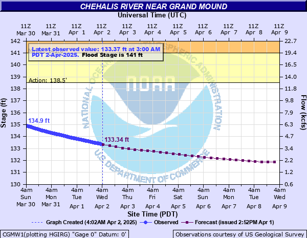
Latest Observation
Updated: 8:00 AM PST 12/6/25
Status: No Flooding
Stage: 133.04 ft
Flow: 3.53 kcfs
Forecast
| Time | Stage (ft) | Flow (kcfs) |
|---|---|---|
| 10 AM 12/6 | 133.06 | 3.55 |
| 4 PM 12/6 | 133.03 | 3.51 |
| 10 PM 12/6 | 132.99 | 3.46 |
| 4 AM 12/7 | 132.99 | 3.46 |
| 10 AM 12/7 | 133.02 | 3.5 |
| 4 PM 12/7 | 133.01 | 3.49 |
| 10 PM 12/7 | 132.98 | 3.45 |
| 4 AM 12/8 | 133.14 | 3.65 |
| 10 AM 12/8 | 133.53 | 4.17 |
| 4 PM 12/8 | 134.12 | 5 |
| 10 PM 12/8 | 135.05 | 6.44 |
| 4 AM 12/9 | 136.57 | 9.04 |
| 10 AM 12/9 | 138.22 | 12.2 |
| 4 PM 12/9 | 139.6 | 15.4 |
| 10 PM 12/9 | 140.57 | 18.1 |
| 4 AM 12/10 | 141.19 | 20 |
| 10 AM 12/10 | 141.61 | 21.4 |
| 4 PM 12/10 | 141.97 | 22.6 |
| 10 PM 12/10 | 142.17 | 23.9 |
| 4 AM 12/11 | 142.39 | 25.4 |
| 10 AM 12/11 | 142.66 | 27.3 |
| 4 PM 12/11 | 142.9 | 29.1 |
| 10 PM 12/11 | 143.01 | 30 |
| 4 AM 12/12 | 142.99 | 29.8 |
| 10 AM 12/12 | 142.89 | 29.1 |
| 4 PM 12/12 | 142.77 | 28.1 |
| 10 PM 12/12 | 142.64 | 27.2 |
| 4 AM 12/13 | 142.52 | 26.3 |
| 10 AM 12/13 | 142.38 | 25.3 |
| 4 PM 12/13 | 142.22 | 24.2 |
| 10 PM 12/13 | 142.03 | 22.9 |
| 4 AM 12/14 | 141.67 | 21.6 |
| 10 AM 12/14 | 141.21 | 20.1 |
| 4 PM 12/14 | 140.68 | 18.4 |
| 10 PM 12/14 | 140.1 | 16.8 |
| 4 AM 12/15 | 139.52 | 15.2 |
| 10 AM 12/15 | 138.9 | 13.7 |
| 4 PM 12/15 | 138.43 | 12.7 |
| 10 PM 12/15 | 138.13 | 12 |
| 4 AM 12/16 | 138.04 | 11.8 |
| Time | Stage (ft) | Flow (kcfs) |
|---|---|---|
| 8:00 AM 12/6 | 133.04 | 3.53 |
| 7:45 AM 12/6 | 133.04 | 3.53 |
| 7:30 AM 12/6 | 133.04 | 3.53 |
| 7:15 AM 12/6 | 133.03 | 3.51 |
| 7:00 AM 12/6 | 133.03 | 3.51 |
| 6:45 AM 12/6 | 133.03 | 3.51 |
| 6:30 AM 12/6 | 133.02 | 3.5 |
| 6:15 AM 12/6 | 133.02 | 3.5 |
| 6:00 AM 12/6 | 133.02 | 3.5 |
| 5:45 AM 12/6 | 133.02 | 3.5 |
| 5:30 AM 12/6 | 133.01 | 3.49 |
| 5:15 AM 12/6 | 133.01 | 3.49 |
| 5:00 AM 12/6 | 133.01 | 3.49 |
| 4:45 AM 12/6 | 133 | 3.48 |
| 4:30 AM 12/6 | 132.99 | 3.46 |
| 4:15 AM 12/6 | 132.99 | 3.46 |
| 4:00 AM 12/6 | 132.99 | 3.46 |
| 3:45 AM 12/6 | 132.98 | 3.45 |
| 3:30 AM 12/6 | 132.97 | 3.44 |
| 3:15 AM 12/6 | 132.97 | 3.44 |
| 3:00 AM 12/6 | 132.97 | 3.44 |
| 2:45 AM 12/6 | 132.96 | 3.42 |
| 2:30 AM 12/6 | 132.96 | 3.42 |
| 2:15 AM 12/6 | 132.95 | 3.41 |
| 2:00 AM 12/6 | 132.94 | 3.4 |
| 1:45 AM 12/6 | 132.94 | 3.4 |
| 1:30 AM 12/6 | 132.93 | 3.39 |
| 1:15 AM 12/6 | 132.92 | 3.37 |
| 1:00 AM 12/6 | 132.91 | 3.36 |
| 12:45 AM 12/6 | 132.9 | 3.34 |
146' -
the Chehalis River in Thurston County will cause severe near record flooding, with deep and swift flood waters inundating the Independence Valley. Flooding will occur all along the river including headwaters, tributaries, and other streams within and near the Chehalis River Basin.
144.5' -
the Chehalis River in Thurston County will cause major flooding, inundating roads and farm lands in Independence Valley. Deep and swift flood waters will cover SR-12 and James, Independence and Moon Roads. Flooding will occur all along the river including headwaters, tributaries, and other streams within and near the Chehalis River Basin.
142.5' -
the Chehalis River in Thurston County will flood several roads in Independence Valley with swiftly moving water including SR-12 and James, Independence, Moon and Anderson Roads. Flood waters will cut off access to and from Chehalis Reservation and inundate nearby farm lands. Some residential structures may be threatened.
141' -
the Chehalis River in Thurston County will flood several roads in Independence Valley including James Road, Independence Road, and Moon road. Flood waters will also cover nearby farm lands.
139.5' -
the Chehalis River in Thurston County will locally spill out of its banks into nearby fields and over a few roads.
| Date | Stage (ft) |
|---|---|
| Dec 4, 2007 | 147.26 |
| Jan 7, 2022 | 145.21 |
| Jan 14, 2021 | 142.88 |
| Dec 22, 2019 | 142.68 |
| Jan 4, 2021 | 142.59 |
| Mar 2, 2022 | 142.59 |
| Jan 8, 2020 | 142.41 |
| Dec 7, 2023 | 142.28 |
| Nov 13, 2021 | 141.41 |
| Jan 28, 2024 | 140.85 |
| Dec 4, 2007 | 20.23 |
| Feb 9, 1996 | 19.98 |
| Jan 10, 1990 | 19.34 |
| Nov 25, 1986 | 18.41 |
| Dec 29, 1937 | 18.39 |
| Jan 21, 1972 | 18.21 |
| Jan 8, 2009 | 18.18 |
| Nov 25, 1990 | 18.12 |
| Dec 5, 1975 | 17.73 |
| Apr 6, 1991 | 17.66 |
Data provided by the National Weather Service.