« Back to Crescent Valley Rivers
Snoqualmie River near Carnation
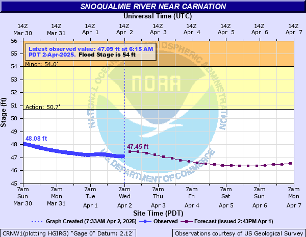
Critical Stages
50.7' - Action
54' - Flood
56' - Moderate
58' - Major
Latest Observation
Updated: 8:15 AM PST 12/6/25
Status: No Flooding
Stage: 46.94 ft
Flow: 5.16 kcfs
Forecast
| Time | Stage (ft) | Flow (kcfs) |
|---|---|---|
| 10 AM 12/6 | 47.09 | 5.45 |
| 4 PM 12/6 | 47.5 | 6.1 |
| 10 PM 12/6 | 47.69 | 6.41 |
| 4 AM 12/7 | 47.53 | 6.15 |
| 10 AM 12/7 | 47.15 | 5.54 |
| 4 PM 12/7 | 47.07 | 5.41 |
| 10 PM 12/7 | 47.78 | 6.56 |
| 4 AM 12/8 | 48.59 | 7.99 |
| 10 AM 12/8 | 48.83 | 8.43 |
| 4 PM 12/8 | 49.58 | 10.5 |
| 10 PM 12/8 | 52.3 | 16.9 |
| 4 AM 12/9 | 56.01 | 25.3 |
| 10 AM 12/9 | 57.94 | 33.7 |
| 4 PM 12/9 | 58.29 | 38.5 |
| 10 PM 12/9 | 58.13 | 36.3 |
| 4 AM 12/10 | 57.74 | 31.3 |
| 10 AM 12/10 | 57.81 | 32.1 |
| 4 PM 12/10 | 58.01 | 34.7 |
| 10 PM 12/10 | 58.27 | 38.2 |
| 4 AM 12/11 | 58.28 | 38.3 |
| 10 AM 12/11 | 58.2 | 37.2 |
| 4 PM 12/11 | 58.01 | 34.7 |
| 10 PM 12/11 | 58.02 | 34.8 |
| 4 AM 12/12 | 57.88 | 33 |
| 10 AM 12/12 | 57.69 | 30.7 |
| 4 PM 12/12 | 56.69 | 26.9 |
| 10 PM 12/12 | 54.93 | 22.8 |
| 4 AM 12/13 | 54.22 | 21.2 |
| 10 AM 12/13 | 53.99 | 20.7 |
| 4 PM 12/13 | 53.34 | 19.2 |
| 10 PM 12/13 | 52.37 | 17 |
| 4 AM 12/14 | 51.56 | 15.2 |
| 10 AM 12/14 | 50.91 | 13.8 |
| 4 PM 12/14 | 50.29 | 12.5 |
| 10 PM 12/14 | 49.81 | 11.3 |
| 4 AM 12/15 | 49.53 | 10.4 |
| Time | Stage (ft) | Flow (kcfs) |
|---|---|---|
| 8:15 AM 12/6 | 46.94 | 5.16 |
| 8:00 AM 12/6 | 46.93 | 5.14 |
| 7:45 AM 12/6 | 46.92 | 5.12 |
| 7:30 AM 12/6 | 46.9 | 5.07 |
| 7:15 AM 12/6 | 46.89 | 5.05 |
| 7:00 AM 12/6 | 46.87 | 5 |
| 6:45 AM 12/6 | 46.86 | 4.98 |
| 6:30 AM 12/6 | 46.85 | 4.95 |
| 6:15 AM 12/6 | 46.84 | 4.93 |
| 6:00 AM 12/6 | 46.84 | 4.93 |
| 5:45 AM 12/6 | 46.83 | 4.91 |
| 5:30 AM 12/6 | 46.82 | 4.88 |
| 5:15 AM 12/6 | 46.82 | 4.88 |
| 5:00 AM 12/6 | 46.8 | 4.84 |
| 4:45 AM 12/6 | 46.8 | 4.84 |
| 4:30 AM 12/6 | 46.78 | 4.79 |
| 4:15 AM 12/6 | 46.77 | 4.77 |
| 4:00 AM 12/6 | 46.75 | 4.73 |
| 3:45 AM 12/6 | 46.74 | 4.7 |
| 3:30 AM 12/6 | 46.71 | 4.64 |
| 3:15 AM 12/6 | 46.69 | 4.59 |
| 3:00 AM 12/6 | 46.67 | 4.54 |
| 2:45 AM 12/6 | 46.63 | 4.46 |
| 2:30 AM 12/6 | 46.6 | 4.39 |
| 2:15 AM 12/6 | 46.56 | 4.3 |
| 2:00 AM 12/6 | 46.54 | 4.26 |
| 1:45 AM 12/6 | 46.51 | 4.19 |
| 1:30 AM 12/6 | 46.48 | 4.13 |
| 1:15 AM 12/6 | 46.44 | 4.05 |
| 1:00 AM 12/6 | 46.4 | 3.96 |
60' -
the Snoqualmie River will cause severe near record flooding from Fall City downstream through Carnation and Duvall. Deep and swift flood waters will inundate many farms...residential areas...and roads. Flooding will occur all along the river including headwaters...tributaries...and other streams within and near the Snoqualmie River Basin.
58' -
the Snoqualmie River will cause major flooding from Fall City downstream through Carnation and Duvall. Deep and swift flood waters will inundate many farms...residential areas...and roads. Flooding will occur all along the river including headwaters...tributaries...and other streams within and near the Snoqualmie River Basin.
56' -
the Snoqualmie River will cause widespread flooding from Fall City downstream through Carnation and Duvall...inundating much of the farm land and numerous roads.
54' -
the Snoqualmie River will flood much of the farm land and several roads from Fall City downstream through Carnation and Duvall.
51' -
the Snoqualmie River will spill over its banks from Fall City downstream through Carnation and Duvall...with shallow water over some farm land and several roads.
| Date | Stage (ft) |
|---|---|
| Jan 8, 2009 | 62.21 |
| Nov 7, 2006 | 61.28 |
| Nov 24, 1990 | 60.7 |
| Nov 12, 2008 | 60.49 |
| Feb 9, 1996 | 60.34 |
| Nov 29, 1995 | 60.3 |
| Nov 13, 1932 | 59.93 |
| Nov 24, 1986 | 59.89 |
| Feb 27, 1932 | 59.88 |
| Dec 9, 2015 | 59.78 |
| Nov 10, 1990 | 59.48 |
| Dec 3, 1975 | 59.39 |
| Jan 17, 2011 | 59.32 |
| Jan 6, 2015 | 59.26 |
| Jan 6, 2015 | 59.24 |
| Feb 10, 1951 | 59.18 |
| Mar 2, 2022 | 59.14 |
| Jan 19, 2005 | 59.08 |
| Jan 10, 1990 | 59.06 |
| Nov 23, 1959 | 58.93 |
Data provided by the National Weather Service.