« Back to Crescent Valley Rivers
Puyallup River at Puyallup
Critical Stages
24' - Action
26.2' - Flood
30' - Moderate
31' - Major
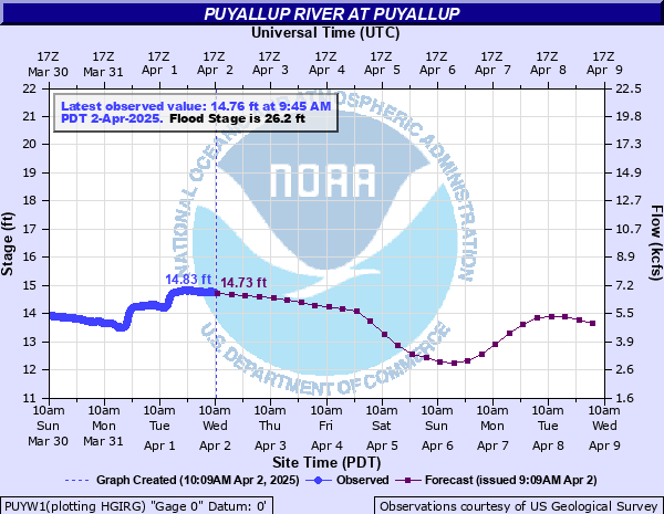
Latest Observation
Updated: 7:45 AM PST 12/6/25
Status: No Flooding
Stage: 14.76 ft
Flow: 6.77 kcfs
Forecast
| Time | Stage (ft) | Flow (kcfs) |
|---|---|---|
| 10 AM 12/6 | 16.21 | 9.24 |
| 4 PM 12/6 | 16.24 | 9.29 |
| 10 PM 12/6 | 16.04 | 8.93 |
| 4 AM 12/7 | 15.66 | 8.27 |
| 10 AM 12/7 | 15.29 | 7.64 |
| 4 PM 12/7 | 15.14 | 7.4 |
| 10 PM 12/7 | 15.21 | 7.51 |
| 4 AM 12/8 | 15.23 | 7.54 |
| 10 AM 12/8 | 15.44 | 7.89 |
| 4 PM 12/8 | 16.66 | 10.1 |
| 10 PM 12/8 | 20.09 | 17.5 |
| 4 AM 12/9 | 23.73 | 27.5 |
| 10 AM 12/9 | 24.88 | 31.1 |
| 4 PM 12/9 | 24.02 | 28.4 |
| 10 PM 12/9 | 23.92 | 28.1 |
| 4 AM 12/10 | 25.02 | 31.6 |
| 10 AM 12/10 | 26.03 | 34.9 |
| 4 PM 12/10 | 26.38 | 36.1 |
| 10 PM 12/10 | 25.84 | 34.3 |
| 4 AM 12/11 | 25.23 | 32.2 |
| 10 AM 12/11 | 24.34 | 29.4 |
| 4 PM 12/11 | 23.97 | 28.2 |
| 10 PM 12/11 | 22.88 | 25 |
| 4 AM 12/12 | 22.52 | 24 |
| 10 AM 12/12 | 22.15 | 22.9 |
| 4 PM 12/12 | 21.41 | 20.9 |
| 10 PM 12/12 | 21.12 | 20.1 |
| 4 AM 12/13 | 20.78 | 19.2 |
| 10 AM 12/13 | 20.33 | 18.1 |
| 4 PM 12/13 | 19.88 | 17 |
| 10 PM 12/13 | 19.66 | 16.5 |
| 4 AM 12/14 | 19.21 | 15.4 |
| 10 AM 12/14 | 18.89 | 14.7 |
| 4 PM 12/14 | 18.6 | 14 |
| 10 PM 12/14 | 18.34 | 13.5 |
| 4 AM 12/15 | 18.17 | 13.1 |
| Time | Stage (ft) | Flow (kcfs) |
|---|---|---|
| 7:45 AM 12/6 | 14.76 | 6.77 |
| 7:30 AM 12/6 | 14.72 | 6.7 |
| 7:15 AM 12/6 | 14.73 | 6.72 |
| 7:00 AM 12/6 | 14.72 | 6.7 |
| 6:45 AM 12/6 | 14.69 | 6.65 |
| 6:30 AM 12/6 | 14.68 | 6.64 |
| 6:15 AM 12/6 | 14.65 | 6.59 |
| 6:00 AM 12/6 | 14.6 | 6.5 |
| 5:45 AM 12/6 | 14.6 | 6.5 |
| 5:30 AM 12/6 | 14.56 | 6.44 |
| 5:15 AM 12/6 | 14.55 | 6.42 |
| 5:00 AM 12/6 | 14.54 | 6.41 |
| 4:45 AM 12/6 | 14.5 | 6.34 |
| 4:30 AM 12/6 | 14.49 | 6.33 |
| 4:15 AM 12/6 | 14.45 | 6.26 |
| 4:00 AM 12/6 | 14.44 | 6.25 |
| 3:45 AM 12/6 | 14.4 | 6.18 |
| 3:30 AM 12/6 | 14.38 | 6.15 |
| 3:15 AM 12/6 | 14.38 | 6.15 |
| 3:00 AM 12/6 | 14.36 | 6.12 |
| 2:45 AM 12/6 | 14.34 | 6.09 |
| 2:30 AM 12/6 | 14.32 | 6.06 |
| 2:15 AM 12/6 | 14.31 | 6.04 |
| 2:00 AM 12/6 | 14.29 | 6.01 |
| 1:45 AM 12/6 | 14.28 | 5.99 |
| 1:30 AM 12/6 | 14.28 | 5.99 |
| 1:15 AM 12/6 | 14.29 | 6.01 |
| 1:00 AM 12/6 | 14.27 | 5.98 |
| 12:45 AM 12/6 | 14.26 | 5.96 |
| 12:30 AM 12/6 | 14.25 | 5.94 |
31' -
the Puyallup will cause major flooding along the lower reaches of the river from Sumner downstream to the mouth. Swift waters will overtop levees and flood much of the Puyallup Valley. Erosion with the overtopping is likely to damage levees. The Sumner sewage treatment plant may be flooded. Flooding will occur all along the river including headwaters...tributaries...and other streams within and near the Puyallup River Basin.
30' -
the Puyallup will flood the lower reaches of the river from Sumner downstream to the mouth...overtopping and possibly damaging some levees.
26.2' -
the Puyallup River will flood low-lying and flood prone areas along the river from just downstream and west of the Meridian bridge in Puyallup...upstream to the east end of Sumner.
| Date | Stage (ft) |
|---|---|
| Dec 18, 1917 | 34.15 |
| Jan 23, 1919 | 32.03 |
| Dec 22, 1915 | 31.84 |
| Mar 10, 1916 | 31.2 |
| Dec 30, 1917 | 29.93 |
| Feb 9, 1996 | 29.77 |
| Jan 8, 2009 | 29.55 |
| Nov 19, 1915 | 29.12 |
| Nov 7, 2006 | 28.62 |
| Dec 13, 1916 | 28.12 |
| Jan 9, 1990 | 28.04 |
| Nov 24, 1986 | 27.74 |
| Feb 7, 2020 | 27.33 |
| Dec 2, 1977 | 27.2 |
| Nov 24, 1990 | 27.19 |
| Dec 9, 2015 | 27.07 |
| Nov 12, 2008 | 26.87 |
| Jan 29, 1965 | 26.84 |
| Jan 25, 1984 | 26.01 |
| Dec 11, 1946 | 25.78 |
Data provided by the National Weather Service.