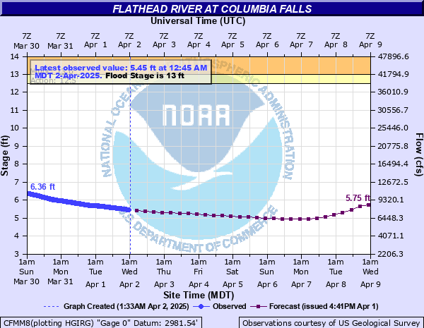
Flathead River at Columbia Falls
Critical Stages
12.5' - Action
13' - Flood
18' - Moderate
22' - Major
Latest Observation
Updated: 8:45 AM MST 12/16/25
Status: No Flooding
Stage: 8.11 ft
Flow: 16.9 kcfs
Forecast
| Time | Stage (ft) | Flow (kcfs) |
|---|---|---|
| 11 AM 12/16 | 8.23 | 17.4 |
| 5 PM 12/16 | 8.52 | 18.7 |
| 11 PM 12/16 | 8.62 | 19.1 |
| 5 AM 12/17 | 8.82 | 20 |
| 11 AM 12/17 | 8.89 | 20.3 |
| 5 PM 12/17 | 8.86 | 20.2 |
| 11 PM 12/17 | 8.81 | 19.9 |
| 5 AM 12/18 | 8.7 | 19.4 |
| 11 AM 12/18 | 8.56 | 18.8 |
| 5 PM 12/18 | 8.41 | 18.2 |
| 11 PM 12/18 | 8.28 | 17.6 |
| 5 AM 12/19 | 8.17 | 17.2 |
| 11 AM 12/19 | 8.07 | 16.8 |
| 5 PM 12/19 | 7.98 | 16.4 |
| 11 PM 12/19 | 7.9 | 16.1 |
| 5 AM 12/20 | 7.82 | 15.8 |
| 11 AM 12/20 | 7.75 | 15.5 |
| 5 PM 12/20 | 7.67 | 15.2 |
| 11 PM 12/20 | 7.6 | 14.9 |
| 5 AM 12/21 | 7.53 | 14.6 |
| 11 AM 12/21 | 7.47 | 14.4 |
| 5 PM 12/21 | 7.41 | 14.2 |
| 11 PM 12/21 | 7.36 | 14 |
| 5 AM 12/22 | 7.68 | 15.2 |
| 11 AM 12/22 | 7.79 | 15.7 |
| 5 PM 12/22 | 7.74 | 15.5 |
| 11 PM 12/22 | 7.7 | 15.3 |
| 5 AM 12/23 | 7.66 | 15.1 |
| 11 AM 12/23 | 7.62 | 15 |
| 5 PM 12/23 | 7.59 | 14.9 |
| 11 PM 12/23 | 7.55 | 14.7 |
| 5 AM 12/24 | 7.51 | 14.6 |
| 11 AM 12/24 | 7.48 | 14.4 |
| 5 PM 12/24 | 7.45 | 14.3 |
| 11 PM 12/24 | 7.41 | 14.2 |
| 5 AM 12/25 | 7.38 | 14.1 |
| 11 AM 12/25 | 7.35 | 14 |
| 5 PM 12/25 | 7.32 | 13.8 |
| 11 PM 12/25 | 7.3 | 13.8 |
| 5 AM 12/26 | 7.27 | 13.7 |
| Time | Stage (ft) | Flow (kcfs) |
|---|---|---|
| 8:45 AM 12/16 | 8.11 | 16.9 |
| 8:30 AM 12/16 | 8.09 | 16.9 |
| 8:15 AM 12/16 | 8.08 | 16.8 |
| 8:00 AM 12/16 | 8.06 | 16.7 |
| 7:45 AM 12/16 | 8.05 | 16.7 |
| 7:30 AM 12/16 | 8.03 | 16.6 |
| 7:15 AM 12/16 | 8.02 | 16.6 |
| 7:00 AM 12/16 | 8.01 | 16.5 |
| 6:45 AM 12/16 | 7.99 | 16.5 |
| 6:30 AM 12/16 | 7.97 | 16.4 |
| 6:15 AM 12/16 | 7.96 | 16.3 |
| 6:00 AM 12/16 | 7.94 | 16.3 |
| 5:45 AM 12/16 | 7.93 | 16.2 |
| 5:30 AM 12/16 | 7.92 | 16.2 |
| 5:15 AM 12/16 | 7.91 | 16.1 |
| 5:00 AM 12/16 | 7.89 | 16.1 |
| 4:45 AM 12/16 | 7.89 | 16.1 |
| 4:30 AM 12/16 | 7.87 | 16 |
| 4:15 AM 12/16 | 7.86 | 15.9 |
| 4:00 AM 12/16 | 7.85 | 15.9 |
| 3:45 AM 12/16 | 7.84 | 15.9 |
| 3:30 AM 12/16 | 7.82 | 15.8 |
| 3:15 AM 12/16 | 7.82 | 15.8 |
| 3:00 AM 12/16 | 7.81 | 15.7 |
| 2:45 AM 12/16 | 7.8 | 15.7 |
| 2:30 AM 12/16 | 7.8 | 15.7 |
| 2:15 AM 12/16 | 7.8 | 15.7 |
| 2:00 AM 12/16 | 7.79 | 15.7 |
| 1:45 AM 12/16 | 7.78 | 15.6 |
| 1:30 AM 12/16 | 7.77 | 15.6 |
22' -
Flooding in Columbia Falls, Kalispell, Creston and Foy's Bend causing isolation of many homes within the valley. Many secondary roads are impassable and closures of Highway 93 are expected.
18' -
Flooding of low lying areas in Columbia Falls including many buildings and secondary roads. There is also possible flooding along Highway 93 between Kalispell and Sommers.
16.1' -
A trailer and RV park located just north of Highway 35 in Evergreen may be flooded.
16' -
Low lying buildings and roads in the vicinity of Kalispell, Creston, Columbia Falls and Foy's Bend begin flooding.
14' -
Flooding of farmers crops adjacent to the Flathead River is likely. Sections of the Steel Bridge Road become inundated with water and impassable.
13' -
Farmers crops adjacent to the Flathead River are inundated with water.
| Date | Stage (ft) |
|---|---|
| Jun 9, 1964 | 25.58 |
| Jun 1, 1894 | 22.7 |
| May 23, 1948 | 19.08 |
| May 27, 1928 | 18.71 |
| Jun 16, 1933 | 17.63 |
| Jun 1, 1923 | 17.3 |
| May 9, 1947 | 17.27 |
| Jun 20, 1975 | 16.85 |
| May 22, 1932 | 16.46 |
| Jun 22, 1950 | 16.16 |
| Jun 8, 1995 | 15.77 |
| Jun 5, 1922 | 15.7 |
| May 29, 1946 | 15.63 |
| May 12, 1951 | 15.57 |
| May 20, 1954 | 15.57 |
| May 15, 1936 | 15.4 |
| May 18, 1997 | 15.36 |
| May 21, 1956 | 15.34 |
| May 24, 1935 | 15.28 |
| May 27, 1938 | 15.25 |
Data provided by the National Weather Service.