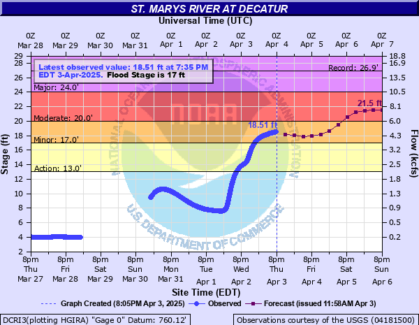
St. Marys River at Decatur
Critical Stages
13' - Action
17' - Flood
20' - Moderate
24' - Major
Latest Observation
Updated: 11:40 PM EST 12/4/25
Status: No Flooding
Stage: 2.79 ft
Flow: 0.0244 kcfs
Forecast
Forecast not available for this location.
| Time | Stage (ft) | Flow (kcfs) |
|---|---|---|
| 11:40 PM 12/4 | 2.79 | 0.0244 |
| 11:35 PM 12/4 | 2.8 | 0.0252 |
| 11:30 PM 12/4 | 2.8 | 0.0252 |
| 11:25 PM 12/4 | 2.79 | 0.0244 |
| 11:20 PM 12/4 | 2.8 | 0.0252 |
| 11:15 PM 12/4 | 2.8 | 0.0252 |
| 11:10 PM 12/4 | 2.8 | 0.0252 |
| 11:05 PM 12/4 | 2.8 | 0.0252 |
| 11:00 PM 12/4 | 2.81 | 0.0259 |
| 10:55 PM 12/4 | 2.81 | 0.0259 |
| 10:50 PM 12/4 | 2.82 | 0.0267 |
| 10:45 PM 12/4 | 2.82 | 0.0267 |
| 10:40 PM 12/4 | 2.82 | 0.0267 |
| 10:35 PM 12/4 | 2.82 | 0.0267 |
| 10:30 PM 12/4 | 2.82 | 0.0267 |
| 10:25 PM 12/4 | 2.83 | 0.0275 |
| 10:20 PM 12/4 | 2.83 | 0.0275 |
| 10:15 PM 12/4 | 2.83 | 0.0275 |
| 10:10 PM 12/4 | 2.83 | 0.0275 |
| 10:05 PM 12/4 | 2.83 | 0.0275 |
| 10:00 PM 12/4 | 2.83 | 0.0275 |
| 9:55 PM 12/4 | 2.83 | 0.0275 |
| 9:50 PM 12/4 | 2.83 | 0.0275 |
| 9:45 PM 12/4 | 2.83 | 0.0275 |
| 9:40 PM 12/4 | 2.83 | 0.0275 |
| 9:35 PM 12/4 | 2.83 | 0.0275 |
| 9:30 PM 12/4 | 2.83 | 0.0275 |
| 9:25 PM 12/4 | 2.83 | 0.0275 |
| 9:20 PM 12/4 | 2.83 | 0.0275 |
| 9:15 PM 12/4 | 2.83 | 0.0275 |
30.6' -
Flood water begins to hit the bottom of the bridge at the gage site.
27.5' -
Flood water reaches the 100 year flood level.
26.5' -
Record flooding is in progress. Evacuations are necessary in Decatur, Indiana and Wilshire, Ohio. Serious flooding of the Central Soya Plant can be expected along with widespread flooding and disruption of land transportation.
24.5' -
Major flooding is in progress with water at the top of the levee protecting the Central Soya Plant. US Highway 33 near Willshire, Ohio begins to flood. Extensive flooding of the east side of Decatur along with Bellmont High School occurs. Evacuations become necessary.
23.5' -
Many east side city streets and county roads are flooded. Evacuation of east side residents near Bellmont High School becomes necessary.
23' -
Portions of Ohio Routes 33, 49 and 81 are closed near Willshire.
22.5' -
Piqua Road begins to flood at Decatur. Evacuations begin on Ogg Street. Ohio State Route 49 near Willshire becomes flooded.
21.5' -
High water affects Piqua Rd...Ohio State Route 49 near the state line along with east side Decatur streets. Residential flooding begins on East Jackson and Ogg Streets. Bellmont High School grounds begin flooding.
20.5' -
Indiana 101 north of Pleasant Mills is closed by flood water. Extensive agricultural flooding is in progress. Residents of the east and southeast side of Decatur become concerned.
19.5' -
Flooding expands into more farm land in the Decatur area. Flood waters approach Piqua Road...Ohio State Route 49 and Indiana 101 just north of Pleasant Mills. Flood water begins to cross Ohio highway 49 north of Willshire, Ohio.
18.8' -
Flood water begins to cross Ohio Highway 49 north of Willshire, Ohio.
18.5' -
County Road 225 North...just north of Pleasant Mills Indiana is closed by flood water. Low land areas of Kekionga Park on the southeast side of Decatur begin flooding. Flooding is limited to farm land in Pleasant Mills Indiana and Willshire Ohio.
17.5' -
County road 225 north of Pleasant Mills is flooded. Agricultural land flooding increases in northern...central and eastern Adams County.
17' -
Agricultural flooding occurs along the river in northern...central and eastern Adams County.
| Date | Stage (ft) |
|---|---|
| Jul 9, 2003 | 26.92 |
| Jun 18, 2015 | 25.11 |
| Mar 14, 1982 | 24.4 |
| Feb 25, 1985 | 24.31 |
| Feb 10, 1959 | 24.22 |
| Jan 14, 2005 | 24.2 |
| Jul 17, 1992 | 24.13 |
| Dec 31, 1990 | 23.81 |
| Feb 8, 2008 | 23.6 |
| Feb 15, 1950 | 23.6 |
| Mar 23, 1978 | 23.55 |
| May 18, 1943 | 23.4 |
| Jan 25, 1999 | 23.13 |
| Jan 22, 1974 | 22.86 |
| Jun 4, 1980 | 22.69 |
| Mar 5, 1979 | 22.59 |
| Mar 3, 2011 | 22.49 |
| Apr 23, 1972 | 22.42 |
| Dec 19, 1977 | 22.32 |
| Feb 18, 1976 | 22.26 |
Data provided by the National Weather Service.