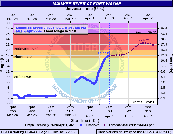
Maumee River at Fort Wayne
Critical Stages
9.6' - Action
17' - Flood
20' - Moderate
26' - Major
Latest Observation
Updated: 11:40 PM EST 12/4/25
Status: No Flooding
Stage: 1.45 ft
Flow: 0.126 kcfs
Forecast
| Time | Stage (ft) | Flow (kcfs) |
|---|---|---|
| 1 AM 12/5 | 1.5 | 0.151 |
| 7 AM 12/5 | 1.5 | 0.151 |
| 1 PM 12/5 | 1.5 | 0.151 |
| 7 PM 12/5 | 1.5 | 0.151 |
| 1 AM 12/6 | 1.5 | 0.151 |
| 7 AM 12/6 | 1.5 | 0.151 |
| 1 PM 12/6 | 1.5 | 0.151 |
| 7 PM 12/6 | 1.5 | 0.151 |
| 1 AM 12/7 | 1.5 | 0.151 |
| 7 AM 12/7 | 1.5 | 0.151 |
| 1 PM 12/7 | 1.5 | 0.151 |
| 7 PM 12/7 | 1.5 | 0.151 |
| 1 AM 12/8 | 1.5 | 0.151 |
| 7 AM 12/8 | 1.5 | 0.151 |
| 1 PM 12/8 | 1.5 | 0.151 |
| 7 PM 12/8 | 1.5 | 0.151 |
| 1 AM 12/9 | 1.5 | 0.151 |
| 7 AM 12/9 | 1.5 | 0.151 |
| Time | Stage (ft) | Flow (kcfs) |
|---|---|---|
| 11:40 PM 12/4 | 1.45 | 0.126 |
| 11:35 PM 12/4 | 1.45 | 0.126 |
| 11:30 PM 12/4 | 1.47 | 0.136 |
| 11:25 PM 12/4 | 1.45 | 0.126 |
| 11:20 PM 12/4 | 1.47 | 0.136 |
| 11:15 PM 12/4 | 1.46 | 0.131 |
| 11:10 PM 12/4 | 1.46 | 0.131 |
| 11:05 PM 12/4 | 1.45 | 0.126 |
| 11:00 PM 12/4 | 1.47 | 0.136 |
| 10:55 PM 12/4 | 1.48 | 0.14 |
| 10:50 PM 12/4 | 1.46 | 0.131 |
| 10:45 PM 12/4 | 1.46 | 0.131 |
| 10:40 PM 12/4 | 1.46 | 0.131 |
| 10:35 PM 12/4 | 1.46 | 0.131 |
| 10:30 PM 12/4 | 1.46 | 0.131 |
| 10:25 PM 12/4 | 1.47 | 0.136 |
| 10:20 PM 12/4 | 1.47 | 0.136 |
| 10:15 PM 12/4 | 1.48 | 0.14 |
| 10:10 PM 12/4 | 1.48 | 0.14 |
| 10:05 PM 12/4 | 1.46 | 0.131 |
| 10:00 PM 12/4 | 1.48 | 0.14 |
| 9:55 PM 12/4 | 1.47 | 0.136 |
| 9:50 PM 12/4 | 1.46 | 0.131 |
| 9:45 PM 12/4 | 1.46 | 0.131 |
| 9:40 PM 12/4 | 1.47 | 0.136 |
| 9:35 PM 12/4 | 1.48 | 0.14 |
| 9:30 PM 12/4 | 1.48 | 0.14 |
| 9:25 PM 12/4 | 1.46 | 0.131 |
| 9:20 PM 12/4 | 1.46 | 0.131 |
| 9:15 PM 12/4 | 1.46 | 0.131 |
26' -
A record flood is in progress.
23' -
Approaching major flood.
22' -
Flooding becomes serious. Twenty-four hour flood fighting commences if river continues to rise.
21' -
An increasing number of city streets begin to flood. Evacuations are necessary in River Haven.
20' -
Some evacuations may be necessary in low, unprotected areas of River Haven.
19' -
The city of Fort Wayne launches 24-hour flood fight.
18' -
The lowest unprotected city streets begin to flood. Parrott Road between Maplecrest Road and Hartzell Road as well as residents of River Haven are affected by high water.
17' -
Flooding occurs in parks and farmland in Allen County. Unprotected lowland and county roads become affected by flood waters.
15' -
Flooding of city parks and farmland in Allen County begins.
| Date | Stage (ft) |
|---|---|
| Mar 26, 1913 | 26.1 |
| Mar 17, 1982 | 25.93 |
| Feb 27, 1985 | 24.55 |
| Jan 1, 1991 | 23.9 |
| Mar 24, 1978 | 23.76 |
| Mar 13, 2009 | 23.58 |
| Feb 8, 2008 | 22.93 |
| Mar 8, 1908 | 22.5 |
| Jan 14, 2005 | 22.44 |
| Jan 15, 1930 | 22.4 |
| May 19, 1943 | 22.24 |
| Dec 1, 2011 | 22.15 |
| Mar 18, 1919 | 21.7 |
| Apr 23, 1920 | 21.5 |
| Jun 28, 2015 | 21.48 |
| Feb 20, 1976 | 21.43 |
| Feb 12, 1959 | 21.3 |
| Jul 10, 2003 | 21.24 |
| Dec 10, 1966 | 21.23 |
| Jan 31, 1969 | 21.18 |
Data provided by the National Weather Service.