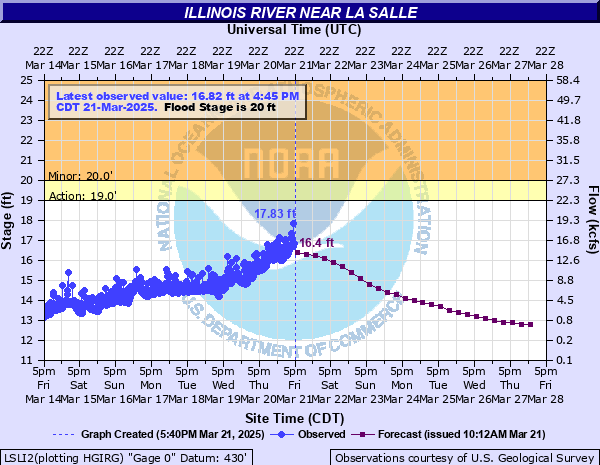
Illinois River near La Salle
Critical Stages
19' - Action
20' - Flood
27' - Moderate
31' - Major
Latest Observation
Updated: 4:45 AM CST 12/12/25
Status: No Flooding
Stage: 10.85 ft
Flow: 0 kcfs
Forecast
| Time | Stage (ft) | Flow (kcfs) |
|---|---|---|
| 12 PM 12/12 | 10.5 | 0 |
| 6 PM 12/12 | 10.5 | 0 |
| 12 AM 12/13 | 10.5 | 0 |
| 6 AM 12/13 | 10.5 | 0 |
| 12 PM 12/13 | 10.5 | 0 |
| 6 PM 12/13 | 10.5 | 0 |
| 12 AM 12/14 | 10.5 | 0 |
| 6 AM 12/14 | 10.5 | 0 |
| 12 PM 12/14 | 10.5 | 0 |
| 6 PM 12/14 | 10.5 | 0 |
| 12 AM 12/15 | 10.5 | 0 |
| 6 AM 12/15 | 10.5 | 0 |
| 12 PM 12/15 | 10.5 | 0 |
| 6 PM 12/15 | 10.5 | 0 |
| 12 AM 12/16 | 10.5 | 0 |
| 6 AM 12/16 | 10.5 | 0 |
| 12 PM 12/16 | 10.5 | 0 |
| 6 PM 12/16 | 10.5 | 0 |
| 12 AM 12/17 | 10.5 | 0 |
| 6 AM 12/17 | 10.5 | 0 |
| 12 PM 12/17 | 10.5 | 0 |
| 6 PM 12/17 | 10.5 | 0 |
| 12 AM 12/18 | 10.5 | 0 |
| 6 AM 12/18 | 10.5 | 0 |
| 12 PM 12/18 | 10.6 | 0 |
| 6 PM 12/18 | 10.6 | 0 |
| Time | Stage (ft) | Flow (kcfs) |
|---|---|---|
| 5:45 AM 12/12 | 10.63 | 0 |
| 5:30 AM 12/12 | 10.62 | 0 |
| 5:15 AM 12/12 | 10.64 | 0 |
| 5:00 AM 12/12 | 10.66 | 0 |
| 4:45 AM 12/12 | 10.85 | 0 |
| 4:30 AM 12/12 | 10.77 | 0 |
| 4:15 AM 12/12 | 10.76 | 0 |
| 4:00 AM 12/12 | 10.77 | 0 |
| 3:45 AM 12/12 | 10.76 | 0 |
| 3:30 AM 12/12 | 10.76 | 0 |
| 3:15 AM 12/12 | 10.76 | 0 |
| 3:00 AM 12/12 | 10.78 | 0 |
| 2:45 AM 12/12 | 10.79 | 0 |
| 2:30 AM 12/12 | 10.74 | 0 |
| 2:15 AM 12/12 | 10.76 | 0 |
| 2:00 AM 12/12 | 10.76 | 0 |
| 1:45 AM 12/12 | 10.74 | 0 |
| 1:30 AM 12/12 | 10.72 | 0 |
| 1:15 AM 12/12 | 10.75 | 0 |
| 1:00 AM 12/12 | 10.78 | 0 |
| 12:45 AM 12/12 | 10.74 | 0 |
| 12:30 AM 12/12 | 10.75 | 0 |
| 12:15 AM 12/12 | 10.8 | 0 |
| 12:00 AM 12/12 | 10.8 | 0 |
| 11:45 PM 12/11 | 10.74 | 0 |
| 11:30 PM 12/11 | 10.75 | 0 |
| 11:15 PM 12/11 | 10.75 | 0 |
| 11:00 PM 12/11 | 10.77 | 0 |
| 10:45 PM 12/11 | 10.77 | 0 |
| 10:30 PM 12/11 | 10.75 | 0 |
34.5' -
North Utica Village Hall, police department, and wastewater treatment plant property are threatened.
33' -
A couple structures are threatened near the river in downtown La Salle.
32' -
Numerous industrial and utility properties are threatened along Water Street near downtown LaSalle. A few residences threatened in North Utica. IL-178 (Clark Street) threatened in North Utica.
31' -
A couple structures threatened in North Utica.
30' -
La Salle water pumping station property is threatened.
28.5' -
Water Street is threatened in Peru.
28' -
Dee Bennet Road is threatened between Ottawa and Utica.
22' -
Lower parking lot at Starved Rock State Park is inundated east of La Salle. High water levels begin to impact shipping interests along the river.
20' -
Agricultural areas in La Salle, Spring Valley, and Peru are inundated.
17.5' -
Low-lying agricultural land near the river is inundated.
| Date | Stage (ft) |
|---|---|
| Apr 20, 2013 | 34.44 |
| Sep 16, 2008 | 33.79 |
| May 20, 2020 | 33.14 |
| May 3, 2019 | 32.14 |
| Dec 5, 1982 | 32.05 |
| Mar 12, 2009 | 32.02 |
| Mar 21, 1979 | 31.75 |
| Mar 6, 1985 | 31.7 |
| May 22, 1943 | 31 |
| Feb 23, 1997 | 30.83 |
| Feb 23, 2018 | 30.61 |
| Aug 26, 2007 | 30.34 |
| Jan 22, 1916 | 30.2 |
| May 16, 1970 | 30.1 |
| Dec 31, 2015 | 29.73 |
| Nov 29, 1990 | 29.27 |
| Mar 27, 1904 | 29.2 |
| Jun 24, 2015 | 28.98 |
| Jan 15, 2005 | 28.94 |
| May 14, 2002 | 28.86 |
Data provided by the National Weather Service.