Arkansas River near Muskogee
Critical Stages
27' - Action
28' - Flood
32' - Moderate
34' - Major
Latest Observation
Updated: 3:00 PM CST 12/15/25
Status: No Flooding
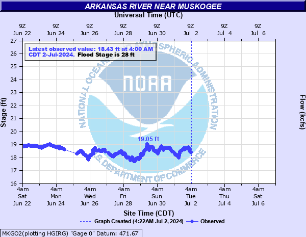
Stage: 18.5 ft
Flow: 19.1 kcfs
Forecast
Forecast not available for this location.
| Time | Stage (ft) | Flow (kcfs) |
|---|---|---|
| 3:00 PM 12/15 | 18.5 | 19.1 |
| 2:45 PM 12/15 | 18.51 | 19.3 |
| 2:30 PM 12/15 | 18.49 | 19 |
| 2:15 PM 12/15 | 18.45 | 18.4 |
| 2:00 PM 12/15 | 18.43 | 18.1 |
| 1:45 PM 12/15 | 18.4 | 17.5 |
| 1:30 PM 12/15 | 18.39 | 17.2 |
| 1:15 PM 12/15 | 18.37 | 16.7 |
| 1:00 PM 12/15 | 18.34 | 16 |
| 12:45 PM 12/15 | 18.32 | 15.6 |
| 12:30 PM 12/15 | 18.33 | 15.8 |
| 12:15 PM 12/15 | 18.32 | 15.6 |
| 12:00 PM 12/15 | 18.29 | 14.9 |
| 11:45 AM 12/15 | 18.26 | 14.3 |
| 11:30 AM 12/15 | 18.26 | 14.3 |
| 11:15 AM 12/15 | 18.31 | 15.3 |
| 11:00 AM 12/15 | 18.37 | 16.7 |
| 10:45 AM 12/15 | 18.41 | 17.7 |
| 10:30 AM 12/15 | 18.43 | 18.1 |
| 10:15 AM 12/15 | 18.44 | 18.3 |
| 10:00 AM 12/15 | 18.41 | 17.7 |
| 9:45 AM 12/15 | 18.46 | 18.6 |
| 9:30 AM 12/15 | 18.45 | 18.4 |
| 9:15 AM 12/15 | 18.46 | 18.6 |
| 9:00 AM 12/15 | 18.46 | 18.6 |
| 8:45 AM 12/15 | 18.46 | 18.6 |
| 8:30 AM 12/15 | 18.46 | 18.6 |
| 8:15 AM 12/15 | 18.47 | 18.7 |
| 8:00 AM 12/15 | 18.48 | 18.8 |
| 7:45 AM 12/15 | 18.52 | 19.4 |
44' -
very severe flooding occurs along the Arkansas River from Muskogee to Webbers Falls. Numerous roads are closed near the river. Buildings on the OG&E power plant are flooded. This is an extremely dangerous and life threatening situation.
41' -
very severe flooding occurs along the Arkansas River from Muskogee to Webbers Falls. Numerous roads are closed near the river. Buildings on the OG&E power plant are flooded. This is an extremely dangerous and life threatening situation.
39' -
very severe flooding occurs along the Arkansas River from Muskogee to Webbers Falls. Several roads are closed near the river. Buildings on the OG&E power plant are flooded. This is an extremely dangerous and life threatening situation.
37' -
very severe flooding occurs along the Arkansas River near Muskogee. Buildings on the OG&E power plant are flooded. The flood of October 6, 1986 reached 39.6 feet. This is an extremely dangerous and life threatening situation.
34' -
severe flooding occurs along the Arkansas River near Muskogee. Many areas on the grounds of the OG&E power plant are flooded. This will compare with the flood of October 7, 1959 when the stage reached 34.0 feet. This is a dangerous situation.
32' -
areas on the grounds of the OG&E power plant are flooded. Moderate agricultural flooding occurs.
31' -
a boating marina north of the OG&E power plant is flooded. Areas on the grounds of the OG&E power plant may be threatened. Some agricultural lands are flooded.
30' -
a boating marina north of OG&E power plant is flooded. Some agricultural lands are flooded.
29' -
minor lowland flooding occurs. A boating marina north of the OG&E power plant may be flooded.
28' -
minor lowland flooding occurs.
27' -
no flooding occurs but low lying agricultural areas may be threatened. Continue to monitor later forecasts.
| Date | Stage (ft) |
|---|---|
| May 21, 1943 | 48.2 |
| May 26, 2019 | 46.39 |
| May 30, 2019 | 46 |
| Oct 6, 1986 | 39.6 |
| May 26, 1957 | 39.03 |
| May 11, 1943 | 38.32 |
| Oct 31, 1941 | 37.23 |
| Apr 18, 1945 | 36.65 |
| Apr 15, 1927 | 36.5 |
| Dec 29, 2015 | 35.41 |
| Oct 7, 1959 | 34 |
| Jun 25, 2019 | 33.07 |
| Jun 24, 2019 | 33.07 |
| Apr 21, 1941 | 32.72 |
| May 9, 1961 | 32.7 |
| Jun 7, 2019 | 32.63 |
| May 30, 2015 | 32.39 |
| May 22, 1957 | 31.85 |
| Jun 14, 1923 | 31.8 |
| Jul 6, 2007 | 31.62 |
Data provided by the National Weather Service.