White Oak Bayou at Houston
Critical Stages
29' - Action
32' - Flood
33.5' - Moderate
36' - Major
Latest Observation
Updated: 3:45 AM CST 12/15/25
Status: No Flooding
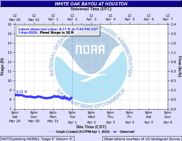
Stage: 7.95 ft
Flow: 0.0579 kcfs
Forecast
Forecast not available for this location.
| Time | Stage (ft) | Flow (kcfs) |
|---|---|---|
| 4:45 AM 12/15 | 7.89 | 0.0533 |
| 4:30 AM 12/15 | 7.93 | 0.0563 |
| 4:15 AM 12/15 | 7.94 | 0.0571 |
| 4:00 AM 12/15 | 7.96 | 0.0587 |
| 3:45 AM 12/15 | 7.95 | 0.0579 |
| 3:30 AM 12/15 | 7.94 | 0.0571 |
| 3:15 AM 12/15 | 7.94 | 0.0571 |
| 3:00 AM 12/15 | 7.92 | 0.0555 |
| 2:45 AM 12/15 | 7.93 | 0.0563 |
| 2:30 AM 12/15 | 7.96 | 0.0587 |
| 2:15 AM 12/15 | 7.97 | 0.0595 |
| 2:00 AM 12/15 | 7.99 | 0.0612 |
| 1:45 AM 12/15 | 7.98 | 0.0603 |
| 1:30 AM 12/15 | 7.97 | 0.0595 |
| 1:15 AM 12/15 | 7.97 | 0.0595 |
| 1:00 AM 12/15 | 7.96 | 0.0587 |
| 12:45 AM 12/15 | 7.95 | 0.0579 |
| 12:30 AM 12/15 | 7.97 | 0.0595 |
| 12:15 AM 12/15 | 7.94 | 0.0571 |
| 12:00 AM 12/15 | 7.98 | 0.0603 |
| 11:45 PM 12/14 | 7.98 | 0.0603 |
| 11:30 PM 12/14 | 7.97 | 0.0595 |
| 11:15 PM 12/14 | 7.93 | 0.0563 |
| 11:00 PM 12/14 | 7.94 | 0.0571 |
| 10:45 PM 12/14 | 7.97 | 0.0595 |
| 10:30 PM 12/14 | 7.96 | 0.0587 |
| 10:15 PM 12/14 | 7.95 | 0.0579 |
| 10:00 PM 12/14 | 7.93 | 0.0563 |
| 9:45 PM 12/14 | 7.9 | 0.054 |
| 9:30 PM 12/14 | 7.93 | 0.0563 |
40.29' -
At levels above 40.3 feet, major lowland flooding continues as the Heights Boulevard bridge is inundated.
38.5' -
At levels above 38.5 feet, major lowland flooding continues as the I-45 main lanes north of I-10 are inundated.
36' -
At levels above 36.0 feet, major lowland flooding begins as apartments along White Oak Drive begin flooding. The I-45 southbound ramp to I-10 West is under 2.5 feet of water and the I-10 eastbound feeder road west of Studemont is inundated. The I-45 main lanes north of I-10 are close to being flooded.
33.5' -
At levels above 33.5 feet, moderate lowland flooding begins as the southbound ramp to I-10 West floods.
29' -
At levels above 29.0 feet, minor lowland flooding begins as water escapes the main channel and floods White Oak Drive between Taylor Street and I-10.
| Date | Stage (ft) |
|---|---|
| Jun 9, 2001 | 52.84 |
| Dec 9, 1935 | 51.5 |
| Mar 4, 1992 | 50.43 |
| Sep 11, 1998 | 47.06 |
| May 31, 1929 | 47 |
| Sep 14, 2008 | 46 |
| Aug 28, 2017 | 45.6 |
| Jun 26, 1989 | 44.48 |
| Nov 17, 2003 | 44.32 |
| Nov 13, 1961 | 43.6 |
| Mar 20, 1972 | 43.5 |
| Oct 29, 2002 | 41.81 |
| May 24, 1997 | 41.49 |
| Jun 13, 1973 | 41.06 |
| Jun 19, 2006 | 40.22 |
| May 26, 2015 | 40.22 |
| Oct 16, 2006 | 39.68 |
| Jun 6, 2001 | 38.87 |
| Apr 18, 2016 | 38.76 |
| Oct 25, 1984 | 38.22 |
Data provided by the National Weather Service.